Oak Grove, Illinois
Oak Grove | |
|---|---|
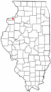
 Location of Oak Grove in Rock Island County, Illinois. | |
 Location of Illinois in the United States | |
| Coordinates: 41°24′48″N 90°34′11″W / 41.41333°N 90.56972°WCoordinates: 41°24′48″N 90°34′11″W / 41.41333°N 90.56972°W | |
| Country | United States |
| State | Illinois |
| County | Rock Island |
| Area | |
| • Total | 0.66 sq mi (1.70 km2) |
| • Land | 0.66 sq mi (1.70 km2) |
| • Water | 0.00 sq mi (0.00 km2) |
| Population (2010) | |
| • Total | 396 |
| • Estimate (2019)[2] | 591 |
| • Density | 898.18/sq mi (346.82/km2) |
| Time zone | UTC-6 (CST) |
| • Summer (DST) | UTC-5 (CDT) |
| ZIP Code(s) | XXXXX |
| Area code(s) | 309 |
| FIPS code | 17-54703 |
| Wikimedia Commons | Oak Grove, Illinois |

Oak Grove is a village in Rock Island County, Illinois, United States. The population was 396 at the 2010 census.
Geography[]
Oak Grove is located at 41°24′48″N 90°34′11″W / 41.41333°N 90.56972°W (41.413413, -90.569794).[3]
According to the 2010 census, Oak Grove has a total area of 0.57 square miles (1.48 km2), all land.[4]
Demographics[]
| Historical population | |||
|---|---|---|---|
| Census | Pop. | %± | |
| 1960 | 888 | — | |
| 1970 | 618 | −30.4% | |
| 1980 | 695 | 12.5% | |
| 1990 | 626 | −9.9% | |
| 2000 | 1,318 | 110.5% | |
| 2010 | 396 | −70.0% | |
| 2019 (est.) | 591 | [2] | 49.2% |
| U.S. Decennial Census[5] | |||
At the 2000 census there were 1,318 people, 109 households, and 61 families living in the village. The population density was 2,088.2 people per square mile (807.8/km2). There were 114 housing units at an average density of 180.6 per square mile (69.9/km2). The racial makeup of the village was 34.22% White, 57.74% African American, 0.53% Native American, 0.15% Asian, 7.36% from other races. Hispanic or Latino of any race were 8.65%.[6]
Of the 109 households 23.9% had children under the age of 18 living with them, 33.0% were married couples living together, 13.8% had a female householder with no husband present, and 44.0% were non-families. 35.8% of households were one person and 4.6% were one person aged 65 or older. The average household size was 2.02 and the average family size was 2.49.
The age distribution was 3.2% under the age of 18, 17.7% from 18 to 24, 62.8% from 25 to 44, 14.3% from 45 to 64, and 2.0% 65 or older. The median age was 34 years. For every 100 females, there were 1,120.4 males. For every 100 females age 18 and over, there were 1,437.3 males.
The median household income was $30,833 and the median family income was $36,667. Males had a median income of $12,259 versus $15,000 for females. The per capita income for the village was $15,045. About 10.6% of families and 13.3% of the population were below the poverty line, including 18.2% of those under age 18 and 12.8% of those age 65 or over.
References[]
- ^ "2019 U.S. Gazetteer Files". United States Census Bureau. Retrieved July 14, 2020.
- ^ a b "Population and Housing Unit Estimates". United States Census Bureau. May 24, 2020. Retrieved May 27, 2020.
- ^ "US Gazetteer files: 2010, 2000, and 1990". United States Census Bureau. 2011-02-12. Retrieved 2011-04-23.
- ^ "G001 - Geographic Identifiers - 2010 Census Summary File 1". United States Census Bureau. Archived from the original on 2020-02-13. Retrieved 2015-12-25.
- ^ "Census of Population and Housing". Census.gov. Retrieved June 4, 2015.
- ^ "U.S. Census website". United States Census Bureau. Retrieved 2008-01-31.
Municipalities and communities of Rock Island County, Illinois, United States | ||
|---|---|---|
| Cities | ||
| Villages | ||
| Townships | ||
| CDPs | ||
| Footnotes | ‡This populated place also has portions in an adjacent county or counties | |
| ||
- Villages in Rock Island County, Illinois
- Villages in Illinois
- Cities in the Quad Cities