Rock Island County, Illinois
Rock Island County | |
|---|---|
U.S. county | |
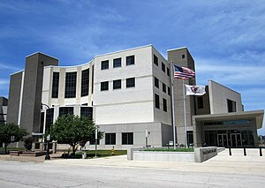 Rock Island County Justice Center | |
|
Logo | |
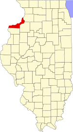 Location within the U.S. state of Illinois | |
 Illinois's location within the U.S. | |
| Coordinates: 41°28′N 90°34′W / 41.47°N 90.57°W | |
| Country | |
| State | |
| Founded | 1831 |
| Named for | Rock (Arsenal) Island |
| Seat | Rock Island |
| Largest city | Moline |
| Area | |
| • Total | 451 sq mi (1,170 km2) |
| • Land | 428 sq mi (1,110 km2) |
| • Water | 24 sq mi (60 km2) 5.2% |
| Population (2010) | |
| • Total | 147,546 |
| • Estimate (2019) | 141,879 |
| • Density | 330/sq mi (130/km2) |
| Time zone | UTC−6 (Central) |
| • Summer (DST) | UTC−5 (CDT) |
| Congressional district | 17th |
| Website | www |

Rock Island County is a county located in the U.S. state of Illinois, bounded on the west by the Mississippi River. According to the 2010 census, it had a population of 147,546.[1] Its county seat is Rock Island; its largest city is neighboring Moline.[2] Rock Island County is one of the four counties that make up the Davenport-Moline-Rock Island, IA-IL Metropolitan Statistical Area.[3]
History[]

Rock Island County was formed in 1831 out of Jo Daviess County. It was named for Rock Island, an island in the Mississippi River now known as Arsenal Island.[4] The Rock River (which the Sauk and Fox Indians called Sinnissippi meaning "rocky waters")[5] flows from Whiteside County and points further east and north and joins the Mississippi River at Rock Island. The Sinnissippi Mounds, dating from the Hopewell period and on the National Register of Historic Places are upriver at Sterling in Whiteside County.
Geography[]
According to the U.S. Census Bureau, the county has a total area of 451 square miles (1,170 km2), of which 428 square miles (1,110 km2) is land and 24 square miles (62 km2) (5.2%) is water.[6]
Climate and weather[]
| Rock Island, Illinois | ||||||||||||||||||||||||||||||||||||||||||||||||||||||||||||
|---|---|---|---|---|---|---|---|---|---|---|---|---|---|---|---|---|---|---|---|---|---|---|---|---|---|---|---|---|---|---|---|---|---|---|---|---|---|---|---|---|---|---|---|---|---|---|---|---|---|---|---|---|---|---|---|---|---|---|---|---|
| Climate chart (explanation) | ||||||||||||||||||||||||||||||||||||||||||||||||||||||||||||
| ||||||||||||||||||||||||||||||||||||||||||||||||||||||||||||
| ||||||||||||||||||||||||||||||||||||||||||||||||||||||||||||
In recent years, average temperatures in the county seat of Rock Island have ranged from a low of 13 °F (−11 °C) in January to a high of 85 °F (29 °C) in July, although a record low of −22 °F (−30 °C) was recorded in February 1996 and a record high of 103 °F (39 °C) was recorded in July 2006. Average monthly precipitation ranged from 1.28 inches (33 mm) in January to 4.75 inches (121 mm) in June.[7]
Major highways[]
 Interstate 74
 Interstate 80
 Interstate 88
 Interstate 280
 U.S. Highway 6
 U.S. Highway 67
 U.S. Highway 150
 Illinois Route 2 (formerly)
 Illinois Route 5
 Illinois Route 84
 Illinois Route 92
 Illinois Route 94
 Illinois Route 110
 Illinois Route 192
Adjacent counties[]
- Clinton County, Iowa (north)
- Whiteside County (northeast)
- Henry County (southeast)
- Mercer County (south)
- Louisa County, Iowa (southwest)
- Muscatine County, Iowa (west)
- Scott County, Iowa (northwest)
National protected area[]
Demographics[]
| Historical population | |||
|---|---|---|---|
| Census | Pop. | %± | |
| 1840 | 2,610 | — | |
| 1850 | 6,937 | 165.8% | |
| 1860 | 21,005 | 202.8% | |
| 1870 | 29,783 | 41.8% | |
| 1880 | 38,302 | 28.6% | |
| 1890 | 41,917 | 9.4% | |
| 1900 | 55,249 | 31.8% | |
| 1910 | 70,404 | 27.4% | |
| 1920 | 92,297 | 31.1% | |
| 1930 | 98,191 | 6.4% | |
| 1940 | 113,323 | 15.4% | |
| 1950 | 133,558 | 17.9% | |
| 1960 | 150,991 | 13.1% | |
| 1970 | 166,734 | 10.4% | |
| 1980 | 165,968 | −0.5% | |
| 1990 | 148,723 | −10.4% | |
| 2000 | 149,374 | 0.4% | |
| 2010 | 147,546 | −1.2% | |
| 2019 (est.) | 141,879 | [8] | −3.8% |
| U.S. Decennial Census[9] 1790-1960[10] 1900-1990[11] 1990-2000[12] 2010-2019[1] | |||
As of the 2010 United States Census, there were 147,546 people, 61,303 households, and 38,384 families residing in the county.[13] The population density was 345.0 inhabitants per square mile (133.2/km2). There were 65,756 housing units at an average density of 153.8 per square mile (59.4/km2).[6] The racial makeup of the county was 81.6% white, 9.0% black or African American, 1.6% Asian, 0.3% American Indian, 4.4% from other races, and 3.0% from two or more races. Those of Hispanic or Latino origin made up 11.6% of the population.[13] In terms of ancestry, 25.9% were German, 14.2% were Irish, 8.7% were English, 6.8% were Swedish, and 5.2% were American.[14]
Of the 61,303 households, 29.0% had children under the age of 18 living with them, 45.3% were married couples living together, 12.7% had a female householder with no husband present, 37.4% were non-families, and 31.6% of all households were made up of individuals. The average household size was 2.34 and the average family size was 2.93. The median age was 40.0 years.[13]
The median income for a household in the county was $46,226 and the median income for a family was $58,962. Males had a median income of $42,548 versus $31,917 for females. The per capita income for the county was $25,071. About 8.7% of families and 12.3% of the population were below the poverty line, including 19.0% of those under age 18 and 7.1% of those age 65 or over.[15]
Economy[]
At one time Mississippi Valley Airlines had its headquarters in Quad City Airport in the county.[16] John Deere is headquartered in Moline.[17]
Communities[]
Cities[]
- East Moline
- Moline
- Rock Island
- Silvis
Villages[]
- Andalusia
- Carbon Cliff
- Coal Valley (part)
- Cordova
- Hampton
- Hillsdale
- Milan
- Oak Grove
- Port Byron
- Rapids City
- Reynolds (part)
Census-designated places[]
Unincorporated communities[]
- Barstow
- Buffalo Prairie
- Campbell's Island
- Edgington
- Illinois City
- Joslin
- Taylor Ridge
Townships[]
Rock Island County is divided into eighteen townships:
- Andalusia
- Blackhawk
- Bowling
- Buffalo Prairie
- Canoe Creek
- Coal Valley
- Coe
- Cordova
- Drury
- Edgington
- Hampton
- Moline
- Port Byron
- Rock Island
- Rural
- South Moline
- South Rock Island
- Zuma
Forts[]
Politics[]
Before 1932, Rock Island County was a Republican stronghold in presidential elections, backing the party's candidate in every election from 1892 to 1928. From 1932 on, it has consistently backed Democratic Party presidential candidates outside of four national Republican landslides. In 2016, Donald Trump managed to keep Hillary Clinton to a single-digit margin of victory, the first Republican to do so since Ronald Reagan in 1984; in 2020, Joe Biden increased the Democratic margin from 8.3% to 12.1%. Due to the dominance of the Democratic Party in county politics, Rock Island County remains one of the most Democratic counties outside of the Chicago area in Illinois. Since 2010 the Republican Party began making inroads in county politics, gaining a few seats on the Democratic-dominated county board; however, since 2018, the Republican Party influence on the board has begun to decrease as the county resumed heavy Democratic voting.[18]
See also[]
- National Register of Historic Places listings in Rock Island County, Illinois
- Quad Cities International Airport
Footnotes[]
- ^ Jump up to: a b "State & County QuickFacts". United States Census Bureau. Archived from the original on June 7, 2011. Retrieved July 8, 2014.
- ^ "Find a County". National Association of Counties. Archived from the original on May 31, 2011. Retrieved June 7, 2011.
- ^ United States Office of Management and Budget. "Update of Statistical Area Definitions and Guidance on Their Uses" (PDF). pp. 5, 36. Archived from the original (PDF) on May 14, 2006. Retrieved July 21, 2006.
- ^ Rock Island, the island, History: Introduction Archived January 14, 2009, at the Wayback Machine, US Army Corps of Engineers
- ^ "Castle Rock State Park". Illinois DNR. Archived from the original on April 1, 2007. Retrieved August 3, 2014.
- ^ Jump up to: a b "Population, Housing Units, Area, and Density: 2010 - County". United States Census Bureau. Archived from the original on February 12, 2020. Retrieved July 12, 2015.
- ^ Jump up to: a b "Monthly Averages for Rock Island, Illinois". The Weather Channel. Archived from the original on November 12, 2009. Retrieved January 27, 2011.
- ^ "Population and Housing Unit Estimates". Retrieved May 21, 2020.
- ^ "U.S. Decennial Census". United States Census Bureau. Retrieved July 8, 2014.
- ^ "Historical Census Browser". University of Virginia Library. Archived from the original on August 11, 2012. Retrieved July 8, 2014.
- ^ "Population of Counties by Decennial Census: 1900 to 1990". United States Census Bureau. Archived from the original on April 24, 2014. Retrieved July 8, 2014.
- ^ "Census 2000 PHC-T-4. Ranking Tables for Counties: 1990 and 2000" (PDF). United States Census Bureau. Archived (PDF) from the original on December 18, 2014. Retrieved July 8, 2014.
- ^ Jump up to: a b c "DP-1 Profile of General Population and Housing Characteristics: 2010 Demographic Profile Data". United States Census Bureau. Archived from the original on February 13, 2020. Retrieved July 12, 2015.
- ^ "DP02 SELECTED SOCIAL CHARACTERISTICS IN THE UNITED STATES – 2006-2010 American Community Survey 5-Year Estimates". United States Census Bureau. Archived from the original on February 13, 2020. Retrieved July 12, 2015.
- ^ "DP03 SELECTED ECONOMIC CHARACTERISTICS – 2006-2010 American Community Survey 5-Year Estimates". United States Census Bureau. Archived from the original on February 13, 2020. Retrieved July 12, 2015.
- ^ "World Airline Directory." Flight International. March 30, 1985. 98 Archived February 23, 2013, at the Wayback Machine. "Head Office: PO Box 949, Quad City Airport, Moline, Illinois 61265, USA."
- ^ "Deere & Company World Headquarters". Retrieved March 21, 2019.
- ^ https://www.rockislandcounty.org/PreviousElections/
- ^ Leip, David. "Dave Leip's Atlas of U.S. Presidential Elections". uselectionatlas.org. Archived from the original on March 23, 2018. Retrieved May 6, 2018.
Further reading[]
- Portrait and Biographical Album of Rock Island County, Illinois: Containing Full-Page Portraits and Biographical Sketches of Prominent and Representative Citizens of the County, Together with Portraits and Biographies of All the Governors of Illinois, and of the Presidents of the United States; Also Containing a History of the County, from its Earliest Settlement to the Present Time. Chicago: Biographical Publishing Co., 1885.
External links[]
| show Places adjacent to Rock Island County, Illinois |
|---|
| show Municipalities and communities of Rock Island County, Illinois, United States |
|---|

| show Authority control |
|---|
- Illinois counties
- Rock Island County, Illinois
- 1831 establishments in Illinois
- Populated places established in 1831
- Quad Cities
- Illinois counties on the Mississippi River