Old Cleveland Road, Brisbane
This article needs additional citations for verification. (December 2013) |
Old Cleveland Road | |
|---|---|
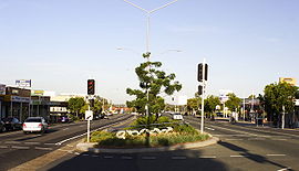 | |
Old Cleveland Road at Carina | |
| General information | |
| Type | Road |
| Length | 19.3 km (12 mi) |
| Route number(s) |
|
| Major junctions | |
| West end | |
| East end | |
| Location(s) | |
| Major suburbs | Coorparoo, Camp Hill, Carina, Carindale, Chandler, Capalaba |
Old Cleveland Road is a major road in Brisbane, Queensland. It runs 19.3 kilometres (12.0 mi) from Stones Corner to Capalaba in Brisbane, with most of the route signed as State Route 22.[citation needed] Sections of the road are also part of State Routes 30, 54, and 55.[citation needed] The road is the main route from inner Brisbane to Capalaba and Cleveland since New Cleveland Road only links Tingalpa with Capalaba.
The road provides the quickest access to the suburbs of Capalaba and Carindale from Logan Road and the Gateway Motorway, as well as being a main access road for Westfield Carindale Shopping Centre and Capalaba Central Shopping Centre. When completed the Eastern Busway will run parallel to, and (in some parts) in the middle of, the road so bus patrons can avoid severe peak hour traffic congestion road-wide.[1]
History[]
In 1839 and 1841 surveyors James Warner, Granville Stayplton and Robert Dixon were directed by incoming Lieutenant Owen Gorman to prepare the Moreton Bay Penal Colony for civil administration and private (rather than convict only) occupation. In particular Warner surveyed Norman Creek from (present day) Stones Corner, Hilliard's Creek and Tingalpa Creek to the Brisbane River, suggesting on his survey a road from Coopers Plains (then called Cowpers Plains) to Cleveland Point (the only eligible site that a mooted port could be located) along a line approximately 2.4 kilometres (1.5 mi) south of where Old Cleveland Road is today. A subsequent 1841 survey proposed a slightly different alignment, crossing over Tingalpa Creek only once.[2]
In 1849, Major Thomas Mitchell, Surveyor-General of the Colony of New South Wales directed that a town at Cleveland Point be surveyed as per Warner's suggestion in the 1941 survey. Warner submitted his Survey of a practicable road from Brisbane in the County of Stanley to the proposed Town of Cleveland in the same County on 22 May 1850, the first definitive plan and (subsequent) construction of a road on the current's approximate alignment. The first sale of blocks of land at Cleveland occurred on 13 August 1851 after Warner submitted a survey of allotments for the new town on 25 April of that same year.[2]

Old Cleveland Road's alignment was variously altered by various surveyors, including Warner and Gould, and the New South Wales and (subsequent) Queensland colonial and State governments until 1961, the route of which remains largely unchanged to this day. Oddly, a 1926 Brisbane City Council map called the road Cleveland Road whilst today's Mt. Gravatt-Capalaba Road was labelled by council as Old Cleveland Road. A 1975 Brisbane City Council proposal to rename the current Old Cleveland Road was halted after the Redland City council objected to the change.[2]
Between 1912 and 1926, part of the Belmont Tramway ran along the road at Carina. Between 1948 and 1969, Brisbane City Council electric trams ran along Old Cleveland Road between Logan Road and Belmont. Approximately 625 m (684 yd) of tram track remains in the median strip between Jones Road to Orwell Street in Carina. This remaining tram track is listed on the Queensland Heritage Register.[3]
Landmarks[]
- Eastern Busway
- Westfield Carindale Shopping Centre
- Sleeman Centre
- Gateway Motorway
- Capalaba Central Shopping Centre
- Coorparoo State School and the Queen Alexandra Home Community Centre
- Camp Hill State Primary School
- Belmont State Primary School
Major intersections[]
The entire road is in the Brisbane local government area.[4]
| Location | km | mi | Destinations | Notes | |
|---|---|---|---|---|---|
| Greenslopes | 0 | 0.0 | Logan Road (no route number) - south-east - rejoins State Route 95 in Greenslopes | Western end of Old Cleveland Road (State Route 22) Western concurrency terminus with State Route 95 | |
| 0.21 | 0.13 | Laura Street - north - Greenslopes | Eastern concurrency terminus with State Route 95 | ||
| Coorparoo | 1.6 | 0.99 | south-east - Holland Park | ||
| Camp Hill | 3.5 | 2.2 | |||
| Carina - Carindale boundary | 6.1 | 3.8 | south - Upper Mount Gravatt | ||
| Carindale / Belmont boundary | 8.5 | 5.3 | south - Mackenzie | ||
| Chandler | 11.1 | 6.9 | north (no route number) - Gumdale | Western concurrency terminus with State Route 30 | |
| 12.8 | 8.0 | Old Cleveland Road continues east as State Route 30 | |||
| 14.2 | 8.8 | Old Cleveland Road continues south-east with no route number | |||
| 15.0 | 9.3 | Camrose Street - north-east - Chandler | Old Cleveland Road continues south-east as State Route 54 | ||
| Capalaba | 15.4 | 9.6 | |||
| 16.5 | 10.3 | ||||
| Birkdale | 18.5 | 11.5 | Old Cleveland Road continues south-east as State Route 55 | ||
| 19.3 | 12.0 | Rossinton Street - south - Birkdale / Currawong Drive - north - Birkdale | Eastern end of Old Cleveland Road. State Route 55 continues east as Old Cleveland Road East | ||
1.000 mi = 1.609 km; 1.000 km = 0.621 mi
| |||||
See also[]
- Ipswich Road
- Logan Road
- Road transport in Brisbane
References[]
- ^ Translink Transit Authority (Queensland)(2012) 'Eastern Busway Alignment Maps'. Retrieved 8 August 2012.
- ^ Jump up to: a b c Fr. Michael A. Endicott O.S.A., M.A. (November 1975) 'The Origins of Old Cleveland Road'. In Coorparoo and Saint James' Church. Accessed from the University of Queensland Library. Retrieved 8 August 2012.
- ^ "Old Cleveland Road Tramway Tracks (entry 601839)". Queensland Heritage Register. Queensland Heritage Council. Retrieved 12 August 2015.
- ^ Google (20 July 2017). "Old Cleveland Road, Brisbane" (Map). Google Maps. Google. Retrieved 20 July 2017.
- Old Cleveland Road, Brisbane
- Roads in Brisbane
- Roads in Redland City
- Capalaba, Queensland