Olleros District, Huaraz
Olleros | |
|---|---|
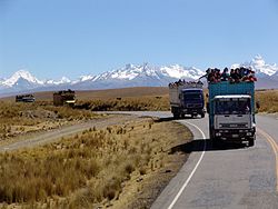 The Cordillera Blanca with Shaqsha (center) as seen from the southwest | |
| Country | |
| Region | Ancash |
| Province | Huaraz |
| Founded | October 16, 1933 |
| Capital | |
| Government | |
| • Mayor | Sixto Feliciano Blacido León |
| Area | |
| • Total | 222.91 km2 (86.07 sq mi) |
| Elevation | 3,336 m (10,945 ft) |
| Population (2005 census) | |
| • Total | 2,761 |
| • Density | 12/km2 (32/sq mi) |
| Time zone | UTC-5 (PET) |
| UBIGEO | 020108 |
Olleros District is one of twelve districts of the province Huaraz in Peru.[1]
Geography[]
The Cordillera Blanca traverses the district. Some of the highest peaks of the district are listed below:[2]
- Ararankha
- Arway
- Kashan
- Puma Waqanqa
- Ruriq
- Shaqsha
- Tuqtu
- Tuqtu Punta
- Urwashrahu
- Wamash Punta
- Yanarahu
Ethnic groups[]
The people in the district are mainly indigenous citizens of Quechua descent. Quechua is the language which the majority of the population (67.54%) learnt to speak in childhood, 32.17% of the residents started speaking using the Spanish language (2007 Peru Census).[3]
References[]
- ^ (in Spanish) Instituto Nacional de Estadística e Informática. Banco de Información Distrital Archived 2008-04-23 at the Wayback Machine. Retrieved April 11, 2008.
- ^ escale.minedu.gob.pe - UGEL map of the Huaraz Province (Ancash Region)
- ^ inei.gob.pe Archived 2013-01-27 at the Wayback Machine INEI, Peru, Censos Nacionales 2007, Frequencias: Preguntas de Población: Idioma o lengua con el que aprendió hablar (in Spanish)
Coordinates: 9°37′59″S 77°28′59″W / 9.63306°S 77.48306°W

This Ancash Region geography article is a stub. You can help Wikipedia by . |
Categories:
- Districts of the Huaraz Province
- Districts of the Ancash Region
- Ancash Region geography stubs