Onaga, Kansas
Onaga, Kansas | |
|---|---|
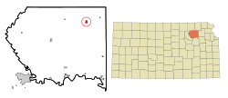 Location within Pottawatomie County and Kansas | |
 | |
| Coordinates: 39°29′22″N 96°10′8″W / 39.48944°N 96.16889°WCoordinates: 39°29′22″N 96°10′8″W / 39.48944°N 96.16889°W | |
| Country | United States |
| State | Kansas |
| County | Pottawatomie |
| Platted | 1877 |
| Incorporated | 1926 |
| Area | |
| • Total | 0.66 sq mi (1.70 km2) |
| • Land | 0.66 sq mi (1.70 km2) |
| • Water | 0.00 sq mi (0.00 km2) |
| Elevation | 1,102 ft (336 m) |
| Population | |
| • Total | 702 |
| • Estimate (2019)[3] | 682 |
| • Density | 1,039.63/sq mi (401.50/km2) |
| Time zone | UTC-6 (CST) |
| • Summer (DST) | UTC-5 (CDT) |
| ZIP code | 66521 |
| Area code | 785 |
| FIPS code | 20-52875 [4] |
| GNIS ID | 0476116 [5] |
| Website | cityofonaga.com |

Onaga is a city in Pottawatomie County, Kansas, United States. As of the 2010 census, the city population was 702.[6]
History[]
Onaga was platted in 1877 by the railroad.[7] Onaga is a Potawatomi Indian name for Small Potatoes.[8]
The first post office in Onaga was established in December 1877.[9]
Geography[]
Onaga is located at 39°29′22″N 96°10′8″W / 39.48944°N 96.16889°W (39.489415, -96.168993).[10] According to the United States Census Bureau, the city has a total area of 0.64 square miles (1.66 km2), all of it land.[11]
Climate[]
This climatic region is typified by large seasonal temperature differences, with warm to hot (and often humid) summers and cold (sometimes severely cold) winters. According to the Köppen Climate Classification system, Onaga has a humid continental climate, abbreviated "Dfa" on climate maps.[12]
Demographics[]
| Historical population | |||
|---|---|---|---|
| Census | Pop. | %± | |
| 1880 | 242 | — | |
| 1890 | 423 | 74.8% | |
| 1900 | 598 | 41.4% | |
| 1910 | 759 | 26.9% | |
| 1920 | 838 | 10.4% | |
| 1930 | 930 | 11.0% | |
| 1940 | 741 | −20.3% | |
| 1950 | 882 | 19.0% | |
| 1960 | 850 | −3.6% | |
| 1970 | 761 | −10.5% | |
| 1980 | 752 | −1.2% | |
| 1990 | 761 | 1.2% | |
| 2000 | 704 | −7.5% | |
| 2010 | 702 | −0.3% | |
| 2019 (est.) | 682 | [3] | −2.8% |
| U.S. Decennial Census | |||
Onaga is part of the Manhattan, Kansas Metropolitan Statistical Area.
2010 census[]
As of the census[2] of 2010, there were 702 people, 286 households, and 166 families residing in the city. The population density was 1,096.9 inhabitants per square mile (423.5/km2). There were 359 housing units at an average density of 560.9 per square mile (216.6/km2). The racial makeup of the city was 97.0% White, 0.3% African American, 0.4% Native American, 0.7% Asian, 0.3% from other races, and 1.3% from two or more races. Hispanic or Latino of any race were 2.0% of the population.
There were 286 households, of which 30.8% had children under the age of 18 living with them, 45.5% were married couples living together, 9.4% had a female householder with no husband present, 3.1% had a male householder with no wife present, and 42.0% were non-families. 37.8% of all households were made up of individuals, and 21.6% had someone living alone who was 65 years of age or older. The average household size was 2.32 and the average family size was 3.13.
The median age in the city was 40.8 years. 26.1% of residents were under the age of 18; 5.3% were between the ages of 18 and 24; 22.7% were from 25 to 44; 22.6% were from 45 to 64; and 23.4% were 65 years of age or older. The gender makeup of the city was 46.4% male and 53.6% female.
2000 census[]
As of the census[4] of 2000, there were 704 people, 292 households, and 162 families residing in the city. The population density was 1,109.2 people per square mile (431.5/km2). There were 347 housing units at an average density of 546.7 per square mile (212.7/km2). The racial makeup of the city was 96.73% White, 0.28% African American, 0.71% Native American, 0.43% Asian, 0.28% from other races, and 1.56% from two or more races. Hispanic or Latino of any race were 2.41% of the population.
There were 292 households, out of which 27.4% had children under the age of 18 living with them, 46.9% were married couples living together, 6.5% had a female householder with no husband present, and 44.5% were non-families. 40.8% of all households were made up of individuals, and 25.7% had someone living alone who was 65 years of age or older. The average household size was 2.21 and the average family size was 3.02.
In the city, the population was spread out, with 23.6% under the age of 18, 6.1% from 18 to 24, 21.2% from 25 to 44, 19.9% from 45 to 64, and 29.3% who were 65 years of age or older. The median age was 44 years. For every 100 females, there were 86.7 males. For every 100 females age 18 and over, there were 81.1 males.
The median income for a household in the city was $28,929, and the median income for a family was $38,173. Males had a median income of $30,347 versus $21,250 for females. The per capita income for the city was $16,219. About 8.4% of families and 13.2% of the population were below the poverty line, including 17.5% of those under age 18 and 9.4% of those age 65 or over.
Education[]
The community is served by Onaga USD 322 public school district.
References[]
- ^ "2019 U.S. Gazetteer Files". United States Census Bureau. Retrieved July 24, 2020.
- ^ Jump up to: a b "U.S. Census website". United States Census Bureau. Retrieved 2012-07-06.
- ^ Jump up to: a b "Population and Housing Unit Estimates". United States Census Bureau. May 24, 2020. Retrieved May 27, 2020.
- ^ Jump up to: a b "U.S. Census website". United States Census Bureau. Retrieved 2008-01-31.
- ^ "US Board on Geographic Names". United States Geological Survey. 2007-10-25. Retrieved 2008-01-31.
- ^ "2010 City Population and Housing Occupancy Status". U.S. Census Bureau. Retrieved March 6, 2011.[dead link]
- ^ Blackmar, Frank Wilson (1912). Kansas: A Cyclopedia of State History, Volume 2. Standard Publishing Company. pp. 391.
- ^ Kansas State Historical Society (1916). Biennial Report of the Board of Directors of the Kansas State Historical Society. Kansas State Printing Plant. pp. 263.
- ^ "Kansas Post Offices, 1828-1961". Kansas Historical Society. Archived from the original on October 9, 2013. Retrieved 22 June 2014.
- ^ "US Gazetteer files: 2010, 2000, and 1990". United States Census Bureau. 2011-02-12. Retrieved 2011-04-23.
- ^ "US Gazetteer files 2010". United States Census Bureau. Archived from the original on 2012-01-25. Retrieved 2012-07-06.
- ^ Climate Summary for Onaga, Kansas
Further reading[]
External links[]
| hide Municipalities and communities of Pottawatomie County, Kansas, United States | ||
|---|---|---|
| Cities |  | |
| Unincorporated communities | ||
| Footnotes | ‡This populated place also has portions in an adjacent county or counties | |
| ||
| show Authority control |
|---|
- Cities in Pottawatomie County, Kansas
- Cities in Kansas
- Manhattan, Kansas metropolitan area
- 1877 establishments in Kansas
- Populated places established in 1877