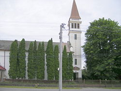
Ondrejovce
Ondrejovce | |
|---|---|
Village | |
 | |
 Ondrejovce Location of Ondrejovce in Slovakia | |
| Coordinates: 48°08′N 18°31′E / 48.133°N 18.517°ECoordinates: 48°08′N 18°31′E / 48.133°N 18.517°E | |
| Country | Slovakia |
| Region | Nitra |
| District | Levice |
| First mentioned | 1260 |
| Area | |
| • Total | 19.61 km2 (7.57 sq mi) |
| Elevation | 163 m (535 ft) |
| Population (2007-10-30) | |
| • Total | 481 |
| • Density | 25/km2 (64/sq mi) |
| Postal code | 935 51 |
| Area code(s) | +421-36 |
| Car plate | LV |
| Website | www.obecondrejovce.sk |

Ondrejovce (Hungarian: Barsendréd) is a village and municipality in the Levice District in the Nitra Region of Slovakia.
History[]
In historical records the village was first mentioned in 1260.
Geography[]
The village lies at an altitude of 163 metres and covers an area of 19.611 km². It has a population of about 470 people.
Ethnicity[]
The village is approximately 62% Slovak and 37% Magyar and 1% Gypsy.
Facilities[]
The village has a public library and football pitch.
External links[]
This Levice District geography article is a stub. You can help Wikipedia by . |
Categories:
- Villages and municipalities in Levice District
- Levice District geography stubs