Ormiston, Queensland
| Ormiston Redland City, Queensland | |||||||||||||||
|---|---|---|---|---|---|---|---|---|---|---|---|---|---|---|---|
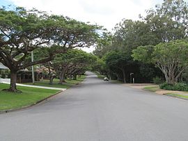 Wellington Street, 2013 | |||||||||||||||
 Ormiston | |||||||||||||||
| Coordinates | 27°30′44″S 153°15′15″E / 27.5122°S 153.2541°ECoordinates: 27°30′44″S 153°15′15″E / 27.5122°S 153.2541°E | ||||||||||||||
| Population | 5,793 (2016 census)[1] | ||||||||||||||
| • Density | 950/km2 (2,460/sq mi) | ||||||||||||||
| Postcode(s) | 4160 | ||||||||||||||
| Area | 6.1 km2 (2.4 sq mi) | ||||||||||||||
| Time zone | AEST (UTC+10:00) | ||||||||||||||
| Location |
| ||||||||||||||
| LGA(s) | Redland City | ||||||||||||||
| State electorate(s) | Oodgeroo | ||||||||||||||
| Federal Division(s) | Bowman | ||||||||||||||
| |||||||||||||||

Ormiston is a coastal residential locality in the City of Redland, Queensland, Australia.[2] In the 2016 census, Ormiston had a population of 5,793 people.[1]
Geography[]
Ormiston is adjacent to the suburbs of Cleveland and Wellington Point.
History[]
Pre settlement[]
The Koobenpul lived on the mainland coastal strip stretching from Talwarrapin (Redland Bay) to the mouth of the Mairwar (Brisbane River), including the area now known as Ormiston. Canoe trees and a bora ring from pre-settlement days still remain along Hilliards creek.[3][4]
Post settlement[]

Originally part of the township of Cleveland, early industry included a brickworks established by James Maskell on the eastern bank of Hilliards Creek in 1852 and fellmongery (wool scour) owned by a Thomas Blacket Stephens until the early 1860s. Joseph Clark raised cattle in the district from 1855 until he relinquished the lease in 1858.[5]
Land around Ormiston was bought in 1853 by Captain Louis Hope, a Scottish aristocrat and a founder of the Queensland sugar industry.[6] Hope built Ormiston House from 1858 and 1865 as the centre of a 325-acre (1.32 km2) sugar estate.[7] Ormiston House is one of the finest examples of colonial architecture in Queensland.[6]

The property was originally called Woojanness, but was renamed Ormiston after the Hope's family ancestral village of Ormiston, Scotland. It has an ornamental garden that dates from the building of the house. Hope continued with his plantation until 1875, until he lost a dispute over access to his sugar mill and decided to dismantle it. Since the 1960s the house has been a museum. Although the house was called Ormiston, the area around it was still known as Cleveland for many years. When the railway came through the area in 1889, the new railway station and the area around it also became known as Ormiston.[2][8]
Cleveland West State School opened on 13 April 1872. It was renamed Ormiston State School circa 1900.[9]
Ormiston College opened on 27 January 1988.[9]
Heritage listings[]

Ormiston has a number of heritage-listed sites, including:
- 11-13 Empire Vistas: Empire Point foreshore [10]
- 56 Hilliard Street: Old Bridge over Hilliards Creek [10]
- Sturgeon Street: Ormiston Fellmongery [11]
- 277-295 Wellington Street: Ormiston House Estate [10][12]
- 209-213 Wellington Street: St Andrews Church [10][13]
Transport[]
Ormiston railway station provides access to regular Queensland Rail City network services to Brisbane and Cleveland.
Amenities[]
Ormiston is home to the Redlands Christian Reformed Church and Ormiston House.
It has the Ormiston Redbacks Swim Club (amateur swimming club), the Redlands Softball League and the Redlands Boxing Club.
Education[]
Ormiston State School is a government primary (Prep-6) school for boys and girls at 82-110 Gordon Street (27°30′59″S 153°15′31″E / 27.5164°S 153.2585°E).[14][15] In 2017, the school had an enrolment of 608 students with 45 teachers (38 full-time equivalent) and 23 non-teaching staff (15 full-time equivalent).[16] It includes a special education program.[14]
Ormiston College is a private primary and secondary (Prep-12) school for boys and girls at 97 Dundas Street West (27°30′55″S 153°14′48″E / 27.5153°S 153.2468°E).[14][17] In 2017, the school had an enrolment of 1,279 students with 95 teachers (94 full-time equivalent) and 62 non-teaching staff (47 full-time equivalent).[16]
Demographics[]
In the 2011 census, Ormiston recorded a population of 5,641 people, 52.4% female and 47.6% male.[18] The median age of the Ormiston population was 44 years, 7 years above the national median of 37. 67.3% of people living in Ormiston were born in Australia. The other top responses for country of birth were England 9.9%, New Zealand 5.5%, South Africa 3.3%, Scotland 1.6%, Germany 0.8%. 90.8% of people spoke only English at home; the next most common languages were 0.7% German, 0.6% Afrikaans, 0.6% Mandarin, 0.5% Italian, 0.3% Greek.[18]
Notable residents[]
- John Cameron, built and occupied the house Doobawah in Ormiston [19]
- Louis Hope, established the Ormiston Estate [19]
References[]
- ^ Jump up to: a b Australian Bureau of Statistics (27 June 2017). "Ormiston (SSC)". 2016 Census QuickStats. Retrieved 20 October 2018.

- ^ Jump up to: a b "Ormiston – locality in City of Redland (entry 43631)". Queensland Place Names. Queensland Government. Retrieved 17 November 2019.
- ^ "Aboriginal cultural heritage". Redland City Council. Archived from the original on 10 March 2011. Retrieved 10 June 2019.
- ^ "In the beginning". Redland City Council. Archived from the original on 12 November 2009. Retrieved 10 June 2019.
- ^ "Hilliards Creek History". Redland City Council. Archived from the original on 10 March 2011. Retrieved 10 June 2019.
- ^ Jump up to: a b Cook, Penny (2006). Discover Queensland Heritage. Corinda, Queensland: Pictorial Press Australia. p. 33. ISBN 1876561424.
- ^ "Captain Hope and Ormiston House". Redland City Council. Archived from the original on 12 July 2009. Retrieved 10 June 2019.
- ^ "Ormiston". Redland City Council. Archived from the original on 3 October 2009. Retrieved 10 June 2019.
- ^ Jump up to: a b Queensland Family History Society (2010), Queensland schools past and present (Version 1.01 ed.), Queensland Family History Society, ISBN 978-1-921171-26-0
- ^ Jump up to: a b c d "Schedule 4 - Heritage Places Register" (PDF). Redland City Council. March 2006. p. 1. Archived (PDF) from the original on 5 September 2020. Retrieved 5 September 2020.
- ^ "Ormiston Fellmongery (entry 645606)". Queensland Heritage Register. Queensland Heritage Council. Retrieved 5 September 2020.
- ^ "Ormiston House Estate (entry 600775)". Queensland Heritage Register. Queensland Heritage Council. Retrieved 12 July 2013.
- ^ "St Andrews Church (entry 600774)". Queensland Heritage Register. Queensland Heritage Council. Retrieved 12 July 2013.
- ^ Jump up to: a b c "State and non-state school details". Queensland Government. 9 July 2018. Archived from the original on 21 November 2018. Retrieved 21 November 2018.
- ^ "Ormiston State School". Archived from the original on 27 February 2014. Retrieved 21 November 2018.
- ^ Jump up to: a b "ACARA School Profile 2017". Archived from the original on 22 November 2018. Retrieved 22 November 2018.
- ^ "Ormiston College". Archived from the original on 23 October 2018. Retrieved 21 November 2018.
- ^ Jump up to: a b Australian Bureau of Statistics (31 October 2012). "Ormiston (State Suburb)". 2011 Census QuickStats. Retrieved 17 March 2013.
- ^ Jump up to: a b "Ormiston timeline". www.redland.qld.gov.au. Archived from the original on 22 December 2015. Retrieved 21 December 2015.
External links[]
| Wikimedia Commons has media related to Ormiston, Queensland. |
- "Ormiston". Queensland Places. Centre for the Government of Queensland, University of Queensland.
- Suburbs of Redland City
- Ormiston, Queensland
- Coastline of Queensland
- Localities in Queensland