Oshkosh, Nebraska
Oshkosh, Nebraska | |
|---|---|
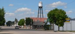 Downtown Oshkosh: Main Street, looking north | |
 Location of Oshkosh, Nebraska | |
| Coordinates: 41°24′31″N 102°20′47″W / 41.40861°N 102.34639°WCoordinates: 41°24′31″N 102°20′47″W / 41.40861°N 102.34639°W | |
| Country | United States |
| State | Nebraska |
| County | Garden |
| Incorporated | 1910[1] |
| Area | |
| • Total | 0.67 sq mi (1.73 km2) |
| • Land | 0.67 sq mi (1.73 km2) |
| • Water | 0.00 sq mi (0.00 km2) |
| Elevation | 3,389 ft (1,033 m) |
| Population | |
| • Total | 884 |
| • Estimate (2019)[4] | 777 |
| • Density | 1,161.43/sq mi (448.54/km2) |
| Time zone | UTC−7 (Mountain (MST)) |
| • Summer (DST) | UTC−6 (MDT) |
| ZIP codes | 69154, 69190 |
| Area code(s) | 308 |
| FIPS code | 31-37560[5] |
| GNIS feature ID | 0831911[6] |
| Website | oshkoshnebraska.com |

Oshkosh is a city in Garden County, Nebraska, United States. The population was 884 at the 2010 census. It is the county seat of Garden County.[7]
History[]
Oshkosh was founded in the 1880s by cattlemen who found the surrounding area ideal for livestock grazing.[8] It was named after the city of Oshkosh, Wisconsin.[9] The first post office in Oshkosh was established in 1889.[10]
The railroad was extended to Oshkosh in 1908, and Oshkosh was designated county seat in 1909 of the new Garden County.[11]
Oshkosh was incorporated in 1910.[1]
Geography[]
Oshkosh is located at 41°24′31″N 102°20′47″W / 41.40861°N 102.34639°W (41.408570, -102.346391),[12] just north of the North Platte River.
According to the United States Census Bureau, the city has a total area of 0.67 square miles (1.74 km2), all land.[13]
Demographics[]
| Historical population | |||
|---|---|---|---|
| Census | Pop. | %± | |
| 1920 | 707 | — | |
| 1930 | 843 | 19.2% | |
| 1940 | 910 | 7.9% | |
| 1950 | 1,124 | 23.5% | |
| 1960 | 1,025 | −8.8% | |
| 1970 | 1,067 | 4.1% | |
| 1980 | 1,057 | −0.9% | |
| 1990 | 986 | −6.7% | |
| 2000 | 887 | −10.0% | |
| 2010 | 884 | −0.3% | |
| 2019 (est.) | 777 | [4] | −12.1% |
| U.S. Decennial Census[14] | |||
2010 census[]
As of the census[3] of 2010, there were 884 people, 400 households, and 229 families residing in the city. The population density was 1,319.4 inhabitants per square mile (509.4/km2). There were 490 housing units at an average density of 731.3 per square mile (282.4/km2). The racial makeup of the city was 97.1% White, 0.1% African American, 0.3% Native American, 0.7% from other races, and 1.8% from two or more races. Hispanic or Latino of any race were 4.2% of the population.
There were 400 households, of which 25.0% had children under the age of 18 living with them, 45.0% were married couples living together, 8.3% had a female householder with no husband present, 4.0% had a male householder with no wife present, and 42.8% were non-families. 39.0% of all households were made up of individuals, and 22% had someone living alone who was 65 years of age or older. The average household size was 2.13 and the average family size was 2.82.
The median age in the city was 47.5 years. 21.9% of residents were under the age of 18; 5.8% were between the ages of 18 and 24; 19.7% were from 25 to 44; 25.4% were from 45 to 64; and 27.4% were 65 years of age or older. The gender makeup of the city was 48.4% male and 51.6% female.
2000 census[]
As of the census[5] of 2000, there were 887 people, 413 households, and 249 families residing in the city. The population density was 1,316.8 people per square mile (511.2/km2). There were 489 housing units at an average density of 726.0 per square mile (281.8/km2). The racial makeup of the city was 99.44% White, 0.11% Native American, 0.11% Asian, and 0.34% from two or more races. Hispanic or Latino of any race were 1.92% of the population.
There were 413 households, out of which 23.2% had children under the age of 18 living with them, 49.2% were married couples living together, 7.5% had a female householder with no husband present, and 39.7% were non-families. 37.3% of all households were made up of individuals, and 19.6% had someone living alone who was 65 years of age or older. The average household size was 2.07 and the average family size was 2.72.
In the city, the population was spread out, with 20.6% under the age of 18, 4.5% from 18 to 24, 21.8% from 25 to 44, 23.6% from 45 to 64, and 29.5% who were 65 years of age or older. The median age was 47 years. For every 100 females, there were 84.8 males. For every 100 females age 18 and over, there were 81.0 males.
As of 2000 the median income for a household in the city was $27,135, and the median income for a family was $33,750. Males had a median income of $22,303 versus $18,000 for females. The per capita income for the city was $16,292. About 9.5% of families and 11.7% of the population were below the poverty line, including 17.9% of those under age 18 and 5.3% of those age 65 or over.
Climate[]
Oshkosh is the site of the coldest temperature ever recorded in Nebraska: on December 22, 1989, the temperature fell to −47 °F or −43.9 °C, tying a state record set by Bridgeport in 1899.[15]
The table below was compiled from data spanning from 1913 until July 2018.[16]
| hideClimate data for Oshkosh, NE | |||||||||||||
|---|---|---|---|---|---|---|---|---|---|---|---|---|---|
| Month | Jan | Feb | Mar | Apr | May | Jun | Jul | Aug | Sep | Oct | Nov | Dec | Year |
| Record high °F (°C) | 75 (24) |
79 (26) |
87 (31) |
95 (35) |
100 (38) |
109 (43) |
111 (44) |
108 (42) |
103 (39) |
94 (34) |
83 (28) |
76 (24) |
111 (44) |
| Average high °F (°C) | 38.5 (3.6) |
43.8 (6.6) |
51.8 (11.0) |
62.9 (17.2) |
72.2 (22.3) |
81.9 (27.7) |
88.8 (31.6) |
86.7 (30.4) |
78.2 (25.7) |
66.8 (19.3) |
51.2 (10.7) |
40.6 (4.8) |
63.6 (17.6) |
| Average low °F (°C) | 11.0 (−11.7) |
15.7 (−9.1) |
23.1 (−4.9) |
33.1 (0.6) |
43.9 (6.6) |
53.7 (12.1) |
60.0 (15.6) |
57.5 (14.2) |
46.9 (8.3) |
34.1 (1.2) |
21.7 (−5.7) |
13.3 (−10.4) |
34.5 (1.4) |
| Record low °F (°C) | −34 (−37) |
−29 (−34) |
−29 (−34) |
−10 (−23) |
14 (−10) |
29 (−2) |
34 (1) |
35 (2) |
14 (−10) |
−5 (−21) |
−21 (−29) |
−47 (−44) |
−47 (−44) |
| Average precipitation inches (mm) | 0.31 (7.9) |
0.39 (9.9) |
0.91 (23) |
1.93 (49) |
2.90 (74) |
2.88 (73) |
2.53 (64) |
1.98 (50) |
1.48 (38) |
1.04 (26) |
0.57 (14) |
0.43 (11) |
17.35 (439.8) |
| Average snowfall inches (cm) | 4.4 (11) |
4.8 (12) |
6.2 (16) |
3.1 (7.9) |
0.4 (1.0) |
0 (0) |
0 (0) |
0 (0) |
0.1 (0.25) |
1.0 (2.5) |
4.3 (11) |
4.7 (12) |
29 (73.65) |
| Source: https://wrcc.dri.edu/cgi-bin/cliMAIN.pl?ne6385 | |||||||||||||
References[]
- ^ Jump up to: a b "Oshkosh Nebraska". City-Data.com. Retrieved October 19, 2012.
- ^ "2019 U.S. Gazetteer Files". United States Census Bureau. Retrieved July 26, 2020.
- ^ Jump up to: a b "U.S. Census website". United States Census Bureau. Retrieved 2012-06-24.
- ^ Jump up to: a b "Population and Housing Unit Estimates". United States Census Bureau. May 24, 2020. Retrieved May 27, 2020.
- ^ Jump up to: a b "U.S. Census website". United States Census Bureau. Retrieved 2008-01-31.
- ^ "US Board on Geographic Names". United States Geological Survey. 2007-10-25. Retrieved 2008-01-31.
- ^ "Find a County". National Association of Counties. Retrieved 2011-06-07.
- ^ "Oshkosh History". County of Oshkosh, NE. Archived from the original on 18 December 2014. Retrieved 9 August 2014.
- ^ "Profile for Oshkosh City, Nebraska, NE". ePodunk. Archived from the original on August 26, 2016. Retrieved October 19, 2012.
- ^ "Garden County". Jim Forte Postal History. Retrieved 9 August 2014.
- ^ "Oshkosh, Garden County". Center for Advanced Land Management Information Technologies. University of Nebraska. Retrieved 9 August 2014.
- ^ "US Gazetteer files: 2010, 2000, and 1990". United States Census Bureau. 2011-02-12. Retrieved 2011-04-23.
- ^ "US Gazetteer files 2010". United States Census Bureau. Archived from the original on 2012-01-25. Retrieved 2012-06-24.
- ^ "Census of Population and Housing". Census.gov. Retrieved June 4, 2015.
- ^ Enloe. "State Climate Extremes Committee (SCEC) | Extremes | National Centers for Environmental Information (NCEI)". www.ncdc.noaa.gov. Retrieved 2018-07-24.
- ^ "OSHKOSH, NEBRASKA - Climate Summary". wrcc.dri.edu. Retrieved 2018-07-24.
External links[]
| Wikimedia Commons has media related to Oshkosh, Nebraska. |
| show Municipalities and communities of Garden County, Nebraska, United States |
|---|
| Authority control |
|
|---|
- Cities in Nebraska
- Cities in Garden County, Nebraska
- County seats in Nebraska
- Populated places established in 1910
- 1910 establishments in Nebraska