Paicines, California
Paicines, California | |
|---|---|
 Paicines General Store marks the intersection of SR25 and County Road J1. | |
 Paicines, California | |
| Coordinates: 36°43′43″N 121°16′39″W / 36.728611°N 121.27750°WCoordinates: 36°43′43″N 121°16′39″W / 36.728611°N 121.27750°W | |
| Country | United States |
| State | California |
| County | San Benito |
| Elevation | 682 ft (208 m) |
| Time zone | UTC-8 (Pacific (PST)) |
| • Summer (DST) | UTC-7 (PDT) |
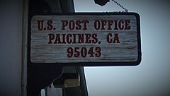
| Zip code | 95043 |
| Area code(s) | 209 |
| GNIS feature ID | 1659334[1] |


The unincorporated community of Paicines, formerly Tres Pinos, is located at 680 feet (207 m) above mean sea level (AMSL) in San Benito County, California along State Route 25. Guide signs along SR 25 say the community is 13 miles (21 km) south of Hollister. The community is at the intersection of Panoche Road and SR 25. Bolado County Park is just over three miles (5 km) north of the community and the site of the San Benito County Fair.
Hydrologic features in the area include Tres Pinos Creek, the San Benito River, and the Paicines Reservoir. The area is in the San Andreas Rift Zone area in proximity to the San Andreas Fault. Areas to the south and east are mountainous. The county line runs along the Gabilan Range.
The community is a gateway to Pinnacles National Park, a National Park straddling the mountains along the Monterey-San Benito County line.

Famous people associated with Paicines include Lieutenant General Janet C. Wolfenbarger, the highest-ranking woman in the United States Air Force; her parents Eldon and Shirley Libby reside in Paicines.[2] Charlie Root, the famous Chicago Cubs pitcher and coach, retired there to a ranch. Actress Judy Garland (born Frances Ethel Gumm; 10 June 1922 – 22 June 1969) married her third husband, Sid Luft, at what was then known as The Law Ranch, now called The Paicines Ranch. Tiburcio Vásquez, a bandido, was active in the area.
The ZIP Code is 95043. The community is inside area code 831. The local prefix is 389. Local telephone service is provided by Pinnacles Telephone Co., an independent telephone company.[3]
History[]
The town of Paicines was originally located 5 miles north of the town of Tres Pinos. The opposite is true today.
The railroad was tasked to build a line to Tres Pinos. By 1873 they made it to Paicines but did not wish to continue building more line. So in 1874 the names of the two towns were switched so the railroad could say they had fulfilled their commitment to build a line all the way to Tres Pinos.[citation needed]
Politics[]
In the state legislature, Paicines is located in the 12th Senate District, represented by Republican Anthony Cannella, and in the 28th Assembly District, represented by Democrat Anna M. Caballero.
In the United States House of Representatives, Paicines is in California's 20th congressional district, represented by Democrat Jimmy Panetta.[4]
Climate[]
According to the Köppen Climate Classification system, Paicines has a semi-arid climate, abbreviated "BSk" on climate maps.[5]
See also[]
References[]
- ^ "Paicines". Geographic Names Information System. United States Geological Survey.
- ^ Janet C. Wolfenbarger, Gilroy Dispatch (Gilroy, California), 20 May 2005 (accessed 10 December 2009).
- ^ Our History
- ^ "California's 20th Congressional District - Representatives & District Map". Civic Impulse, LLC. Retrieved 24 September 2014.
- ^ Climate Summary for Paicines, California
External links[]
| hide Municipalities and communities of San Benito County, California, United States | ||
|---|---|---|
| Cities |  | |
| CDPs | ||
| Unincorporated communities | ||
| Ghost town | ||
| Footnotes | ‡This populated place also has portions in an adjacent county or counties | |
| ||
- Unincorporated communities in San Benito County, California
- Unincorporated communities in California