Palermo, North Dakota
Palermo, North Dakota | |
|---|---|
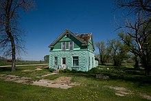
 Houses in Palermo | |
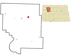 Location of Palermo, North Dakota | |
| Coordinates: 48°20′22″N 102°13′47″W / 48.33944°N 102.22972°WCoordinates: 48°20′22″N 102°13′47″W / 48.33944°N 102.22972°W | |
| Country | United States |
| State | North Dakota |
| County | Mountrail |
| Area | |
| • Total | 2.25 sq mi (5.84 km2) |
| • Land | 2.25 sq mi (5.83 km2) |
| • Water | 0.01 sq mi (0.01 km2) |
| Elevation | 2,208 ft (673 m) |
| Population | |
| • Total | 74 |
| • Estimate (2019)[3] | 98 |
| • Density | 43.56/sq mi (16.82/km2) |
| Time zone | UTC-6 (Central (CST)) |
| • Summer (DST) | UTC-5 (CDT) |
| ZIP code | 58769 |
| Area code(s) | 701 |
| FIPS code | 38-60620 |
| GNIS feature ID | 1030621[4] |

Palermo (/ˈpælərmoʊ/ PAL-ər-moh) is a city in Mountrail County, North Dakota, United States. The population was 74 at the 2010 census.[5]
History[]
Palermo was founded in 1902. The city's name is a transfer from Palermo, in Sicily.[6]
Geography[]
Palermo is located at 48°20′22″N 102°13′47″W / 48.339412°N 102.229796°W.[7]
According to the United States Census Bureau, the city has a total area of 2.21 square miles (5.72 km2), all land.[8]
Demographics[]
| Historical population | |||
|---|---|---|---|
| Census | Pop. | %± | |
| 1910 | 177 | — | |
| 1920 | 179 | 1.1% | |
| 1930 | 205 | 14.5% | |
| 1940 | 178 | −13.2% | |
| 1950 | 150 | −15.7% | |
| 1960 | 188 | 25.3% | |
| 1970 | 146 | −22.3% | |
| 1980 | 97 | −33.6% | |
| 1990 | 95 | −2.1% | |
| 2000 | 77 | −18.9% | |
| 2010 | 74 | −3.9% | |
| 2019 (est.) | 98 | [3] | 32.4% |
| U.S. Decennial Census[9] 2018 Estimate[10] | |||
2010 census[]
As of the census[2] of 2010, there were 74 people, 39 households, and 18 families residing in the city. The population density was 33.5 inhabitants per square mile (12.9/km2). There were 67 housing units at an average density of 30.3 per square mile (11.7/km2). The racial makeup of the city was 95.9% White, 1.4% African American, 1.4% Native American, and 1.4% from two or more races. Hispanic or Latino of any race were 1.4% of the population.
There were 39 households, of which 15.4% had children under the age of 18 living with them, 35.9% were married couples living together, 7.7% had a female householder with no husband present, 2.6% had a male householder with no wife present, and 53.8% were non-families. 51.3% of all households were made up of individuals, and 7.7% had someone living alone who was 65 years of age or older. The average household size was 1.90 and the average family size was 2.83.
The median age in the city was 49.5 years. 14.9% of residents were under the age of 18; 9.5% were between the ages of 18 and 24; 16.3% were from 25 to 44; 37.9% were from 45 to 64; and 21.6% were 65 years of age or older. The gender makeup of the city was 59.5% male and 40.5% female.
2000 census[]
As of the census of 2000, there were 77 people, 38 households, and 22 families residing in the city. The population density was 35.2 people per square mile (13.6/km2). There were 53 housing units at an average density of 24.2 per square mile (9.3/km2). The racial makeup of the city was 97.40% White, 1.30% Asian, and 1.30% from two or more races.
There were 38 households, out of which 18.4% had children under the age of 18 living with them, 52.6% were married couples living together, 5.3% had a female householder with no husband present, and 39.5% were non-families. 39.5% of all households were made up of individuals, and 26.3% had someone living alone who was 65 years of age or older. The average household size was 2.03 and the average family size was 2.65.
In the city, the population was spread out, with 18.2% under the age of 18, 3.9% from 18 to 24, 18.2% from 25 to 44, 23.4% from 45 to 64, and 36.4% who were 65 years of age or older. The median age was 51 years. For every 100 females, there were 83.3 males. For every 100 females age 18 and over, there were 96.9 males.
The median income for a household in the city was $33,125, and the median income for a family was $35,313. Males had a median income of $27,500 versus $22,500 for females. The per capita income for the city was $14,028. There were no families and 2.4% of the population living below the poverty line, including no under eighteens and none of those over 64.
References[]
- ^ "2019 U.S. Gazetteer Files". United States Census Bureau. Retrieved July 27, 2020.
- ^ Jump up to: a b "U.S. Census website". United States Census Bureau. Retrieved June 14, 2012.
- ^ Jump up to: a b "Population and Housing Unit Estimates". United States Census Bureau. May 24, 2020. Retrieved May 27, 2020.
- ^ "US Board on Geographic Names". United States Geological Survey. October 25, 2007. Retrieved January 31, 2008.
- ^ "2010 Census Redistricting Data (Public Law 94-171) Summary File". American FactFinder. United States Census Bureau. Retrieved May 2, 2011.[dead link]
- ^ Cahn, Lauren. "The Most Difficult-to-Pronounce Town in Every Single State". Reader's Digest. Archived from the original on June 26, 2019. Retrieved July 7, 2019.
- ^ "US Gazetteer files: 2010, 2000, and 1990". United States Census Bureau. February 12, 2011. Retrieved April 23, 2011.
- ^ "US Gazetteer files 2010". United States Census Bureau. Archived from the original on January 25, 2012. Retrieved June 14, 2012.
- ^ United States Census Bureau. "Census of Population and Housing". Retrieved July 29, 2013.
- ^ "Population Estimates". United States Census Bureau. Retrieved September 21, 2019.
| hide Municipalities and communities of Mountrail County, North Dakota, United States | ||
|---|---|---|
| Cities |  | |
| Townships | ||
| Unorganized territories | ||
| Unincorporated communities | ||
| Ghost town | ||
| Indian reservation | ||
| Footnotes | ‡This populated place also has portions in an adjacent county or counties | |
| ||
| Authority control |
|
|---|
- Cities in North Dakota
- Cities in Mountrail County, North Dakota
- Populated places established in 1902
- 1902 establishments in North Dakota