Pascoe Vale Road
This article needs additional citations for verification. (February 2014) |
Pascoe Vale Road | |
|---|---|
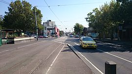 | |
| Pascoe Vale Road in Moonee Ponds | |
 | |
 North end South end | |
| Coordinates | |
| General information | |
| Type | Road |
| Length | 14.9 km (9.3 mi)[1] |
| Route number(s) | |
| Major junctions | |
| North end | David Munroe Drive Coolaroo, Melbourne |
| |
| South end | Moonee Ponds, Melbourne |
| Location(s) | |
| Major suburbs | Meadow Heights, Coolaroo, Dallas, Broadmeadows, Jacana, Glenroy, Oak Park, Pascoe Vale, Strathmore |

Pascoe Vale Road is a major thoroughfare through the northern suburbs of Melbourne, connecting the outer northern fringe to the inner northern suburbs.
Route[]
Pascoe Vale Road starts at the intersection with Somerton Road in Coolaroo and runs south as a four-lane, dual-carriageway road until the underpass with Camp Road and Johnstone Street in Broadmeadows, where it narrows to a four-lane, single-carriageway road. It continues south over the Western Ring Road through Glenroy, under CityLink and over the Craigieburn railway line through Strathmore, until the intersection with Fletcher Street in Essendon, where it shares surface tram tracks. It continues south to eventually terminate at Moonee Ponds Junction, where it meets Mount Alexander Road and Ascot Vale Road in Moonee Ponds.
Tram route 59 passes along the length of Pascoe Vale Road between Fletcher Street in Essendon and Moonee Ponds Junction.
History[]
Pascoe Vale Road originally ran north from Mount Alexander Road in Moonee Ponds to Camp Road at Broadmeadows. The Country Roads Board (later VicRoads) declared an northern extension to the existing allocation as a Main Road in the 1959/60 financial year,[2] from Camp Road to the intersection with Somerton Road in Coolaroo.[2] Construction to eliminate the railway crossing at the Broadmeadows railway gates, where Camp Road crossed the Broadmeadows railway line and then Pascoe Vale Road, with a road-over-rail overpass in Broadmeadows, was completed in January 1978.[3]
Pascoe Vale Road was signed as State Route 35 between Broadmeadows North and Moonee Ponds in 1965, heading east along Barry Road to eventually meet Hume Highway in Campbellfield. It was extended further north in 1989 along the entire road, heading east along Somerton Road to eventually meet Hume Highway in Coolaroo. State Route 35 continues south along Ascot Vale Road eventually to Laverton.
The passing of the Road Management Act 2004[4] granted the responsibility of overall management and development of Victoria's major arterial roads to VicRoads: in 2004, VicRoads re-declared Pascoe Vale Road (Arterial #5819) from Somerton Road in Coolaroo to Ascot Vale Road in Moonee Ponds.[5]
Major intersections[]
| LGA | Location[1][5] | km[1] | mi | Destinations | Notes |
|---|---|---|---|---|---|
| Hume | Coolaroo-Meadow Heights boundary | 0.0 | 0.0 | David Munroe Drive (north) – Roxburgh Park | Northern terminus of road |
| State Route 35 continues east along Somerton Road | |||||
| Coolaroo-Meadow Heights-Broadmeadows tripoint | 2.9 | 1.8 | Barry Road – Campbellfield | ||
| Broadmeadows | 5.1 | 3.2 | Dimboola Road – Broadmeadows | Access to Johnstone Street and Camp Road not otherwise available from overpass | |
| 5.4 | 3.4 | Southbound exit from Camp Road westbound only; no exit eastbound from Johnstone Street | |||
| Hume–Moreland boundary | Jacana-Broadmeadows-Glenroy tripoint | 6.4 | 4.0 | Westbound entry and eastbound exit only | |
| Moreland | Glenroy | 7.8 | 4.8 | Glenroy Road – Hadfield | |
| Pascoe Vale | 10.4 | 6.5 | Stewart Street, to Gaffney Street – Coburg North | ||
| Moonee Valley | Strathmore | 11.0 | 6.8 | Eastbound entry and westbound exit only | |
| Entry to Bell Street via CityLink ramp | |||||
| 11.7 | 7.3 | Pascoe Avenue, to Woodland Street (west) – Strathmore | |||
| Strathmore-Essendon boundary | 12.2 | 7.6 | Woodland Street (east) – Pascoe Vale South | ||
| Essendon | 13.1 | 8.1 | Moreland Road – Brunswick | ||
| 13.7 | 8.5 | Fletcher Street (west) – Essendon Albion Street (east) – Brunswick East | |||
| Essendon-Moonee Ponds boundary | 13.9 | 8.6 | Buckley Street – Keilor East, Essendon | ||
| Moonee Ponds | 14.5 | 9.0 | Kellaway Avenue – Moonee Ponds | Pascoe Vale Road northbound from Moonee Ponds Junction via Kellaway Avenue | |
| 14.9 | 9.3 | Puckle Street – Moonee Ponds Dean Street – Moonee Ponds | No right turn southbound into Puckle Street, no right turn northbound into Dean Street and Pascoe Vale Road | ||
| Mount Alexander Road – Travancore | No left turn northbound into Ascot Vale Road, no right turn northbound into Dean Street and Pascoe Vale Road | ||||
| Southern terminus of road; State Route 35 continues south along Ascot Vale Road | |||||
1.000 mi = 1.609 km; 1.000 km = 0.621 mi
| |||||
Gallery[]

Pascoe Vale Road in Moonee Ponds
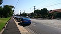
Pascoe Vale Road in Moonee Ponds


See also[]
![]() Australian Roads portal
Australian Roads portal
References[]
- ^ a b c Google (8 November 2021). "Pascoe Vale Road" (Map). Google Maps. Google. Retrieved 8 November 2021.
- ^ a b "Country Roads Board Victoria. Forty-Seventh Annual Report: for the year ended 30 June 1960". Country Roads Board of Victoria. Melbourne: Victorian Government Library Service. 21 November 1960. p. 10.
- ^ "Country Roads Board Victoria. Sixty-Fifth Annual Report: for the year ended 30 June 1978". Country Roads Board of Victoria. Melbourne: Victorian Government Library Service. 29 September 1978. p. 23.
- ^ State Government of Victoria. "Road Management Act 2004" (PDF). Government of Victoria. Archived (PDF) from the original on 19 October 2021. Retrieved 19 October 2021.
- ^ a b VicRoads. "VicRoads – Register of Public Roads (Part A) 2015" (PDF). Government of Victoria. p. 783. Archived from the original on 1 May 2020. Retrieved 19 October 2021.
This article about a place in Melbourne is a stub. You can help Wikipedia by . |
This Australian road or road transport-related article is a stub. You can help Wikipedia by . |
- Streets in Melbourne
- Broadmeadows, Victoria
- Melbourne geography stubs
- Australia road stubs