Peach Orchard, Arkansas
Peach Orchard, Arkansas | |
|---|---|
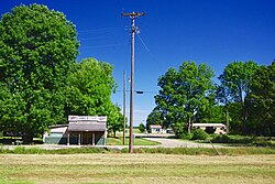 North Main Street | |
 Location of Peach Orchard in Clay County, Arkansas. | |
| Coordinates: 36°16′47″N 90°39′50″W / 36.27972°N 90.66389°WCoordinates: 36°16′47″N 90°39′50″W / 36.27972°N 90.66389°W | |
| Country | United States |
| State | Arkansas |
| County | Clay |
| Area | |
| • Total | 1.03 sq mi (2.67 km2) |
| • Land | 1.03 sq mi (2.67 km2) |
| • Water | 0.00 sq mi (0.00 km2) |
| Elevation | 285 ft (87 m) |
| Population (2020) | |
| • Total | 105 |
| • Density | 101.94/sq mi (39.36/km2) |
| Time zone | UTC-6 (Central (CST)) |
| • Summer (DST) | UTC-5 (CDT) |
| ZIP code | 72453 |
| Area code(s) | 870 |
| FIPS code | 05-54140 |
| GNIS feature ID | 0077966[2] |

Peach Orchard is a city[3] in Clay County, Arkansas, United States. The population was 135 at the 2010 census.[4]
History[]
Peach Orchard is rooted in an estate known as "Petit Baril," established by French explorer Pierre Le Mieux in the early 19th century. Local English-speakers were calling it "Peach Orchard" by the time Le Mieux sold the estate in 1816. A trading post operated at Peach Orchard during the mid-19th century, and was frequently raided by guerrilla forces during the Civil War.[5]
The construction of the St. Louis, Iron Mountain and Southern Railway in the 1870s brought increased development to Peach Orchard, focused primarily on the railroad and the timber industry. A post office opened in 1873, and a depot was constructed. The city incorporated in 1910.[5]
Geography[]
Peach Orchard is located at 36°16′47″N 90°39′50″W / 36.27972°N 90.66389°W (36.279666, -90.663871).[6] The city lies southwest of Corning along Arkansas Highway 90, between Knobel and Delaplaine.
According to the United States Census Bureau, the town has a total area of 1.0 square mile (2.6 km2), all land.
Demographics[]
| Historical population | |||
|---|---|---|---|
| Census | Pop. | %± | |
| 1920 | 484 | — | |
| 1930 | 361 | −25.4% | |
| 1940 | 374 | 3.6% | |
| 1950 | 327 | −12.6% | |
| 1960 | 348 | 6.4% | |
| 1970 | 256 | −26.4% | |
| 1980 | 243 | −5.1% | |
| 1990 | 197 | −18.9% | |
| 2000 | 195 | −1.0% | |
| 2010 | 135 | −30.8% | |
| 2020 | 105 | −22.2% | |
| U.S. Decennial Census[7] | |||
As of the census[8] of 2000, there were 195 people, 78 households, and 56 families residing in the town. The population density was 197.9 inhabitants per square mile (76.1/km2). There were 97 housing units at an average density of 98.5 per square mile (37.8/km2). The racial makeup of the town was 97.44% White, 2.56% from other races. 2.56% of the population were Hispanic or Latino of any race.
There were 78 households, out of which 32.1% had children under the age of 18 living with them, 57.7% were married couples living together, 9.0% had a female householder with no husband present, and 28.2% were non-families. 28.2% of all households were made up of individuals, and 17.9% had someone living alone who was 65 years of age or older. The average household size was 2.50 and the average family size was 2.98.
In the town, the population was spread out, with 25.1% under the age of 18, 6.2% from 18 to 24, 28.2% from 25 to 44, 23.6% from 45 to 64, and 16.9% who were 65 years of age or older. The median age was 40 years. For every 100 females, there were 89.3 males. For every 100 females age 18 and over, there were 89.6 males.
The median income for a household in the town was $30,000, and the median income for a family was $25,750. Males had a median income of $25,833 versus $20,500 for females. The per capita income for the town was $11,051. About 24.5% of families and 18.3% of the population were below the poverty line, including 5.6% of those under the age of eighteen and 42.3% of those 65 or over.
Education[]
Peach Orchard is in an exclave of the Greene County Tech School District surrounded by territory of the Corning School District.[9]
References[]
| Wikimedia Commons has media related to Peach Orchard, Arkansas. |
- ^ "2020 U.S. Gazetteer Files". United States Census Bureau. Retrieved October 29, 2021.
- ^ a b U.S. Geological Survey Geographic Names Information System: Peach Orchard, Arkansas
- ^ Local.Arkansas.gov - Peach Orchard, retrieved September 3, 2012
- ^ "Geographic Identifiers: 2010 Demographic Profile Data (G001): Peach Orchard city, Arkansas". U.S. Census Bureau, American Factfinder. Archived from the original on February 12, 2020. Retrieved June 16, 2014.
- ^ a b Steven Teske, "Peach Orchard (Clay County," Encyclopedia of Arkansas, 2017.
- ^ "US Gazetteer files: 2010, 2000, and 1990". United States Census Bureau. 2011-02-12. Retrieved 2011-04-23.
- ^ "Census of Population and Housing". Census.gov. Retrieved June 4, 2015.
- ^ "U.S. Census website". United States Census Bureau. Retrieved 2008-01-31.
- ^ "SCHOOL DISTRICT REFERENCE MAP (2010 CENSUS): Clay County, AR" (PDF). U.S. Census Bureau. Retrieved 2021-03-04. - Note the 13080 and boundary indicates that Peach Orchard is in a part of Greene County Tech district territory surrounded by Corning School District territory. The article in stated that Peach Orchard is in the Corning district, but the the finder of ArcGIS used by the State of Arkansas confirms it is an exclave of Greene County Tech.
Municipalities and communities of Clay County, Arkansas, United States | ||
|---|---|---|
| Cities |  | |
| Towns | ||
| Unincorporated communities | ||
| Ghost town | ||
| Footnotes | ‡This populated place also has portions in an adjacent county or counties | |
| ||
- Cities in Clay County, Arkansas
- Cities in Arkansas