Pelican Rapids, Minnesota
Pelican Rapids | |
|---|---|
 Pelican Pete, world's largest pelican, is located downtown Pelican Rapids | |
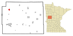 Location of Pelican Rapids within Otter Tail County, Minnesota | |
| Coordinates: 46°34′9″N 96°4′53″W / 46.56917°N 96.08139°W | |
| Country | United States |
| State | Minnesota |
| County | Otter Tail |
| Area | |
| • Total | 2.69 sq mi (6.98 km2) |
| • Land | 2.57 sq mi (6.65 km2) |
| • Water | 0.13 sq mi (0.32 km2) |
| Elevation | 1,306 ft (398 m) |
| Population | |
| • Total | 2,464 |
| • Estimate (2019)[2] | 2,552 |
| • Density | 993.38/sq mi (383.53/km2) |
| Time zone | UTC-6 (Central (CST)) |
| • Summer (DST) | UTC-5 (CDT) |
| ZIP code | 56572 |
| Area code(s) | 218 |
| FIPS code | 27-50164 |
| GNIS feature ID | 0649246[4] |
| Website | pelicanrapids.com |

Pelican Rapids is a city in Otter Tail County, Minnesota, United States. The population was 2,464 at the 2010 census.[5]
History[]
Pelican Rapids was platted in 1872, and named for the rapids on the Pelican River.[6] A post office has been in operation at Pelican Rapids since 1872.[7] Pelican Rapids was incorporated in 1882.[6]
Geography[]
According to the United States Census Bureau, the city has a total area of 2.63 square miles (6.81 km2), of which 2.53 square miles (6.55 km2) is land and 0.10 square miles (0.26 km2) is water.[8]
U.S. Highway 59 and Minnesota State Highway 108 are two of the main routes in the city.
Demographics[]
| Historical population | |||
|---|---|---|---|
| Census | Pop. | %± | |
| 1890 | 624 | — | |
| 1900 | 1,033 | 65.5% | |
| 1910 | 1,019 | −1.4% | |
| 1920 | 1,156 | 13.4% | |
| 1930 | 1,365 | 18.1% | |
| 1940 | 1,560 | 14.3% | |
| 1950 | 1,676 | 7.4% | |
| 1960 | 1,693 | 1.0% | |
| 1970 | 1,835 | 8.4% | |
| 1980 | 1,867 | 1.7% | |
| 1990 | 1,886 | 1.0% | |
| 2000 | 2,374 | 25.9% | |
| 2010 | 2,464 | 3.8% | |
| 2019 (est.) | 2,552 | [2] | 3.6% |
| U.S. Decennial Census[9] 2018 Estimate[10] | |||
2010 census[]
As of the census[3] of 2010, there were 2,464 people, 904 households, and 569 families living in the city. The population density was 973.9 inhabitants per square mile (376.0/km2). There were 984 housing units at an average density of 388.9 per square mile (150.2/km2). The racial makeup of the city was 74.1% White, 5.8% African American, 0.9% Native American, 3.2% Asian, 0.7% Pacific Islander, 11.6% from other races, and 3.7% from two or more races. Hispanic or Latino of any race were 31.5% of the population.
There were 904 households, of which 36.0% had children under the age of 18 living with them, 46.5% were married couples living together, 11.0% had a female householder with no husband present, 5.5% had a male householder with no wife present, and 37.1% were non-families. 33.0% of all households were made up of individuals, and 19% had someone living alone who was 65 years of age or older. The average household size was 2.66 and the average family size was 3.42.
The median age in the city was 35.4 years. 28.6% of residents were under the age of 18; 9.2% were between the ages of 18 and 24; 23.9% were from 25 to 44; 21.1% were from 45 to 64; and 17.1% were 65 years of age or older. The gender makeup of the city was 49.6% male and 50.4% female.

2000 census[]
As of the census of 2000, there were 2,374 people, 884 households, and 558 families living in the city. The population density was 905.8 people per square mile (349.8/km2). There were 962 housing units at an average density of 367.0 per square mile (141.8/km2). The racial makeup of the city was 60.43% White, 0.72% African American, 1.93% Native American, 1.58% Asian, 1.04% Pacific Islander, 6.76% from other races, and 4.54% from two or more races. Hispanic or Latino of any race were 23.59% of the population.
There were 884 households, out of which 33.1% had children under the age of 18 living with them, 50.3% were married couples living together, 7.7% had a female householder with no husband present, and 36.8% were non-families. 33.5% of all households were made up of individuals, and 19.2% had someone living alone who was 65 years of age or older. The average household size was 2.57 and the average family size was 3.31.
In the city, the population was spread out, with 27.6% under the age of 18, 8.7% from 18 to 24, 25.2% from 25 to 44, 17.4% from 45 to 64, and 21.1% who were 65 years of age or older. The median age was 36 years. For every 100 females, there were 97.2 males. For every 100 females age 18 and over, there were 94.6 males.
The median income for a household in the city was $27,232, and the median income for a family was $36,970. Males had a median income of $23,750 versus $20,645 for females. The per capita income for the city was $13,699. About 9.5% of families and 15.8% of the population were below the poverty line, including 20.4% of those under age 18 and 18.7% of those age 65 or over.
Politics[]
Notable people[]
- Dave Goltz - Retired Major League Baseball pitcher
- Roger L. Hanson - American businessman and politician
- Tucker Hibbert - Professional snowmobile racer for Team Monster Energy/Arctic Cat
- Buck Paulson - American painter with a show on PBS
See also[]
- Pelican Pete - fifteen foot sculpture
- The O.A.E. Blyberg House is listed on the National Register of Historic Places.
References[]
- ^ "2019 U.S. Gazetteer Files". United States Census Bureau. Retrieved July 26, 2020.
- ^ Jump up to: a b "Population and Housing Unit Estimates". United States Census Bureau. May 24, 2020. Retrieved May 27, 2020.
- ^ Jump up to: a b "U.S. Census website". United States Census Bureau. Retrieved November 13, 2012.
- ^ "US Board on Geographic Names". United States Geological Survey. October 25, 2007. Retrieved January 31, 2008.
- ^ "2010 Census Redistricting Data (Public Law 94-171) Summary File". American FactFinder. U.S. Census Bureau, 2010 Census. Retrieved April 23, 2011.[dead link]
- ^ Jump up to: a b Upham, Warren (1920). Minnesota Geographic Names: Their Origin and Historic Significance. Minnesota Historical Society. p. 397.
- ^ "Otter Tail County". Jim Forte Postal History. Retrieved July 28, 2015.
- ^ "US Gazetteer files 2010". United States Census Bureau. Archived from the original on July 2, 2012. Retrieved November 13, 2012.
- ^ United States Census Bureau. "Census of Population and Housing". Retrieved September 10, 2013.
- ^ "Population Estimates". United States Census Bureau. Retrieved July 14, 2019.
- ^ "2020 PRECINCT RESULTS SPREADSHEET".
- ^ "2016 PRECINCT RESULTS SPREADSHEET".
- ^ "2012 PRECINCT RESULTS SPREADSHEET".
- ^ "2008 PRECINCT RESULTS SPREADSHEET".
- ^ "2004 PRECINCT RESULTS SPREADSHEET".
- ^ "2000 PRECINCT RESULTS SPREADSHEET".
External links[]
| show Municipalities and communities of Otter Tail County, Minnesota, United States |
|---|

Coordinates: 46°34′15″N 96°04′59″W / 46.57083°N 96.08306°W
| show Authority control |
|---|
- Cities in Otter Tail County, Minnesota
- Cities in Minnesota
- Populated places established in 1872
- 1872 establishments in Minnesota