Perry Township, Tama County, Iowa
Perry Township, Tama County | |
|---|---|
 Bakers Grove Cemetery, May 2007. | |
 | |
| Coordinates: 42°10′01″N 092°28′14″W / 42.16694°N 92.47056°WCoordinates: 42°10′01″N 092°28′14″W / 42.16694°N 92.47056°W | |
| Country | |
| State | |
| County | Tama |
| Area | |
| • Total | 36.1 sq mi (93.51 km2) |
| • Land | 36.07 sq mi (93.42 km2) |
| • Water | 0.03 sq mi (0.09 km2) |
| Elevation | 961 ft (293 m) |
| Population (2000) | |
| • Total | 1,891 |
| • Density | 52.4/sq mi (20.2/km2) |
| FIPS code | 19-93306[2] |
| GNIS feature ID | 0468510 |

Perry Township is a civil township in the northeastern part of Tama County, Iowa, United States. As of the 2000 census, its population was 1,891.
History[]
Perry Township was organized in 1858.[3]
Transportation[]
Important highways in Perry Township include U.S. Route 63 and Iowa Highway 8.
Government[]
Perry Township is administered by the Perry Township trustees, who are elected by the citizens of Perry Township and of Traer.
Geography[]
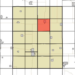
Within the thirty-six sections of Perry Township are located several creeks — Coon, Fourmile, Salt, and Wolf — and four cemeteries: Bakers Grove, Buckingham, Saint Paul's Catholic and West Union.
The city of Traer is located in Perry Township, as is the unincorporated community of . Outside these communities, the township is rural and its land is primarily used for agriculture.
Public services[]
Fire protection and ambulance services in Perry Township are the responsibility of Traer.
The ZIP code for Perry Township is 50675.
References[]
- ^ "US Board on Geographic Names". United States Geological Survey. 2007-10-25. Retrieved 2008-01-31.
- ^ "U.S. Census website". United States Census Bureau. Retrieved 2008-01-31.
- ^ Chapman, Samuel D. (1879). History of Tama County, Iowa: Its Cities, Towns and Villages. Toledo Times Office. pp. 80.
External links[]
Municipalities and communities of Tama County, Iowa, United States | ||
|---|---|---|
| Cities | ||
| Townships | ||
| Unincorporated communities | ||
| Indian reservation | ||
| Footnotes | ‡This populated place also has portions in an adjacent county or counties | |
| ||
- Townships in Tama County, Iowa
- Townships in Iowa