Pine Township, Columbia County, Pennsylvania
Pine Township, Columbia County, Pennsylvania | |
|---|---|
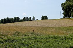 Scenery of Pine Township, Columbia County, Pennsylvania | |
 Map of Columbia County, Pennsylvania highlighting Pine Township | |
 Map of Columbia County, Pennsylvania | |
| Country | United States |
| State | Pennsylvania |
| County | Columbia |
| Settled | 1796 |
| Incorporated | 1853 |
| Area | |
| • Total | 26.49 sq mi (68.60 km2) |
| • Land | 26.43 sq mi (68.46 km2) |
| • Water | 0.05 sq mi (0.14 km2) |
| Population (2010) | |
| • Total | 1,046 |
| • Estimate (2016)[2] | 834; 1,026 |
| • Density | 38.81/sq mi (14.99/km2) |
| Time zone | UTC-5 (Eastern (EST)) |
| • Summer (DST) | UTC-4 (EDT) |
| Area code(s) | 570 |
| FIPS code | 42-037-60304 |
Pine Township is a township in Columbia County, Pennsylvania, United States. The population was 1,046 at the 2010 census.[3]
History[]
Pine Township remained without settlers for a longer time than the neighboring townships. However, by the early 1800s, there was a tannery and a sawmill in the township.[4]
Covered bridges[]
The Sam Eckman Covered Bridge No. 92, Jud Christie Covered Bridge No. 95, Creasyville Covered Bridge, and Shoemaker Covered Bridge were listed on the National Register of Historic Places in 1979.[5]
Geography[]
Pine Township is located along the northwestern boundary of Columbia County, adjacent to Lycoming County. The southeast border of the township follows Little Fishing Creek, which flows south towards the Susquehanna River. The unincorporated community of Pine Summit is located in the southwest part of the township, along Pennsylvania Route 442.
According to the United States Census Bureau, the township has a total area of 26.5 square miles (68.6 km2), of which 26.4 square miles (68.5 km2) is land and 0.04 square miles (0.1 km2), or 0.20%, is water.[3]
Demographics[]
| Historical population | |||
|---|---|---|---|
| Census | Pop. | %± | |
| 2010 | 1,046 | — | |
| 2016 (est.) | 1,026 | [2] | −1.9% |
| U.S. Decennial Census[6] | |||
As of the census[7] of 2000, there were 1,092 people, 404 households, and 324 families residing in the township. The population density was 41.1 people per square mile (15.9/km2). There were 483 housing units at an average density of 18.2/sq mi (7.0/km2). The racial makeup of the township was 99.36% White, 0.09% Native American, 0.09% Asian, 0.09% from other races, and 0.37% from two or more races. Hispanic or Latino of any race were 0.18% of the population.
There were 404 households, out of which 33.9% had children under the age of 18 living with them, 68.6% were married couples living together, 6.4% had a female householder with no husband present, and 19.8% were non-families. 15.6% of all households were made up of individuals, and 5.2% had someone living alone who was 65 years of age or older. The average household size was 2.70 and the average family size was 2.99.
In the township the population was spread out, with 25.1% under the age of 18, 6.2% from 18 to 24, 30.9% from 25 to 44, 25.5% from 45 to 64, and 12.4% who were 65 years of age or older. The median age was 39 years. For every 100 females, there were 100.0 males. For every 100 females age 18 and over, there were 100.0 males.
The median income for a household in the township was $38,375, and the median income for a family was $41,750. Males had a median income of $30,750 versus $21,000 for females. The per capita income for the township was $16,621. About 4.7% of families and 8.3% of the population were below the poverty line, including 9.4% of those under age 18 and 21.2% of those age 65 or over.
References[]
- ^ "2016 U.S. Gazetteer Files". United States Census Bureau. Retrieved Aug 13, 2017.
- ^ a b "Population and Housing Unit Estimates". Retrieved June 9, 2017.
- ^ a b "Geographic Identifiers: 2010 Census Summary File 1 (G001): Pine township, Columbia County, Pennsylvania". U.S. Census Bureau, American Factfinder. Archived from the original on February 13, 2020. Retrieved May 27, 2015.
- ^ "Chapter XV, Madison and Pine Townships, History of Columbia and Montour Counties, Pennsylvania".
- ^ "National Register Information System". National Register of Historic Places. National Park Service. July 9, 2010.
- ^ "Census of Population and Housing". Census.gov. Retrieved June 4, 2016.
- ^ "U.S. Census website". United States Census Bureau. Retrieved 2008-01-31.
Municipalities and communities of Columbia County, Pennsylvania, United States | ||
|---|---|---|
| Town |  | |
| Boroughs | ||
| Townships | ||
| CDPs | ||
| Unincorporated communities | ||
| Ghost Towns | ||
| Footnotes | ‡This populated place also has portions in an adjacent county or counties | |
| ||
Coordinates: 41°15′01″N 76°27′29″W / 41.25028°N 76.45806°W

- Populated places established in 1796
- Bloomsburg–Berwick metropolitan area
- Townships in Columbia County, Pennsylvania
- Townships in Pennsylvania
- 1853 establishments in Pennsylvania