Benton, Columbia County, Pennsylvania
Benton, Pennsylvania | |
|---|---|
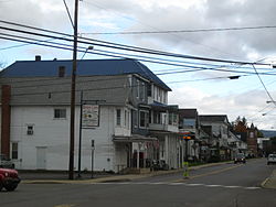 View north on PA 487 in Benton in October 2012 | |
 Location of Benton in Columbia County, Pennsylvania. | |
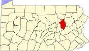 Map showing Columbia County in Pennsylvania | |
 Benton Location of Benton in Pennsylvania | |
| Coordinates: 41°11′46″N 76°23′00″W / 41.19611°N 76.38333°WCoordinates: 41°11′46″N 76°23′00″W / 41.19611°N 76.38333°W | |
| Country | United States |
| State | Pennsylvania |
| County | Columbia |
| Settled | 1833 |
| Incorporated | 1894 |
| Government | |
| • Type | Borough Council |
| • Mayor | George Remphrey |
| Area | |
| • Total | 0.61 sq mi (1.59 km2) |
| • Land | 0.60 sq mi (1.55 km2) |
| • Water | 0.02 sq mi (0.05 km2) |
| Elevation | 765 ft (233 m) |
| Population (2010) | |
| • Total | 824 |
| • Estimate (2019)[2] | 810 |
| • Density | 1,356.78/sq mi (523.91/km2) |
| Time zone | UTC-5 (Eastern (EST)) |
| • Summer (DST) | UTC-4 (EDT) |
| ZIP code | 17814 |
| Area code(s) | 570 |
| FIPS code | 42-05680 |
| GNIS feature ID | 1215122 |


Benton is a borough in Columbia County, Pennsylvania, United States. The population was 824 at the 2010 census.[3] It is part of the Bloomsburg–Berwick Micropolitan Statistical Area.
Geography[]

Benton is located in northern Columbia County at 41°11′46″N 76°23′0″W / 41.19611°N 76.38333°W (41.196144, -76.383354).[4] It is surrounded by Benton Township, a separate municipality. According to the United States Census Bureau, the borough has a total area of 0.61 square miles (1.59 km2), of which 0.60 square miles (1.55 km2) is land and 0.02 square miles (0.05 km2), or 2.96%, is water.[5] Fishing Creek, a south-flowing tributary of the Susquehanna River, runs through the eastern part of Benton.
History[]
The Benton area was first settled by two families in 1792. A schoolhouse was opened in 1799. Starting around 1860, tanning and lumber industries began to grow north of the borough. By 1868, Benton had about fifty houses. The Benton dam was built in 1915.[6]
Transportation[]
State highways. Two highways concurrently serve as Benton's Main Street:
- Pennsylvania Route 239 leads east 14 miles (23 km) to US 11 at Shickshinny on the Susquehanna River and northwest 13 miles (21 km) to PA 42 at North Mountain.
- Pennsylvania Route 487 leads north 13 miles (21 km) to Ricketts Glen State Park and south 17 miles (27 km) to Bloomsburg, the Columbia County seat.

Interstate highway: Benton is 14 miles north of Interstate 80.
Air: Although Williamsport Regional Airport (IATA: IPT) is the closest airport with scheduled airline service, travelers often seek out the lower fares at Trenton–Mercer Airport (IATA: TTN) or Philadelphia International Airport (IATA: PHL).
Rail: (Historical information) From 1888 - 1972, Benton was served by the Bloomsburg and Sullivan Railroad (later the Reading Railroad, Bloomsburg Branch).
Demographics[]
| Historical population | |||
|---|---|---|---|
| Census | Pop. | %± | |
| 1880 | 191 | — | |
| 1900 | 635 | — | |
| 1910 | 719 | 13.2% | |
| 1920 | 696 | −3.2% | |
| 1930 | 733 | 5.3% | |
| 1940 | 786 | 7.2% | |
| 1950 | 890 | 13.2% | |
| 1960 | 981 | 10.2% | |
| 1970 | 1,027 | 4.7% | |
| 1980 | 981 | −4.5% | |
| 1990 | 958 | −2.3% | |
| 2000 | 955 | −0.3% | |
| 2010 | 824 | −13.7% | |
| 2019 (est.) | 810 | [2] | −1.7% |
| Sources:[7][8][9] | |||
As of the census[8] of 2000, there were 955 people, 394 households, and 265 families residing in the borough. The population density was 1,503.6 people per square mile (576.1/km²). There were 436 housing units at an average density of 686.5 per square mile (263.0/km²). The racial makeup of the borough was 99.69% White, 0.10% African American, and 0.21% from two or more races. Hispanic or Latino of any race were 0.10% of the population.
There were 394 households, out of which 33.2% had children under the age of 18 living with them, 48.5% were married couples living together, 12.9% had a female householder with no husband present, and 32.7% were non-families. 28.4% of all households were made up of individuals, and 10.4% had someone living alone who was 65 years of age or older. The average household size was 2.42 and the average family size was 2.95.
In the borough the population was spread out, with 25.9% under the age of 18, 10.3% from 18 to 24, 26.3% from 25 to 44, 22.3% from 45 to 64, and 15.3% who were 65 years of age or older. The median age was 36 years. For every 100 females, there were 91.4 males. For every 100 females age 18 and over, there were 84.9 males.
The median income for a household in the borough was $27,986, and the median income for a family was $32,125. Males had a median income of $28,015 versus $20,625 for females. The per capita income for the borough was $12,831. About 15.2% of families and 19.2% of the population were below the poverty line, including 29.0% of those under age 18 and 8.8% of those age 65 or over.
Education[]
Benton is in the Benton Area School District. The Appleman Elementary school is also in Benton. The nearest college with over 2000 students is the Bloomsburg University of Pennsylvania.[3]
References[]
| Wikimedia Commons has media related to Benton, Columbia County, Pennsylvania. |
- ^ "2019 U.S. Gazetteer Files". United States Census Bureau. Retrieved July 28, 2020.
- ^ Jump up to: a b "Population and Housing Unit Estimates". United States Census Bureau. May 24, 2020. Retrieved May 27, 2020.
- ^ Jump up to: a b "Benton, Pennsylvania". 2012. Retrieved 20 October 2012.
- ^ "US Gazetteer files: 2010, 2000, and 1990". United States Census Bureau. 2011-02-12. Retrieved 2011-04-23.
- ^ "Geographic Identifiers: 2010 Census Summary File 1 (G001): Benton borough, Pennsylvania". U.S. Census Bureau, American Factfinder. Archived from the original on February 13, 2020. Retrieved May 19, 2015.
- ^ http://www.bentonnews.net/History.htm
- ^ "Census of Population and Housing". U.S. Census Bureau. Retrieved 11 December 2013.
- ^ Jump up to: a b "U.S. Census website". United States Census Bureau. Retrieved 2008-01-31.
- ^ "Incorporated Places and Minor Civil Divisions Datasets: Subcounty Resident Population Estimates: April 1, 2010 to July 1, 2012". Population Estimates. U.S. Census Bureau. Archived from the original on 17 June 2013. Retrieved 11 December 2013.
External links[]
| show Municipalities and communities of Columbia County, Pennsylvania, United States |
|---|

| show Authority control |
|---|
- Populated places established in 1793
- Bloomsburg–Berwick metropolitan area
- Boroughs in Columbia County, Pennsylvania
- 1833 establishments in Pennsylvania