Pleasant Township, Brown County, Ohio
Pleasant Township, Brown County, Ohio | |
|---|---|
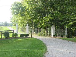 Woods and a farm gate west of Georgetown | |
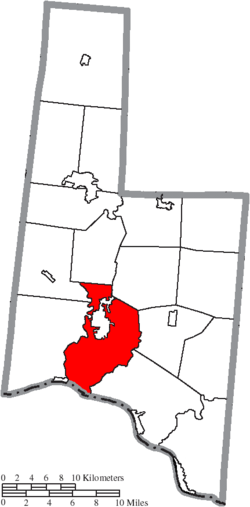 Location of Pleasant Township in Brown County | |
| Coordinates: 38°51′26″N 83°54′3″W / 38.85722°N 83.90083°WCoordinates: 38°51′26″N 83°54′3″W / 38.85722°N 83.90083°W | |
| Country | United States |
| State | Ohio |
| County | Brown |
| Area | |
| • Total | 36.2 sq mi (93.8 km2) |
| • Land | 35.8 sq mi (92.8 km2) |
| • Water | 0.4 sq mi (1.0 km2) |
| Elevation | 922 ft (281 m) |
| Population (2010) | |
| • Total | 5,745 |
| • Density | 160/sq mi (61.9/km2) |
| Time zone | UTC-5 (Eastern (EST)) |
| • Summer (DST) | UTC-4 (EDT) |
| FIPS code | 39-63212[2] |
| GNIS feature ID | 1085803[1] |

Pleasant Township is one of the sixteen townships of Brown County, Ohio, United States. The 2010 census found 5,745 people in the township,[3] 1,417 of whom lived in the unincorporated portions of the township.
Geography[]
Located in the southern part of the county along the Ohio River, it borders the following townships:
- Scott Township - north
- Franklin Township - northeast
- Jefferson Township - east
- Union Township - southeast
- Lewis Township - west
- Clark Township - northwest
Bracken County, Kentucky lies across the Ohio River to the south.
The village of Georgetown, the county seat of Brown County, is located in northern Pleasant Township.
Name and history[]
It is one of fifteen Pleasant Townships statewide.[4]
Pleasant Township was established in 1801.[5] In 1833, eighteen mills operated in Pleasant Township.[6]
Government[]
The township is governed by a three-member board of trustees, who are elected in November of odd-numbered years to a four-year term beginning on the following January 1. Two are elected in the year after the presidential election and one is elected in the year before it. There is also an elected township fiscal officer,[7] who serves a four-year term beginning on April 1 of the year after the election, which is held in November of the year before the presidential election. Vacancies in the fiscal officership or on the board of trustees are filled by the remaining trustees.
References[]
- ^ a b "US Board on Geographic Names". United States Geological Survey. 2007-10-25. Retrieved 2008-01-31.
- ^ "U.S. Census website". United States Census Bureau. Retrieved 2008-01-31.
- ^ "Geographic Identifiers: 2010 Demographic Profile Data (G001): Pleasant township, Brown County, Ohio". U.S. Census Bureau, American Factfinder. Archived from the original on February 12, 2020. Retrieved February 20, 2014.
- ^ "Detailed map of Ohio" (PDF). United States Census Bureau. 2000. Retrieved 2007-02-16.
- ^ The History of Brown County, Ohio: Containing a History of the County, Its Townships, Towns, Churches, Schools, Etc. Higginson Book Company. 1883. pp. 371.
- ^ Kilbourn, John (1833). The Ohio Gazetteer, or, a Topographical Dictionary. Scott and Wright. pp. 376. Retrieved 12 December 2013.
- ^ §503.24, §505.01, and §507.01 of the Ohio Revised Code. Accessed 4/30/2009.
External links[]
Municipalities and communities of Brown County, Ohio, United States | ||
|---|---|---|
| Villages |  | |
| Townships | ||
| CDPs | ||
| Unincorporated communities | ||
| Footnotes | ‡This populated place also has portions in an adjacent county or counties | |
| ||
- Townships in Brown County, Ohio
- Townships in Ohio
- 1801 establishments in the Northwest Territory