Polk Township, Huntington County, Indiana
Polk Township | |
|---|---|
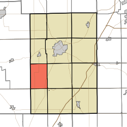 Location in Huntington County | |
| Coordinates: 40°47′09″N 85°36′10″W / 40.78583°N 85.60278°WCoordinates: 40°47′09″N 85°36′10″W / 40.78583°N 85.60278°W | |
| Country | United States |
| State | Indiana |
| County | Huntington |
| Government | |
| • Type | Indiana township |
| Area | |
| • Total | 24.11 sq mi (62.4 km2) |
| • Land | 22.76 sq mi (58.9 km2) |
| • Water | 1.35 sq mi (3.5 km2) 5.60% |
| Elevation | 804 ft (245 m) |
| Population (2010) | |
| • Total | 449 |
| • Density | 19.7/sq mi (7.6/km2) |
| GNIS feature ID | 0453754 |

Polk Township is one of 12 townships in Huntington County, Indiana, United States. As of the 2010 census, its population was 449 and it contained 195 housing units.[1]
History[]
Polk Township was organized in 1846.[2] It was named for President James K. Polk.[3]
Geography[]
According to the 2010 census, the township has a total area of 24.11 square miles (62.4 km2), of which 22.76 square miles (58.9 km2) (or 94.40%) is land and 1.35 square miles (3.5 km2) (or 5.60%) is water.[1]
Cities and towns[]
- Mount Etna (northwest edge)
Unincorporated communities[]
Adjacent townships[]
- Dallas Township (north)
- Huntington Township (northeast)
- Lancaster Township (east)
- Jefferson Township (southeast)
- Wayne Township (south)
- Liberty Township, Wabash County (southwest)
- Lagro Township, Wabash County (northwest)
Cemeteries[]
The township contains one cemetery, Monument City Memorial.
Major highways[]
References[]
- ^ a b "Population, Housing Units, Area, and Density: 2010 - County -- County Subdivision and Place -- 2010 Census Summary File 1". United States Census. Archived from the original on 2020-02-12. Retrieved 2013-05-10.
- ^ Bash, Frank Sumner (1914). History of Huntington County, Indiana: A Narrative Account of Its Historical Progress, Its People, and Its Principal Interests. The Lewis Publishing Company. pp. 108.
- ^ History of Huntington County, Indiana: From the Earliest Time to the Present. Brant & Fuller. 1887. pp. 728.
External links[]
Municipalities and communities of Huntington County, Indiana, United States | ||
|---|---|---|
| City | ||
| Towns | ||
| Townships | ||
| Unincorporated communities | ||
| Footnotes | ‡This populated place also has portions in an adjacent county or counties | |
| ||
Categories:
- Townships in Huntington County, Indiana
- Townships in Indiana