Pont-de-Crau


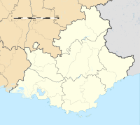
Pont-de-Crau is a village of 3,200 inhabitants within the municipality of Arles, in the Bouches-du-Rhône department, France. It is named after the bridge/aqueduct that was built circa 1585 to carry the Canal de Craponne across the fetid swamps south east of the city.
History[]
In 1554 Adam de Craponne began an irrigation project, building the Canal de Craponne from the river Durance to Salon-de-Provence. In 1581 the Ravel brothers began to extend the canal to Arles, traversing the arid plain of Crau. The project was sanctioned by , councillor of king Henry III of France and president of his court at the Parliament of Aix-en-Provence. De Montcalm used his own money to purchase a two-ninths share of the Arles-Canal de Craponne project, which was confirmed by an act of August 29, 1583.[1]
In 1584, the associates built the Pont-de-Crau, a bridge and aqueduct to cross a fetid foul water swamp south east of Arles. This was significant cost and was commenced on 22 August 1585. Two consuls of Arles had opposed the project and energised a following among the local population, so De Montcalm summoned them to appear before the Parliament of Aix in November 1585, but he died on 20 October 1585, before the hearing.[1]
Administration and Services[]
The public services and amenities of Pont de Crau include two schools and a stadium. The students of the hamlet begin their studies at the kindergarten La Claire-Fontaine, a subsidiary of the Academy of Aix-Marseille. It has 129 children.[2]
Economic activity[]
Shops include a pharmacy, a bakery, a tobacconist, coffee shop, grocery store, three hair salons, a pizzeria, a caterer, and a beautician.
References[]
- ^ a b http://provence-historique.mmsh.univ-aix.fr/Pdf/PH-1958-08-031_03.pdf PDF Robert de Montcalm et le financement du Canal de Craponne, by Albert Waton-Chabert.
- ^ Report on 'La Claire Fontaine' kindergarten
Coordinates: 43°39′54″N 4°38′51″E / 43.665078°N 4.647588°E
- Arles
- Geography of Bouches-du-Rhône
- Tourist attractions in Bouches-du-Rhône
- Transport infrastructure completed in 1585
