Poplar, Montana
Poplar | |
|---|---|
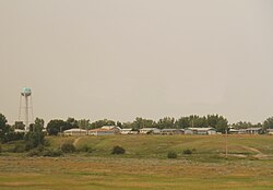 Panorama of Poplar | |
 Location of Poplar, Montana | |
| Coordinates: 48°6′34″N 105°11′42″W / 48.10944°N 105.19500°WCoordinates: 48°6′34″N 105°11′42″W / 48.10944°N 105.19500°W | |
| Country | United States |
| State | Montana |
| County | Roosevelt |
| Area | |
| • Total | 0.28 sq mi (0.72 km2) |
| • Land | 0.28 sq mi (0.72 km2) |
| • Water | 0.00 sq mi (0.00 km2) |
| Elevation | 1,991 ft (607 m) |
| Population | |
| • Total | 810 |
| • Estimate (2019)[3] | 840 |
| • Density | 3,021.58/sq mi (1,166.20/km2) |
| Time zone | UTC-7 (Mountain (MST)) |
| • Summer (DST) | UTC-6 (MDT) |
| ZIP code | 59255 |
| Area code(s) | 406 Exchange: 768 |
| FIPS code | 30-58975 |
| GNIS feature ID | 0775362 |

Poplar is a city in Roosevelt County, Montana, United States. The population was 810 at the 2010 census.[4]
The U.S. Army constructed Camp Poplar here in the 1870s to oversee the Fort Peck Indian Reservation.[5] Poplar became reservation headquarters after the military abandoned the camp in 1893.
Geography[]
Poplar is located at 48°6′34″N 105°11′42″W / 48.10944°N 105.19500°W (48.109474, -105.194891).[6]
According to the United States Census Bureau, the city has a total area of 0.28 square miles (0.73 km2), all land.[7]
The Poplar River joins the Missouri River near town.
Climate[]
According to the Köppen Climate Classification system, Poplar has a semi-arid climate, abbreviated "BSk" on climate maps.[8]
Demographics[]
| Historical population | |||
|---|---|---|---|
| Census | Pop. | %± | |
| 1920 | 1,152 | — | |
| 1930 | 1,046 | −9.2% | |
| 1940 | 1,442 | 37.9% | |
| 1950 | 1,169 | −18.9% | |
| 1960 | 1,565 | 33.9% | |
| 1970 | 1,389 | −11.2% | |
| 1980 | 995 | −28.4% | |
| 1990 | 881 | −11.5% | |
| 2000 | 911 | 3.4% | |
| 2010 | 810 | −11.1% | |
| 2019 (est.) | 840 | [3] | 3.7% |
| U.S. Decennial Census[9] | |||
2010 census[]
As of the census[2] of 2010, there were 810 people, 313 households, and 196 families residing in the city. The population density was 2,892.9 inhabitants per square mile (1,117.0/km2). There were 352 housing units at an average density of 1,257.1 per square mile (485.4/km2). The racial makeup of the city was 25.2% White, 71.4% Native American, 0.2% Asian, 0.1% from other races, and 3.1% from two or more races. Hispanic or Latino of any race were 0.6% of the population.
There were 313 households, of which 40.9% had children under the age of 18 living with them, 31.3% were married couples living together, 19.2% had a female householder with no husband present, 12.1% had a male householder with no wife present, and 37.4% were non-families. 32.3% of all households were made up of individuals, and 9.5% had someone living alone who was 65 years of age or older. The average household size was 2.53 and the average family size was 3.16.
The median age in the city was 31.2 years. 30.7% of residents were under the age of 18; 10.8% were between the ages of 18 and 24; 25% were from 25 to 44; 25% were from 45 to 64; and 8.4% were 65 years of age or older. The gender makeup of the city was 50.2% male and 49.8% female.
2000 census[]
As of the 2000 census,[10] there were 911 people, 325 households, and 206 families residing in the city. The population density was 3,406.0 people per square mile (1,302.7/km2). There were 350 housing units at an average density of 1,308.5 per square mile (500.5/km2). The racial makeup of the city was 32.16% White, 0.11% African American, 63.67% Native American, 0.77% Asian, 0.22% from other races, and 3.07% from two or more races. Hispanic or Latino of any race were 0.88% of the population.
There were 325 households, out of which 33.5% had children under the age of 18 living with them, 36.9% were married couples living together, 19.4% had a female householder with no husband present, and 36.6% were non-families. 32.3% of all households were made up of individuals, and 12.6% had someone living alone who was 65 years of age or older. The average household size was 2.57 and the average family size was 3.26.
In the city, the population was spread out, with 30.7% under the age of 18, 8.0% from 18 to 24, 29.6% from 25 to 44, 20.2% from 45 to 64, and 11.4% who were 65 years of age or older. The median age was 33 years. For every 100 females, there were 106.1 males. For every 100 females age 18 and over, there were 102.9 males.
The median income for a household in the city was $24,896, and the median income for a family was $29,688. Males had a median income of $22,250 versus $19,000 for females. The per capita income for the city was $10,579. About 23.4% of families and 31.5% of the population were below the poverty line, including 32.6% of those under age 18 and 22.2% of those age 65 or over.
Government[]
Poplar is the seat for the Fort Peck Sioux and Assiniboine Tribes, including the tribal law enforcement agency, courthouse,[11] and the Fort Peck Reservation correctional facility.[12]
The Bureau of Indian Affairs maintains an agency office in Poplar.[11]
Education[]
K-12[]
Poplar Public Schools, District 9/2B, is the second largest public school system on the Fort Peck Indian Reservation with a total enrollment of 824 students for the 2006-2007 school year.[13] Poplar Public Schools operates elementary, middle, and junior/senior high schools.[14] Poplar High School's team name is the Indians.[15]

College[]
Poplar is home to the main campus of Fort Peck Community College. A branch campus is located in Wolf Point, Montana.[16]
Library[]
The James E. Shanley Tribal Library is an affiliate of Roosevelt County Library and available to all county patrons.[17]
Infrastructure[]
Transportation[]
U.S. Route 2, a major east-west route across the northern tier of states, connects Poplar with other Hi-line communities in Montana and North Dakota. The Poplar Municipal Airport provides for light aircraft and general aviation on a single 4,400 feet (1,341 m) runway.[18] Amtrak serves Wolf Point, approximately 20 miles west.
Medical facilities[]
The Indian Health Service (IHS) operates the Vern E. Gibbs Health Center through its Fort Peck Service Unit. The health center provides ambulatory, dialysis, and preventive health services. The IHS contracts with Northeast Montana Health Services (NEMHS) which operates Poplar Community Hospital, a critical access hospital with an emergency room, swingbed unit, pharmacy, 22-bed inpatient facility for inpatient services, as well as the Riverside Clinic, and hospital and clinic in Wolf Point, Montana. Poplar has a BLS and ALS ambulance staffed by first responders and EMTs. The ambulance service averages 4.5 calls a day.[19]
Natives[]
- Barry Beach, convicted murderer
- Chrysti Smith, radio broadcaster
References[]
- ^ "2019 U.S. Gazetteer Files". United States Census Bureau. Retrieved July 26, 2020.
- ^ Jump up to: a b "U.S. Census website". United States Census Bureau. Retrieved 2012-12-18.
- ^ Jump up to: a b "Population and Housing Unit Estimates". United States Census Bureau. May 24, 2020. Retrieved May 27, 2020.
- ^ "2010 Census Redistricting Data (Public Law 94-171) Summary File". American FactFinder. United States Census Bureau. Retrieved May 2, 2011.
- ^ "Poplar". Montana Place Names Companion. Montana Historical Society. Retrieved 8 April 2021.
- ^ "US Gazetteer files: 2010, 2000, and 1990". United States Census Bureau. 2011-02-12. Retrieved 2011-04-23.
- ^ "US Gazetteer files 2010". United States Census Bureau. Archived from the original on 2011-02-20. Retrieved 2012-12-18.
- ^ Climate Summary for Poplar, Montana
- ^ "Census of Population and Housing". Census.gov. Retrieved July 23, 2016.
- ^ "U.S. Census website". United States Census Bureau. Retrieved 2008-01-31.
- ^ Jump up to: a b "Oil bust puts tribes, towns over a barrel".
- ^ Annie Waldman, Erica L. Green (2018-12-28). "On a Reservation, a Second Chance for Prisoners and Their". ProPublica. Retrieved 2018-12-30.
- ^ "Directory of Montana Schools, 2007-2008" (PDF). Montana Office of Public Instruction. Archived from the original (PDF) on 2008-04-25. Retrieved 2008-02-06.
- ^ "Poplar Public Schools". Retrieved 2008-02-06.
- ^ "Member Schools". Montana High School Association. Retrieved 19 April 2021.
- ^ "About FPCC". Archived from the original on 2007-09-21. Retrieved 2008-02-06.
- ^ "James E. Shanley Tribal Library". Fort Peck Community College. Retrieved 12 April 2021.
- ^ FAA Airport Form 5010 for PO1 PDF. Federal Aviation Administration. Effective November 15, 2012.
- ^ "Northeast Montana Health Services". Northeast Montana Health Services. 2011. Retrieved 2012-09-03.
External links[]
Municipalities and communities of Roosevelt County, Montana, United States | ||
|---|---|---|
| Cities |  | |
| Towns | ||
| CDP | ||
| Indian reservations | ||
| Ghost town | ||
| Footnotes | ‡This populated place also has portions in an adjacent county or counties | |
| ||
| Authority control |
|---|
- Cities in Roosevelt County, Montana
- Montana populated places on the Missouri River
- Cities in Montana