Port Denison, Western Australia
| Port Denison Western Australia | |
|---|---|
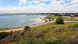 Port Denison and its Boat Harbour, 2014 | |
 Port Denison | |
| Coordinates | 29°17′00″S 114°55′00″E / 29.28333°S 114.91667°ECoordinates: 29°17′00″S 114°55′00″E / 29.28333°S 114.91667°E |
| Population | 1,410 (2016 census)[1] |
| Established | 1867 |
| Postcode(s) | 6525 |
| Elevation | 10 m (33 ft) |
| Location | |
| LGA(s) | Shire of Irwin |
| State electorate(s) | Moore |
| Federal division(s) | Durack |

Port Denison is a town of 3000 residents in the Mid West region of Western Australia. Its local government area is the Shire of Irwin and it is located 4 kilometres (2.5 mi) southwest of Dongara on the Indian Ocean coast.
History[]
Port Denison was initially known as Irwin Port in 1866 due to its position near the mouth of the Irwin River. However, when it was officially named and gazetted in 1867, it was renamed in honour of Sir William Denison, a former Governor of Tasmania who in 1851 had visited Western Australia in connection with transportation of convicts.[2]
Economy[]
Port Denison is the home port of a number of commercial fishermen that catch lobster (known as crayfish locally).[3][4]
References[]
- ^ Australian Bureau of Statistics (27 June 2017). "Port Denison (State Suburb)". 2016 Census QuickStats. Retrieved 29 October 2019.

- ^ Western Australian Land Information Authority. "History of country town names – P". Retrieved 29 December 2009.
- ^ Keenan, Zoe (27 February 2018). "Cray boat the biggest". Midwest Times. Retrieved 23 January 2021 – via The West Australian website.
- ^ "New Crayboat Delivered to Geraldton Fisher". marinelink.com. 18 May 2020. Retrieved 23 January 2021.
External links[]
![]() Media related to Port Denison, Western Australia at Wikimedia Commons
Media related to Port Denison, Western Australia at Wikimedia Commons
This article about a location in Western Australia is a stub. You can help Wikipedia by . |
- Towns in Western Australia
- Shire of Irwin
- Western Australia geography stubs