Portland, North Dakota
Portland, North Dakota | |
|---|---|
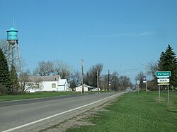 Entrance through Portland on Hwy 200. | |
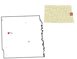 Location of Portland, North Dakota | |
| Coordinates: 47°30′2″N 97°22′19″W / 47.50056°N 97.37194°WCoordinates: 47°30′2″N 97°22′19″W / 47.50056°N 97.37194°W | |
| Country | United States |
| State | North Dakota |
| County | Traill |
| Founded | 1882 |
| Area | |
| • Total | 0.83 sq mi (2.16 km2) |
| • Land | 0.83 sq mi (2.16 km2) |
| • Water | 0.00 sq mi (0.00 km2) |
| Elevation | 984 ft (300 m) |
| Population | |
| • Total | 606 |
| • Estimate (2019)[2] | 595 |
| • Density | 713.43/sq mi (275.50/km2) |
| Time zone | UTC-6 (Central (CST)) |
| • Summer (DST) | UTC-5 (CDT) |
| ZIP code | 58274 |
| Area code(s) | 701 Exchange: 786 |
| FIPS code | 38-63900 |
| GNIS feature ID | 1030786[4] |
| Website | http://www.mayvilleportland.com/ |

Portland is a city in Traill County, North Dakota, United States. The population was 606 at the 2010 census.[5]
Portland is the smaller neighbor of nearby Mayville.
History[]
The first settlement at Portland was made in 1871.[6] Portland was laid out and platted in 1881 when the railroad was extended to that point.[7] A post office has been in operation at Portland since 1882.[8]
Geography[]
Portland is located at 47°30′2″N 97°22′19″W / 47.50056°N 97.37194°W (47.500451, -97.371960).[9]
According to the United States Census Bureau, the city has a total area of 0.86 square miles (2.23 km2), all land.[10]
Demographics[]
| Historical population | |||
|---|---|---|---|
| Census | Pop. | %± | |
| 1890 | 367 | — | |
| 1900 | 524 | 42.8% | |
| 1910 | 561 | 7.1% | |
| 1920 | 623 | 11.1% | |
| 1930 | 500 | −19.7% | |
| 1940 | 551 | 10.2% | |
| 1950 | 641 | 16.3% | |
| 1960 | 606 | −5.5% | |
| 1970 | 534 | −11.9% | |
| 1980 | 627 | 17.4% | |
| 1990 | 602 | −4.0% | |
| 2000 | 604 | 0.3% | |
| 2010 | 606 | 0.3% | |
| 2019 (est.) | 595 | [2] | −1.8% |
| U.S. Decennial Census[11] 2018 Estimate[12] | |||
2010 census[]
As of the census[3] of 2010, there were 606 people, 279 households, and 170 families residing in the city. The population density was 704.7 inhabitants per square mile (272.1/km2). There were 297 housing units at an average density of 345.3 per square mile (133.3/km2). The racial makeup of the city was 95.0% White, 0.7% African American, 1.5% Native American, 0.5% Asian, 1.3% from other races, and 1.0% from two or more races. Hispanic or Latino of any race were 2.6% of the population.
There were 279 households, of which 25.1% had children under the age of 18 living with them, 50.2% were married couples living together, 7.5% had a female householder with no husband present, 3.2% had a male householder with no wife present, and 39.1% were non-families. 35.1% of all households were made up of individuals, and 21.9% had someone living alone who was 65 years of age or older. The average household size was 2.17 and the average family size was 2.76.
The median age in the city was 45.9 years. 21.3% of residents were under the age of 18; 10% were between the ages of 18 and 24; 17.3% were from 25 to 44; 26.3% were from 45 to 64; and 25.2% were 65 years of age or older. The gender makeup of the city was 48.5% male and 51.5% female.
2000 census[]
As of the census of 2000, there were 604 people, 269 households, and 161 families residing in the city. The population density was 702.0 people per square mile (271.2/km2). There were 286 housing units at an average density of 332.4 per square mile (128.4/km2). The racial makeup of the city was 99.50% White, 0.17% Asian, and 0.33% from two or more races. Hispanic or Latino of any race were 0.50% of the population.

There were 269 households, out of which 28.6% had children under the age of 18 living with them, 56.5% were married couples living together, 3.3% had a female householder with no husband present, and 40.1% were non-families. 36.8% of all households were made up of individuals, and 24.2% had someone living alone who was 65 years of age or older. The average household size was 2.25 and the average family size was 2.99.
In the city, the population was spread out, with 23.7% under the age of 18, 5.3% from 18 to 24, 27.0% from 25 to 44, 20.0% from 45 to 64, and 24.0% who were 65 years of age or older. The median age was 42 years. For every 100 females, there were 102.7 males. For every 100 females age 18 and over, there were 100.4 males.
The median income for a household in the city was $30,375, and the median income for a family was $43,250. Males had a median income of $30,089 versus $18,750 for females. The per capita income for the city was $15,149. About 4.3% of families and 6.0% of the population were below the poverty line, including 5.1% of those under age 18 and 11.5% of those age 65 or over.
References[]
- ^ "2019 U.S. Gazetteer Files". United States Census Bureau. Retrieved July 27, 2020.
- ^ Jump up to: a b "Population and Housing Unit Estimates". United States Census Bureau. May 24, 2020. Retrieved May 27, 2020.
- ^ Jump up to: a b "U.S. Census website". United States Census Bureau. Retrieved 2012-06-14.
- ^ "US Board on Geographic Names". United States Geological Survey. 2007-10-25. Retrieved 2008-01-31.
- ^ "2010 Census Redistricting Data (Public Law 94-171) Summary File". American FactFinder. United States Census Bureau. Retrieved 2 May 2011.[dead link]
- ^ Federal Writers' Project (1938). North Dakota, a Guide to the Northern Prairie State. WPA. p. 201. ISBN 978-1-62376-033-5.
- ^ "Our History". City of Portland, North Dakota. Retrieved 13 June 2014.
- ^ "Traill County". Jim Forte Postal History. Retrieved 25 October 2015.
- ^ "US Gazetteer files: 2010, 2000, and 1990". United States Census Bureau. 2011-02-12. Retrieved 2011-04-23.
- ^ "US Gazetteer files 2010". United States Census Bureau. Archived from the original on 2012-07-02. Retrieved 2012-06-14.
- ^ United States Census Bureau. "Census of Population and Housing". Retrieved July 21, 2013.
- ^ "Population Estimates". United States Census Bureau. Retrieved June 16, 2019.
External links[]
| Wikimedia Commons has media related to Portland, North Dakota. |
- Mayville-Portland website
- Portland's 125th Anniversary Celebration website
- Diamond jubilee, Portland, North Dakota, July 1-2, 1882-1957 from the Digital Horizons website
| show Municipalities and communities of Traill County, North Dakota, United States |
|---|

| show Authority control |
|---|
- Cities in Traill County, North Dakota
- Cities in North Dakota
- Populated places established in 1881
- 1881 establishments in Dakota Territory