Préizerdaul
Préizerdaul | |
|---|---|
Commune | |
 Coat of arms | |
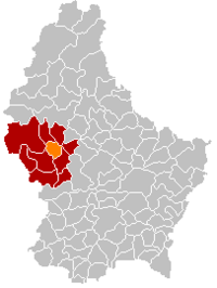 Map of Luxembourg with Préizerdaul highlighted in orange, and the canton in dark red | |
| Coordinates: 49°47′39″N 5°56′15″E / 49.7942°N 5.9375°ECoordinates: 49°47′39″N 5°56′15″E / 49.7942°N 5.9375°E | |
| Country | |
| Canton | Redange |
| Area | |
| • Total | 15.6 km2 (6.0 sq mi) |
| Area rank | 72nd of 102 |
| Highest elevation | 402 m (1,319 ft) |
| • Rank | 48th of 102 |
| Lowest elevation | 255 m (837 ft) |
| • Rank | 58th of 102 |
| Population (2018) | |
| • Total | 1,717 |
| • Rank | 85th of 102 |
| • Density | 110/km2 (290/sq mi) |
| • Density rank | 3rd of 102 |
| Time zone | UTC+1 (CET) |
| • Summer (DST) | UTC+2 (CEST) |
| LU0000702 | |
| Website | preizerdaul.lu |

Préizerdaul (Luxembourgish pronunciation: [ˈpʀəɪ̯tsɐdɑʊ̯l] (![]() listen)) is a commune in western Luxembourg, in the canton of Redange. Until 17 July 2001, it was known as Bettborn, after its administrative centre.[1] Préizerdaul was the first commune to change its name since before the First World War; to date, it is the only commune to have changed its name to a name of Luxembourgish origin.
listen)) is a commune in western Luxembourg, in the canton of Redange. Until 17 July 2001, it was known as Bettborn, after its administrative centre.[1] Préizerdaul was the first commune to change its name since before the First World War; to date, it is the only commune to have changed its name to a name of Luxembourgish origin.
Towns within the commune include Bettborn, Platen, Pratz, and Reimberg.
Twin towns — sister cities[]
Préizerdaul is twinned with:[2]
 Péni, Burkina Faso
 San Agustín, El Salvador
References[]
- ^ "Mémorial A, 2001, No. 91" (PDF) (in French). Service central de législation. Retrieved 2006-08-11.[permanent dead link]
- ^ "Préizerdauler noriichten 1/2019" (PDF). preizerdaul.lu (in German). Préizerdaul. p. 31. Retrieved 2019-09-08.
External links[]
 Media related to Préizerdaul at Wikimedia Commons
| show Places adjacent to Préizerdaul |
|---|

| Authority control |
|---|
This Luxembourg location article is a stub. You can help Wikipedia by . |
Categories:
- Préizerdaul
- Towns in Luxembourg
- Communes in Redange (canton)
- Luxembourg geography stubs