Queen Anne, Maryland
Queen Anne, Maryland | |
|---|---|
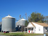  Grain elevators at the edge of town and Main Street in Queen Anne | |
 Location of Queen Anne, Maryland | |
 Queen Anne Location within the U.S. state of Maryland | |
| Coordinates: 38°55′9″N 75°57′10″W / 38.91917°N 75.95278°WCoordinates: 38°55′9″N 75°57′10″W / 38.91917°N 75.95278°W | |
| Country | United States of America |
| State | Maryland |
| Counties | Talbot, Queen Anne's |
| Incorporated | 1953[1] |
| Area | |
| • Total | 0.14 sq mi (0.36 km2) |
| • Land | 0.14 sq mi (0.36 km2) |
| • Water | 0.00 sq mi (0.00 km2) |
| Elevation | 30 ft (9 m) |
| Population | |
| • Total | 222 |
| • Estimate (2019)[4] | 213 |
| • Density | 1,543.48/sq mi (597.52/km2) |
| Time zone | UTC-5 (Eastern (EST)) |
| • Summer (DST) | UTC-4 (EDT) |
| ZIP code | 21657 |
| Area code(s) | 410 |
| FIPS code | 24-64500 |
| GNIS feature ID | 0597934 |


Queen Anne is a town in Queen Anne's and Talbot counties in the U.S. state of Maryland. The population was 222 at the 2010 census.[5]
Geography[]
Queen Anne is located at 38°55′09″N 75°57′10″W / 38.919039°N 75.952827°W (38.919039, -75.952827).[6]
According to the United States Census Bureau, the town has a total area of 0.13 square miles (0.34 km2), all land.[7]
Tuckahoe Creek passes by the town. The likely birthplace of Frederick Douglass is 2–3 miles south, near the banks of the Tuckahoe.[8] Maryland Route 404 passes to the north of town. Tuckahoe State Park is a short ride north of MD 404. The border between Talbot County and Queen Anne's County runs through the middle of town.
History[]
According to the Maryland Municipal League:[9]
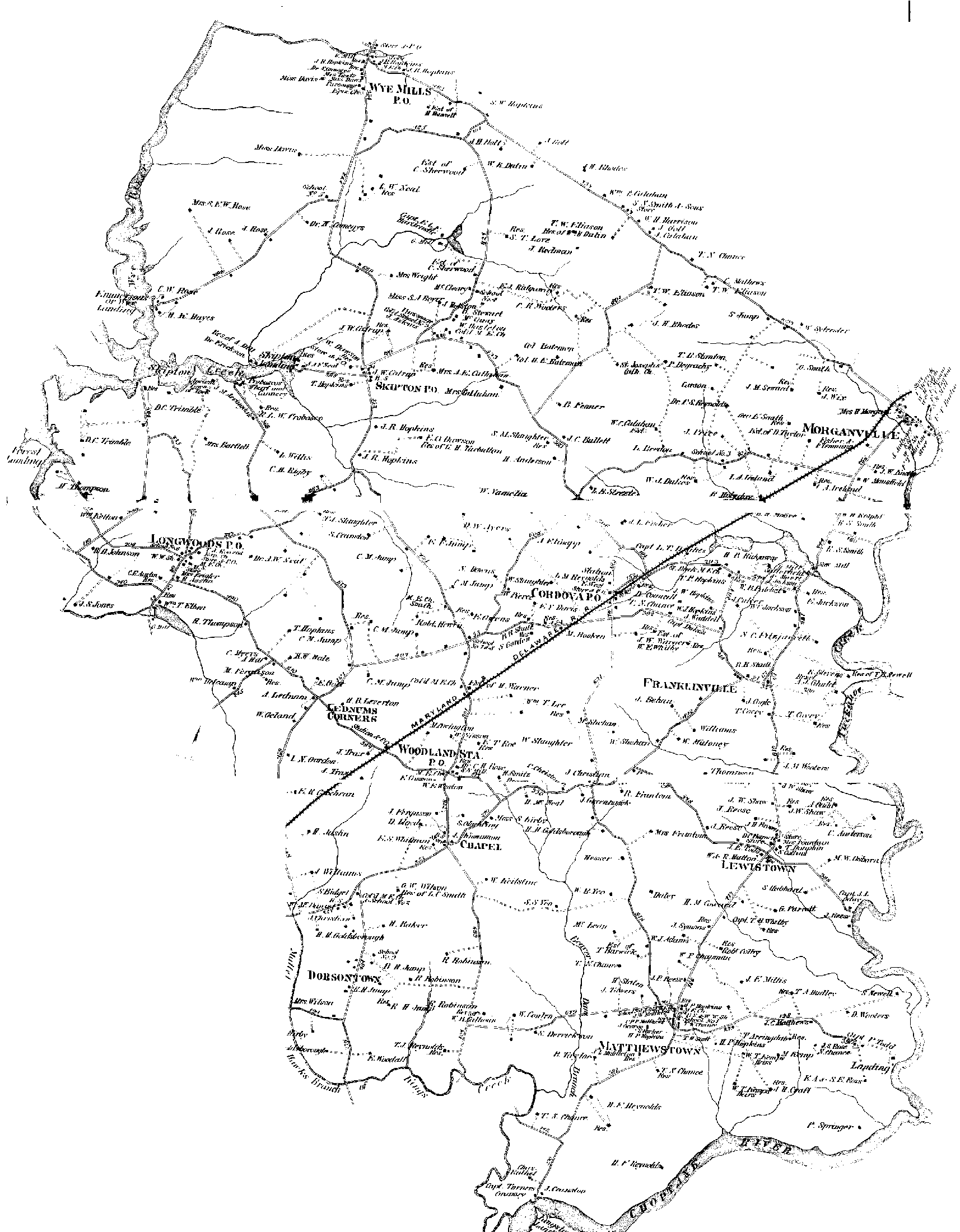
- In the 1850s, the area that is now the town of Queen Anne, was part of a 225-acre farm owned by Jacob Morgan. Initially, the town nucleus was nothing but a 1½-story dwelling, but in 1864 Mr. Morgan built a more substantial place—it was known locally as “the mansion house,” and the locale was known as Morganville.[10]
- At that time, the Pennsylvania Railroad had been laid as far south as Greensboro and, a little later, to Ridgely and Hillsboro and thence across Tuckahoe Creek. In 1878, the railroad purchased a site for a station across the creek in Queen Anne’s County, and, quite logically, named it Queen Anne when the station was finally put into service about 1882.

Demographics[]
| Historical population | |||
|---|---|---|---|
| Census | Pop. | %± | |
| 1880 | 58 | — | |
| 1960 | 283 | — | |
| 1970 | 292 | 3.2% | |
| 1980 | 259 | −11.3% | |
| 1990 | 250 | −3.5% | |
| 2000 | 176 | −29.6% | |
| 2010 | 222 | 26.1% | |
| 2019 (est.) | 213 | [4] | −4.1% |
| U.S. Decennial Census[11] | |||
2010 census[]
As of the census[3] of 2010, there were 222 people, 83 households, and 54 families living in the town. The population density was 1,707.7 inhabitants per square mile (659.3/km2). There were 89 housing units at an average density of 684.6 per square mile (264.3/km2). The racial makeup of the town was 94.6% White, 2.3% African American, 1.8% Asian, and 1.4% from two or more races.
There were 83 households, of which 42.2% had children under the age of 18 living with them, 54.2% were married couples living together, 8.4% had a female householder with no husband present, 2.4% had a male householder with no wife present, and 34.9% were non-families. 24.1% of all households were made up of individuals, and 9.6% had someone living alone who was 65 years of age or older. The average household size was 2.67 and the average family size was 3.28.
The median age in the town was 34.8 years. 27% of residents were under the age of 18; 10% were between the ages of 18 and 24; 27% were from 25 to 44; 26.2% were from 45 to 64; and 9.9% were 65 years of age or older. The gender makeup of the town was 48.2% male and 51.8% female.
References[]
- ^ "Queen Anne". Maryland Manual. Retrieved 27 June 2017.
- ^ "2019 U.S. Gazetteer Files". United States Census Bureau. Retrieved July 25, 2020.
- ^ Jump up to: a b "U.S. Census website". United States Census Bureau. Retrieved 2013-01-25.
- ^ Jump up to: a b "Population and Housing Unit Estimates". United States Census Bureau. May 24, 2020. Retrieved May 27, 2020.
- ^ "2010 Census Interactive Population Search". Retrieved 28 June 2012.
- ^ "US Gazetteer files: 2010, 2000, and 1990". United States Census Bureau. 2011-02-12. Retrieved 2011-04-23.
- ^ "US Gazetteer files 2010". United States Census Bureau. Archived from the original on January 12, 2012. Retrieved 2013-01-25.
- ^ Amanda Barker (1996). "The Search for Frederick Douglass' Birthplace". Retrieved January 8, 2012.
- ^ "Queen Anne, Maryland". Retrieved Sep 28, 2010.
- ^ Note that the Maryland Municipal League page for Queen Anne says the town was named "Morgansville", but see this map: "1876 Maps of Maryland's Eastern Shore". Retrieved 28 July 2011. Look at the east-northeast corner of this 1876/1877 map of the northeast section of Talbot County.
- ^ "Census of Population and Housing". Census.gov. Retrieved June 4, 2015.
- ^ "U.S. Census website". United States Census Bureau. Retrieved 2008-01-31.
| show Municipalities and communities of Queen Anne's County, Maryland, United States |
|---|

| show Municipalities and communities of Talbot County, Maryland, United States |
|---|

| show Authority control |
|---|
- Towns in Maryland
- Towns in Queen Anne's County, Maryland
- Towns in Talbot County, Maryland