R150 road (Ireland)
 | ||||
|---|---|---|---|---|
| Bóthar R150 | ||||
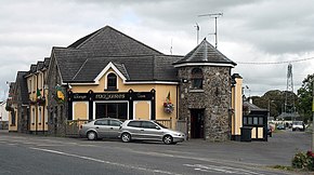 At R153 junction in Kentstown | ||||
| Route information | ||||
| Length | 33.2 km[1][2] (20.6 mi) | |||
| Major junctions | ||||
| From | ||||
| ||||
| To | ||||
| Highway system | ||||
| ||||
| ||||
The R150 road is a regional road in Ireland. It runs from Drogheda to the Meath coast and back inland across east County Meath.[1]
The R150 travels east from the Drogheda's Bull Ring to the Meath coastal towns of Bettystown and Laytown, via Mornington. From Laytown the road turns west to Julianstown and crosses the M1 (no junction) en route to Duleek.[1][2] The Julianstown–Duleek section underwent a major €20 million improvement project from October 2006 to September 2008, a year longer than scheduled.[3]
The R150 intersects with the N2 at Flemingstown before ending at the R153 at Kentstown. The R150 is 33.2 km (20.6 mi) long.[1][2]
See also[]
- Roads in Ireland
- National primary road
- National secondary road
References[]
- ^ a b c d Google (12 July 2019). "Drogheda to Kentstown" (Map). Google Maps. Google. Retrieved 12 July 2019.
- ^ a b c "S.I. No. 54/2012 – Roads Act 1993 (Classification of Regional Roads) Order 2012". Government of Ireland. 28 February 2012. Retrieved 12 July 2019.
- ^ "Finally...R150 road opens". Drogheda Independent. 22 September 2008. Retrieved 12 July 2019 – via Irish Independent.
This Irish road or road transport-related article is a stub. You can help Wikipedia by . |
Categories:
- Regional roads in the Republic of Ireland
- Roads in County Louth
- Roads in County Meath
- Ireland road stubs