R440 road (Ireland)
 | |
|---|---|
| Bóthar R440 | |
 Crossing the Slieve Bloom Mountains | |
| Route information | |
| Length | 36 km (22 mi) |
| Location | |
| Primary destinations |
|
| Highway system | |
| |
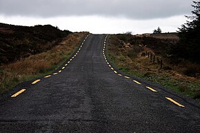
The R440 road is a regional road in Ireland linking Birr, County Offaly and Mountrath, County Laois. It passes through the village of Kinnity, Co. Offaly and from there climbs to the watershed of the Slieve Bloom Mountains north of Stillbrook Hill, crossing at an altitude of 1,503 feet (458 m) into County Laois on the plateau and descending to Mountrath.
The road is 36 km (22 mi) long.
See also[]
- Roads in Ireland
- National primary road
- National secondary road
References[]
- Roads Act 1993 (Classification of Regional Roads) Order 2006 – Department of Transport
Categories:
- Regional roads in the Republic of Ireland
- Roads in County Laois
- Roads in County Offaly