R473 road (Ireland)
 | |
|---|---|
| Bóthar R473 | |
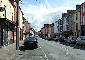 Moore Street, Kilrush, the western extreme of the R473 | |
| Route information | |
| Length | 51.4 km (31.9 mi) |
| Major junctions | |
| From | |
| Crosses at Aughanloge Bridge Passes through Labasheeda, Kildysart, Ballynacally Crosses | |
| To | |
| Road network | |
| |
The R473 road is a regional road in Ireland, located in the southern coastal parts of County Clare.[1][2][3]
References[]
- ^ "R473 - Roader's Digest: The SABRE Wiki". www.sabre-roads.org.uk. Retrieved 22 July 2017.
- ^ (eISB), electronic Irish Statute Book. "electronic Irish Statute Book (eISB)". www.irishstatutebook.ie. Retrieved 22 July 2017.
- ^ Road resurfacing works in the R473 Ennis to Kildysart Road at Barntick Clarecastle, wwwclarecoco.ie, 9 March 2014.[dead link]
Coordinates: 52°39′47″N 9°06′48″W / 52.663112°N 9.113421°W

This Irish road or road transport-related article is a stub. You can help Wikipedia by . |
Categories:
- Regional roads in the Republic of Ireland
- Roads in County Clare
- Ireland road stubs