R664 road (Ireland)
 | ||||
|---|---|---|---|---|
| Bóthar R664 | ||||
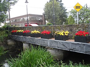 Bridge over the River Ara on Station Road, Tipperary (R664) | ||||
| Route information | ||||
| Length | 9.0 km (5.6 mi) | |||
| Major junctions | ||||
| From | ||||
| ||||
| To | ||||
| Highway system | ||||
| ||||
| ||||
The R664 road is a regional road in County Tipperary, Ireland.[1][2]
It runs from Tipperary's main street southwards, crossing the River Ara and the railway line before meeting the R663 (Bansha–Garryspillane road).[3][4]
References[]
- ^ "The road less travelled through the glen". The Irish Times.
- ^ Somerville, Christopher (3 March 2011). Walking in Ireland. Random House. ISBN 9781407079998 – via Google Books.
- ^ "Gortavoher - Tipperary Town". www.tipperarytown.ie.
- ^ http://www.tipperarycoco.ie/sites/default/files/Publications/Schedule%20of%20Roads%20Treated_0.pdf[bare URL]
- Roads Act 1993 (Classification of Regional Roads) Order 2006 – Department of Transport
Coordinates: 52°28′14″N 8°09′39″W / 52.470583°N 8.160869°W

This article related to the geography of County Tipperary, Ireland is a stub. You can help Wikipedia by . |
This Irish road or road transport-related article is a stub. You can help Wikipedia by . |
Categories:
- Regional roads in the Republic of Ireland
- Roads in County Tipperary
- County Tipperary geography stubs
- Ireland road stubs