Racine County, Wisconsin
Racine County | |
|---|---|
U.S. county | |
 Racine County Court House | |
 Flag | |
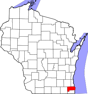 Location within the U.S. state of Wisconsin | |
 Wisconsin's location within the U.S. | |
| Coordinates: 42°47′N 87°46′W / 42.78°N 87.76°W | |
| Country | |
| State | |
| Founded | December 7, 1836 |
| Seat | Racine |
| Largest city | Racine |
| Area | |
| • Total | 792 sq mi (2,050 km2) |
| • Land | 333 sq mi (860 km2) |
| • Water | 460 sq mi (1,200 km2) 58%% |
| Population (2010) | |
| • Total | 195,408 |
| • Estimate (2020) | 195,802 |
| • Density | 250/sq mi (95/km2) |
| Time zone | UTC−6 (Central) |
| • Summer (DST) | UTC−5 (CDT) |
| Congressional district | 1st |
| Website | www |

Racine County (rus-EEN) is a county located in southeastern Wisconsin. As of the 2010 census, its population was 195,408,[1] making it the fifth-most populous county in Wisconsin. Its county seat is Racine.[2] The county was founded in 1836, then a part of the Wisconsin Territory.
Racine County comprises the Racine metropolitan statistical area. This area is included as part of the Milwaukee-Racine-Waukesha combined statistical area.[3]
According to the U.S. Census Bureau, the county has a total area of 792 square miles (2,050 km2), of which 333 square miles (860 km2) is land and 460 square miles (1,200 km2) (58%) is water.[4]
The county's unemployment rate was 5.6% in June 2021.[5]
Geography[]
- Milwaukee County (north)
- Ottawa County, Michigan (northeast)
- Allegan County, Michigan (southeast)
- Kenosha County (south)
- Walworth County (west)
- Waukesha County (northwest)
Demographics[]
| Historical population | |||
|---|---|---|---|
| Census | Pop. | %± | |
| 1840 | 3,475 | — | |
| 1850 | 14,973 | 330.9% | |
| 1860 | 21,360 | 42.7% | |
| 1870 | 26,740 | 25.2% | |
| 1880 | 30,922 | 15.6% | |
| 1890 | 36,268 | 17.3% | |
| 1900 | 45,644 | 25.9% | |
| 1910 | 57,424 | 25.8% | |
| 1920 | 78,961 | 37.5% | |
| 1930 | 90,217 | 14.3% | |
| 1940 | 94,047 | 4.2% | |
| 1950 | 109,585 | 16.5% | |
| 1960 | 141,781 | 29.4% | |
| 1970 | 170,838 | 20.5% | |
| 1980 | 173,132 | 1.3% | |
| 1990 | 175,034 | 1.1% | |
| 2000 | 188,831 | 7.9% | |
| 2010 | 195,408 | 3.5% | |
| 2020 | 197,727 | 1.2% | |
| U.S. Decennial Census[6] 1790–1960[7] 1900–1990[8] 1990–2000[9] 2010–2020[1] 2020 census[10] | |||

As of the census[11] of 2000, there were 188,831 people, 70,819 households, and 49,856 families residing in the county. The population density was 567 people per square mile (219/km2). There were 74,718 housing units at an average density of 224 per square mile (87/km2). The racial makeup of the county was 83.04% White, 10.47% Black or African American, 0.36% Native American, 0.72% Asian, 0.04% Pacific Islander, 3.69% from other races, and 1.67% from two or more races. 7.94% of the population were Hispanic or Latino of any race. 32.9% were of German, 7.4% Polish and 5.5% Irish ancestry.
There were 70,819 households, out of which 34.50% had children under the age of 18 living with them, 54.00% were married couples living together, 12.30% had a female householder with no husband present, and 29.60% were non-families. 24.50% of all households were made up of individuals, and 9.20% had someone living alone who was 65 years of age or older. The average household size was 2.59 and the average family size was 3.09.
In the county, the population was spread out, with 27.00% under the age of 18, 8.30% from 18 to 24, 29.90% from 25 to 44, 22.50% from 45 to 64, and 12.30% who were 65 years of age or older. The median age was 36 years. For every 100 females there were 98.00 males. For every 100 females age 18 and over, there were 95.50 males.
Transportation[]
Major highways[]
Airports[]
- John H. Batten Airport (KRAC) serves the county and surrounding communities.
- Burlington Municipal Airport (KBUU) enhances county service.
- Cindy Guntly Memorial Airport (62C) enhances county service.
- Fox River Airport (96C) enhances county service.
- Sylvania Airport (C89) enhances county service.
Communities[]


Cities[]
- Burlington (partly in Walworth County)
- Racine (county seat)
Villages[]
- Caledonia
- Elmwood Park
- Mount Pleasant
- North Bay
- Raymond
- Rochester
- Sturtevant
- Union Grove
- Waterford
- Wind Point
- Yorkville
Towns[]
- Burlington
- Dover
- Norway
- Waterford
Census-designated places[]
- Bohners Lake (Town of Burlington)
- Browns Lake (Town of Burlington)
- Eagle Lake (Town of Dover)
- Tichigan (Town of Waterford)
- Wind Lake (Town of Norway)
Unincorporated communities[]
- Buena Park
- Caldwell
- Cedar Park
- Eagle Lake Manor
- Eagle Lake Terrace
- Franksville
- Honey Creek (partial)[citation needed]
- Honey Lake (partial)
- Husher
- Ives Grove
- Kansasville
- North Cape
- Raymond
- Tichigan
- Union Church
- Yorkville
Ghost towns/neighborhoods[]
- Beaumont
- DeNoon
- Kneeland
- Muskego Settlement
- Raymond Center
- Rosewood
- Sylvania
Government[]

The County Board consists of 21 members, each elected from single-member districts.[12] The county executive is elected in a countywide vote. The county executive is Jonathan Delagrave. The Circuit Court is made up of ten judges, elected in countywide elections for six-year terms.
Politics[]
Racine County has been a bellwether county, having voted for the winning presidential candidate in 28 of the last 33 elections since 1896 despite its solidly Democratic county seat, Racine, Wisconsin. The only exceptions were when it voted for former Associate Justice Hughes in 1916, President Ford in 1976, Governor Dukakis in 1988, and President Trump in 2020.
| Year | Republican | Democratic | Third parties |
|---|---|---|---|
| 2020 | 51.2% 54,479 | 47.1% 50,159 | 1.7% 1,813 |
| 2016 | 49.5% 46,681 | 45.2% 42,641 | 5.3% 4,980 |
| 2012 | 47.7% 49,347 | 51.3% 53,008 | 1.0% 1,009 |
| 2008 | 45.7% 45,954 | 53.1% 53,408 | 1.3% 1,280 |
| 2004 | 51.7% 52,456 | 47.5% 48,229 | 0.9% 884 |
| 2000 | 49.5% 44,014 | 46.8% 41,563 | 3.7% 3,288 |
| 1996 | 38.8% 30,107 | 49.7% 38,567 | 11.5% 8,894 |
| 1992 | 36.8% 32,310 | 39.7% 34,875 | 23.5% 20,634 |
| 1988 | 47.4% 36,342 | 51.7% 39,631 | 0.9% 658 |
| 1984 | 52.8% 42,092 | 46.4% 36,955 | 0.8% 616 |
| 1980 | 49.8% 39,683 | 42.1% 33,565 | 8.1% 6,494 |
| 1976 | 49.0% 37,088 | 48.5% 36,740 | 2.5% 1,858 |
| 1972 | 56.4% 38,490 | 40.7% 27,778 | 2.9% 1,968 |
| 1968 | 44.8% 28,028 | 43.2% 27,045 | 12.0% 7,513 |
| 1964 | 36.1% 21,434 | 63.7% 37,785 | 0.2% 87 |
| 1960 | 49.0% 29,562 | 50.7% 30,596 | 0.2% 136 |
| 1956 | 58.2% 31,968 | 41.2% 22,646 | 0.6% 305 |
| 1952 | 54.7% 30,628 | 45.0% 25,241 | 0.3% 180 |
| 1948 | 43.5% 19,029 | 53.1% 23,266 | 3.4% 1,502 |
| 1944 | 41.1% 18,220 | 58.0% 25,697 | 0.9% 408 |
| 1940 | 43.6% 18,753 | 54.8% 23,532 | 1.6% 693 |
| 1936 | 28.7% 10,850 | 64.8% 24,474 | 6.5% 2,447 |
| 1932 | 32.5% 10,754 | 60.3% 19,960 | 7.2% 2,383 |
| 1928 | 56.6% 17,423 | 42.3% 13,021 | 1.2% 362 |
| 1924 | 50.2% 13,040 | 5.6% 1,463 | 44.2% 11,466 |
| 1920 | 72.0% 14,406 | 18.2% 3,650 | 9.8% 1,965 |
| 1916 | 47.8% 5,081 | 42.3% 4,495 | 10.0% 1,061 |
| 1912 | 29.4% 2,606 | 44.1% 3,909 | 26.5% 2,343 |
| 1908 | 52.8% 5,490 | 35.5% 3,688 | 11.8% 1,226 |
| 1904 | 55.6% 5,573 | 25.8% 2,584 | 18.6% 1,864 |
| 1900 | 58.4% 5,925 | 38.0% 3,855 | 3.7% 371 |
| 1896 | 57.6% 5,849 | 39.2% 3,975 | 3.2% 329 |
| 1892 | 46.2% 3,956 | 43.8% 3,750 | 10.0% 858 |
See also[]
- Peggy Johnson, a young woman whose body was discovered in 1999 in the town of Raymond, Racine County
- National Register of Historic Places listings in Racine County, Wisconsin
References[]
- ^ Jump up to: a b "State & County QuickFacts". United States Census Bureau. Archived from the original on July 17, 2011. Retrieved January 23, 2014.
- ^ "Find a County". National Association of Counties. Retrieved June 7, 2011.
- ^ US Department of Commerce Economic & Statistics Administration; US Census Bureau (January 2012). "Milwaukee-Racine-Waukesha, WI Combined Statistical Area" (PDF). Census.gov. Retrieved July 8, 2021.
- ^ "2010 Census Gazetteer Files". United States Census Bureau. August 22, 2012. Retrieved August 8, 2015.
- ^ "Unemployment in the United States". Local Area Unemployment Statistics Map. Retrieved August 8, 2021.
- ^ "U.S. Decennial Census". United States Census Bureau. Retrieved August 8, 2015.
- ^ "Historical Census Browser". University of Virginia Library. Retrieved August 8, 2015.
- ^ Forstall, Richard L., ed. (March 27, 1995). "Population of Counties by Decennial Census: 1900 to 1990". United States Census Bureau. Retrieved August 8, 2015.
- ^ "Census 2000 PHC-T-4. Ranking Tables for Counties: 1990 and 2000" (PDF). United States Census Bureau. April 2, 2001. Retrieved August 8, 2015.
- ^ https://www.census.gov/quickfacts/fact/table/racinecountywisconsin,US/PST045219
- ^ "U.S. Census website". United States Census Bureau. Retrieved May 14, 2011.
- ^ Racine County Website, "Archived copy". Archived from the original on May 12, 2016. Retrieved May 5, 2016.CS1 maint: archived copy as title (link)
- ^ Leip, David. "Dave Leip's Atlas of U.S. Presidential Elections". uselectionatlas.org. Retrieved November 11, 2020.
Further reading[]
- Commemorative Biographical Record of Prominent and Representative Men of Racine and Kenosha Counties Wisconsin. Chicago: J. H. Beers, 1906.
External links[]
- Official website
- Racine County map from the Wisconsin Department of Transportation
| show Places adjacent to Racine County, Wisconsin |
|---|
| show Municipalities and communities of Racine County, Wisconsin, United States |
|---|


Coordinates: 42°47′N 87°46′W / 42.78°N 87.76°W
| show Authority control |
|---|
- Wisconsin counties
- Racine County, Wisconsin
- 1836 establishments in Wisconsin Territory
- Populated places established in 1836