List of islands of Wisconsin
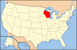 Location of Wisconsin within the United States | |
| Geography | |
|---|---|
| Location | Wisconsin |
| Major islands | Washington Island, Doty Island, Madeline Island, French Island |
| Administration | |
| State | |
The following is a list of islands of the state of Wisconsin.[1] Wisconsin borders both Lake Michigan and Lake Superior producing many of the states islands. The Mississippi River also has many islands on the state's western boundary. Wisconsin has many rivers including the Wisconsin River and Fox River that are large tributaries. Lake Winnebago is the 28th largest lake in the United States and has multiple islands. Wisconsin's 15,074 lakes contain many islands, most unnamed.[2]
Great Lakes[]
Lake Michigan[]
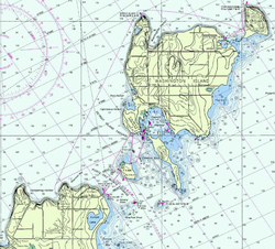
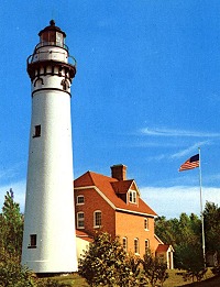
Many of the Wisconsin's islands in Lake Michigan are around the Door Peninsula.[3] Islands in Green Bay include those in and around the Green Bay Breakwater. Washington Island is Wisconsin's largest in Lake Michigan and also has a year-round population of 708 as of the 2010 census. The island has a ferry service and operates Washington Island Airport for air travel.[4] Rock Island is a state park that can only be accessed by ferry from Washington Island. Plum Island has is home to a former Coast Guard Life-Saving Station and historic range lights.[5] The islands surrounding the northern part of the peninsula are outcroppings of the Niagara Escarpment.


| Island Name | County |
|---|---|
| Door | |
| Cana Island | Door |
| Chambers Island | Door |
| Detroit Island | Door |
| Fish Island | Door |
| Gravel Island | Door |
| Green Island | Marinette |
| Hat Island | Door |
| Hog Island | Door |
| Horseshoe Island | Door |
| Door | |
| Pilot Island | Door |
| Plum Island | Door |
| Rock Island | Door |
| Sister Islands | Door |
| (Town of Nasewaupee) | Door |
| (Town of Washington) | Door |
| Spider Island | Door |
| Pirate Island | Door |
| Washington Island | Door |
| Jack Island | Door |
| Little Strawberry Island | Door |
| Adventure Island | Door |
| Birds Tree Island | Brown |
| Cat Island | Brown |
| Grassy Island | Brown |
| Willow Island | Brown |
Lake Superior[]
Wisconsin's northernmost point is on Devils Island, part of the Apostle Islands in Lake Superior. It has a population of 302 as of the 2010 census. It can be reached by ferry and airplanes at Major Gilbert Field Airport. The Islands are part of the Apostle Islands National Lakeshore and are featured in Wisconsin's America the Beautiful quarter.[6]


| Island Name | County |
|---|---|
| Madeline Island | Ashland |
| Stockton Island | Ashland |
| Gull Island | Ashland |
| Eagle Island | Bayfield |
| Outer Island | Ashland |
| Oak Island | Ashland |
| Sand Island | Bayfield |
| Basswood Island | Ashland |
| Bear Island | Ashland |
| Michigan Island | Ashland |
| Hermit Island | Ashland |
| Cat Island | Ashland |
| Otter Island | Ashland |
| Manitou Island | Ashland |
| Rocky Island | Ashland |
| Long Island | Ashland |
| Ironwood Island | Ashland |
| York Island | Bayfield |
| Raspberry Island | Bayfield |
| Devils Island | Ashland |
| South Twin Island | Ashland |
| North Twin Island | Ashland |
| Hog Island | Douglas |
| Barker's Island | Douglas |
Inland Lake Islands[]
Beaver Dam Lake[]
There are 26 islands in Beaver Dam Lake ranging from 0.1 to 2.8 acres.[7] All of the islands are privately owned.
| Island Name | County |
|---|---|
| Grape Island | Dodge |
| Cuba Island | Dodge |
| Round Island | Dodge |
| Little Skunk Island | Dodge |
| Big Skunk Island | Dodge |
| Jones Island | Dodge |
| Fish Camp Island | Dodge |
| Goose Island | Dodge |
| Little Goose Island | Dodge |
| Mink Island | Dodge |
| Wayside Island | Dodge |
| New Island | Dodge |
| Fisher Island | Dodge |
| Seering Island | Dodge |
| Small Island | Dodge |
| Hupf’s Island | Dodge |
| Middle Island | Dodge |
| High Island | Dodge |
| Moon Island | Dodge |
| Lueck Island | Dodge |
| Miller’s Island | Dodge |
| Buckeye Island | Dodge |
| Snipes Island | Dodge |
| Neilsen’s Island | Dodge |
| Majestic Island | Dodge |
| Babe’s Island | Dodge |
| Kopf Island | Dodge |
| Evergreen Island | Dodge |
Fox Lake[]
Fox Lake has eight islands one of which does not have a name.[8]
| Island Name | County |
|---|---|
| Brushwood Island | Dodge |
| Dead Island | Dodge |
| Devil Island | Dodge |
| Elmwood Island | Dodge |
| Fetridge Island | Dodge |
| Lone Island | Dodge |
| Sager Island | Dodge |
| 6.9 acre Unnamed Island | Dodge |
Pelican Lake[]
Pelican Lake is a lake in Oneida County. There are two islands in Pelican Lake.
| Island Name | County |
|---|---|
| Antigo Island | Oneida County |
| Crescent Island | Oneida County |
Lake Winnebago[]
Lake Winnebago has three named islands. Garlic Island was the wintering site of a British Encampment by Col. Robert Dickson during the War of 1812.[9]

| Island Name | County |
|---|---|
| Garlic Island or Island Park | Winnebago |
| Blackbird Island | Winnebago |
| Long Point Island | Winnebago |
Lac Vieux Desert[]
Duck Island is a small island located just inside the Wisconsin border in Lac Vieux Desert. The lake is situated on Wisconsin's northern boundary with Michigan's Upper Peninsula. There are two other islands on the Michigan side of the lake.[10]
| Island Name | County |
|---|---|
| Duck Island | Vilas |
River Islands[]
Mississippi River[]

Wisconsin has many islands in the Mississippi River as it forms the western boundary of the state. Some of the islands are referred to by a number and not named otherwise. French Island has a population of 4,358 as of the 2010 Census and hosts the La Crosse Regional Airport.[11]
| Island Name | County |
|---|---|
| Diamond Island | Pierce |
| Deer Island | Pepin |
| Island Number Sixty-Three | Buffalo |
| Island Number Fifty-Two | Buffalo |
| Island Number Fifty-Three | Buffalo |
| Island Number Fifty-Four | Buffalo |
| Island Number Seventy-One | Buffalo |
| Island Number Sixty-Three | Buffalo |
| Keller Island | Buffalo |
| Muench Island | Buffalo |
| Barron Island | La Crosse |
| Bell Island | La Crosse |
| French Island | La Crosse |
| Goose Island | La Crosse, Vernon |
| Green Island | La Crosse |
| Island Number Ninety-One | La Crosse |
| Isle La Plume | La Crosse |
| Pigeon Island | La Crosse |
| Red Oak Ridge | La Crosse |
| Rosebud Island | La Crosse |
| Taylor Island | La Crosse |
| Battle Island | Vernon |
| Island Number One Hundred Forty-six | Vernon |
| Island Number One Hundred Forty-three | Vernon |
| Island One Hundred Twenty | Vernon |
| Island Number One Hundred Fifty-Six | Crawford |
| Island Number One Hundred Fifty-nine | Crawford |
| Island Number One Hundred Forty-three | Crawford |
| Island Number One Hundred Seventy | Crawford |
| Island Number One Hundred Seventy-two | Crawford |
| Island Number One Hundred Sixty-seven | Crawford |
| Island Number One Hundred Sixty-six | Crawford |
| Saint Feriole Island | Crawford |
| Schmidt Island | Crawford |
| Bergman Island | Crawford |
| Hunter Island | Crawford |
| Scrogum Island | Crawford |
| Snake Island | Crawford |
| Hurricane Island | Grant |
| Island Number One Hundred Eighty-one | Grant |
| Island Number One Hundred Ninety-two | Grant |
| Island Number One Hundred Seventy-seven | Grant |
| Island Number Two Hundred Five | Grant |
| Island Number Two Hundred Nine | Grant |
| Island Number Two Hundred One | Grant |
| Island Number Two Hundred Seven | Grant |
| Jack Oak Island | Grant |
| Rosebrook Island | Grant |
| Stumpf Island | Grant |
Fox River[]
Islands in the Fox River includes Doty Island, named after the 2nd Governor of the Wisconsin Territory James Duane Doty. Doty island is located within the cities of Neenah and Menasha. It has multiple parks and hosts the Theda Clark Regional Medical Center.

| Island Name | County |
|---|---|
| Doty Island | Winnebago |
| James Island | Winnebago |
| Stroebe Island | Winnebago |
| Little Chute Islands | Outagamie |
Menominee River[]
Islands in the Menominee River.
| Island Name | County |
|---|---|
| Ansul Islands | Marinette |
| Boom Island | Marinette |
| Stephenson Island | Marinette |
Saint Louis River[]
Islands in the Saint Louis River.
| Island Name | County |
|---|---|
| Nekuk Island | Douglas |
| Amik Island | Douglas |
| Ondaig Island | Douglas |
| Wahbegon Island | Douglas |
| Clough Island | Douglas |
Wisconsin River[]
Islands in the Wisconsin River.
| Island Name | County |
|---|---|
| Newton Island | Crawford |
| Watson Island | Crawford |
| Weniger Island | Crawford |
| Coumbe Island | Grant |
| Patterson Island | Grant |
| Steamboat Island | Grant |
| Belle Island | Wood |
| Big Island | Wood |
| Edwards Island | Wood |
| Garrison Island | Wood |
| Stephenson Island | Wood |
Wolf River[]
Island in the Wolf River.
| Island Name | County |
|---|---|
| Boom Island | Winnebago |
See also[]
- Geography of Wisconsin
- Great Lakes
- Islands of the Midwest
References[]
- ^ "Wisconsin Islands". USGS. Archived from the original on 13 September 2018. Retrieved 3 February 2020.
- ^ Wisconsin Dept. of Natural Resources, Wisconsin Lakes Archived 2021-01-09 at the Wayback Machine. 2009.
- ^ "Door County WI DOT" (PDF). Wisconsin Department of Transportation. Retrieved 3 February 2020.
- ^ "Washington Island". WashingtonIsland.com. Archived from the original on 2021-01-09. Retrieved 2020-02-03.
- ^ "Plum Island". Washington Island.com. Archived from the original on 9 January 2021. Retrieved 3 February 2020.
- ^ "Apostle Islands". National Park Service. U.S. Department of the Interior. Archived from the original on 9 January 2021. Retrieved 3 February 2020.
- ^ "Lake Survey Map" (PDF). Wisconsin Department of Natural Resources. Wisconsin DNR. Archived (PDF) from the original on 9 January 2021. Retrieved 22 September 2020.
- ^ "Fox Lake Map" (PDF). Wisconsin DNR. Archived (PDF) from the original on 9 January 2021. Retrieved 3 February 2020.
- ^ Draper, Lyman C. (1913). "William Powell's Recollections". Chapters in Fox River Valley History. State Historical Society of Wisconsin. p. 151. Archived from the original on 2021-01-09. Retrieved 2020-02-03.
- ^ "Lac Vieux Desert". Wisconsin Department of Natural Resources. Archived from the original on 9 January 2021. Retrieved 3 February 2020.
- ^ "Airport History". La Crosse Regional Airport. Archived from the original on 9 January 2021. Retrieved 3 February 2020.

- Islands of Wisconsin
- Lists of islands of the United States by state
- Lists of landforms of Wisconsin