Waukesha, Wisconsin
Waukesha, Wisconsin | |
|---|---|
City and county seat | |
| City of Waukesha | |
 The Old Waukesha County Courthouse in 2012 | |
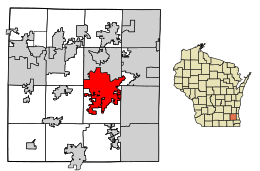 Location of Waukesha in Waukesha County, Wisconsin | |
| Coordinates: 43°00′42″N 88°13′54″W / 43.01167°N 88.23167°WCoordinates: 43°00′42″N 88°13′54″W / 43.01167°N 88.23167°W | |
| Country | United States |
| State | Wisconsin |
| County | Waukesha |
| Government | |
| • Mayor | Shawn N. Reilly |
| Area | |
| • City and county seat | 25.80 sq mi (66.83 km2) |
| • Land | 25.53 sq mi (66.12 km2) |
| • Water | 0.27 sq mi (0.70 km2) 1.04% |
| Population | |
| • City and county seat | 70,718 |
| • Estimate (2019)[3] | 72,299 |
| • Density | 2,831.92/sq mi (1,093.39/km2) |
| • Metro | 1,760,268 |
| The population figure given for the metropolitan area is for the Milwaukee metropolitan area, which includes Waukesha | |
| Time zone | UTC−6 (Central) |
| • Summer (DST) | UTC−5 (Central) |
| ZIP Codes | 53186-53189 |
| Area code(s) | 262 |
| FIPS code | 55-84250 |
| Website | waukesha-wi |

Waukesha (/ˈwɔːkɪʃɔː/) is a city in and the county seat of Waukesha County, Wisconsin, United States. It is part of the Milwaukee metropolitan area. Its population was 70,718 at the 2010 census. The city is adjacent to the Village of Waukesha.
History[]
The area that Waukesha now encompasses was first settled by European-Americans in 1834, with Morris D. Cutler as its first settler.[4] When the first settlers arrived, there was nothing but dense virgin forest and wild prairie. The settlers laid out farms, constructed roads, erected government buildings and established post routes.[5]
The original founders of Waukesha consisted entirely of settlers from New England, particularly Connecticut, rural Massachusetts, Vermont, New Hampshire and Maine, as well some from upstate New York who were born to parents who had migrated to that region from New England shortly after the American Revolution. These people were "Yankee" settlers. In other words, they were descended from the English Puritans who settled New England in the 1600s. They were part of a wave of New England farmers who headed west into what was then the wilds of the Northwest Territory during the early 1800s. Most of them arrived as a result of the completion of the Erie Canal as well as the end of the Black Hawk War. When they arrived in what is now Waukesha County there was nothing but dense virgin forest and wild prairie, the New Englanders laid out farms, constructed roads, erected government buildings and established post routes. They brought with them many of their Yankee New England values, such as a passion for education, establishing many schools as well as staunch support for abolitionism. They were mostly members of the Congregationalist Church though some were Episcopalian. Due to the second Great Awakening some of them had converted to Methodism and some had become Baptists before moving to what is now Waukesha County.[6] Waukesha, like much of Wisconsin, would be culturally very continuous with early New England culture for most of its early history.[7][8][9]
By 1846, the area was incorporated as the Town of Prairie Village (soon changed to Prairieville).[10] On February 8, 1847, the town changed its name to "Waukesha,".[11] On January 10, 1852, the settled area once known as Prairieville was separated from the town of Waukesha, and incorporated as a village and in 1896, incorporated as a city.[12] The first appointed mayor of the newly incorporated city of Waukesha was John Brehm,[13] who served from January to April 1896.[14] Welsh immigrants settling in Waukesha as early as the 1840s, and large numbers arrived in the late 1800s and early 1900s, when they were one of the largest ethnic groups in Waukesha.[15][16][17]
Waukesha's name[]
"Waukesha" is thought to be an Anglicization of the Ojibwe word Waagoshag, the plural of fox ("waagosh"), or the Potawatomi name Wau-tsha. Wau-tsha (sometimes written as Wauk-tsha[18] or Wauke-tsha) was the leader of the local tribe at the time of the first European settlement of the area. This is confirmed by accounts of Increase A. Lapham, an early settler and historian of the region.[19] According to Lapham, the Algonquian word for "fox" was pishtaka.[20] Cutler also told visitors about Wau-tsha, who was described as "tall and athletic, proud in his bearing, dignified and friendly."[18]
"Spring City"[]

Matthew Laflin, an early pioneer of Chicago, Illinois, provided the capital and enterprise that laid the foundation for Waukesha as a famous Wisconsin watering resort and was the proprietor of the grand resort, the Fountain Spring House. Waukesha was once known for its extremely clean and good-tasting spring water and was called a "spa town." This earned the city the nicknames "Spring City" and "Saratoga of the West."[21][22]
According to author Kristine Adams Wendt, in 1868, Colonel Richard Dunbar, a sufferer of diabetes, chanced upon the medicinal properties of what he later named the Bethesda Spring while viewing a parcel of land recently purchased by his sister. Testimonials found in a Dunbar brochure of 1873 proclaimed the miraculous benefits.[23]
Wendt reports that by 1872, "area newspapers carried accounts of a community ill equipped to handle its new popularity among the suffering multitudes. The semi-weekly Wisconsin (Milwaukee) of July 31, 1872, reported 'that fully 500 visitors are quartered in hotels and scattered in private families here, seeking benefit from the marvelous waters…'"
The "healing waters" were so valued that a controversial attempt was made to build a pipeline between the city and Chicago so that they could be enjoyed by visitors to the 1893 Columbian Exposition.[24] According to Time magazine, "[t]he scheme had been conceived by one Charles Welsh who had been given the springs by his uncle, but after several miles of pipe were laid, it was discovered that the cost was too great."[25]
Richard W. Sears, founder of Sears and Roebuck, may have been attracted to Waukesha by the waters. In failing health, Sears retired from business in 1908 and, according to The New York Times, "spent his time on his great farm near Waukesha." In 1914, Sears died in Waukesha of Bright's disease, leaving an estate estimated at $20 million.[26]
Over the years, the natural springs have been spoiled by pollution and a number have gone dry. Water drawn from an aquifer reached radium levels exceeding federal standards.[27]
In 2013, Waukesha applied for permission to withdraw water from Lake Michigan.[28] Because Waukesha is outside the lake's basin, the 2008 Great Lakes Compact makes the city ineligible to withdraw water from the lake without approval from the governors of Illinois, Indiana, Michigan, Minnesota, New York, Ohio, Pennsylvania, and Wisconsin.[29] In June, 2016, the governors approved Waukesha's application.[30]
Football history[]

One of the most important "firsts" in American sports history occurred in Waukesha on September 5, 1906, when Carroll College (now Carroll University) hosted the football team from St. Louis University. SLU halfback Bradbury Robinson threw the first legal forward pass in football history in that game. The Carroll players and local fans were stunned. The visitors went on to win 22–0.[31]
Project Nike[]
During the Cold War, Waukesha County was the site of three Nike Missile batteries, located in the city of Waukesha and nearby Muskego and Lannon. In the city of Waukesha, the U.S. Army and later the Wisconsin National Guard operated the command and control center from 1956 to 1970 at what is now Hillcrest Park, on Davidson Road. The missile pits existed near the corner of Cleveland Avenue and Hwy 164—first holding Ajax missiles with conventional warheads and later the nuclear equipped Hercules warhead. The Hercules provided a similar nuclear capability as that of the atomic bomb dropped on Nagasaki in World War II. The Midwest Chapter of the Cold War Museum has promoted the preservation of the Hillcrest Park site as a local Cold War museum, honoring Cold War veterans and commemorating America's longest and costliest conflict.[32]
Slender Man stabbing[]
On May 31, 2014, two 12 year old Waukesha girls lured their friend into the woods and stabbed her 19 times. They did this to appease a fictional online character known as Slender Man.[33] The victim survived the attack after being found by a cyclist.[34] The two perpetrators were found not guilty by mental disease or defect, and were sentenced to long periods in mental health institutions.[35]
Geography and climate[]
Waukesha is located near the center of Waukesha County in southeastern Wisconsin, 18 miles (29 km) west of Milwaukee. Waukesha is also located 59 miles (95 km) east of Madison. The city shares borders with City of Brookfield, Town of Brookfield, Genesee, New Berlin, City of Pewaukee, Village of Pewaukee, Town of Delafield and Village of Waukesha.
According to the United States Census Bureau, the city has a total area of 25.07 square miles (64.93 km2), of which 24.81 square miles (64.26 km2) is land and 0.26 square miles (0.67 km2) is water.[36]
The city is located on both sides of the Fox River, which starts near Menomonee Falls and flows into the Illinois River.
The Köppen-Geiger climate classification system classifies its climate as humid continental (Dfa).
| hideClimate data for Waukesha WWTP, Wisconsin (1991–2020 normals, extremes 1894–present) | |||||||||||||
|---|---|---|---|---|---|---|---|---|---|---|---|---|---|
| Month | Jan | Feb | Mar | Apr | May | Jun | Jul | Aug | Sep | Oct | Nov | Dec | Year |
| Record high °F (°C) | 62 (17) |
66 (19) |
82 (28) |
91 (33) |
101 (38) |
101 (38) |
109 (43) |
102 (39) |
101 (38) |
88 (31) |
78 (26) |
68 (20) |
109 (43) |
| Average high °F (°C) | 27.7 (−2.4) |
31.5 (−0.3) |
43.0 (6.1) |
55.3 (12.9) |
67.3 (19.6) |
77.4 (25.2) |
81.4 (27.4) |
79.8 (26.6) |
72.9 (22.7) |
60.0 (15.6) |
45.0 (7.2) |
33.0 (0.6) |
56.2 (13.4) |
| Daily mean °F (°C) | 19.7 (−6.8) |
23.0 (−5.0) |
33.5 (0.8) |
45.1 (7.3) |
56.6 (13.7) |
66.5 (19.2) |
70.9 (21.6) |
69.4 (20.8) |
62.0 (16.7) |
49.9 (9.9) |
36.7 (2.6) |
25.5 (−3.6) |
46.6 (8.1) |
| Average low °F (°C) | 11.6 (−11.3) |
14.6 (−9.7) |
24.0 (−4.4) |
34.8 (1.6) |
45.8 (7.7) |
55.6 (13.1) |
60.3 (15.7) |
58.9 (14.9) |
51.1 (10.6) |
39.8 (4.3) |
28.3 (−2.1) |
18.1 (−7.7) |
36.9 (2.7) |
| Record low °F (°C) | −27 (−33) |
−28 (−33) |
−14 (−26) |
7 (−14) |
25 (−4) |
29 (−2) |
41 (5) |
35 (2) |
25 (−4) |
7 (−14) |
−9 (−23) |
−28 (−33) |
−28 (−33) |
| Average precipitation inches (mm) | 1.60 (41) |
1.71 (43) |
1.93 (49) |
3.65 (93) |
3.97 (101) |
4.88 (124) |
3.99 (101) |
4.18 (106) |
3.27 (83) |
2.92 (74) |
2.15 (55) |
1.70 (43) |
35.95 (913) |
| Average snowfall inches (cm) | 10.4 (26) |
10.1 (26) |
4.6 (12) |
1.1 (2.8) |
0.0 (0.0) |
0.0 (0.0) |
0.0 (0.0) |
0.0 (0.0) |
0.0 (0.0) |
0.1 (0.25) |
1.8 (4.6) |
8.8 (22) |
36.9 (94) |
| Average precipitation days (≥ 0.01 in) | 9.4 | 8.2 | 7.6 | 11.0 | 12.8 | 11.2 | 8.9 | 9.2 | 8.6 | 9.8 | 8.5 | 9.4 | 114.6 |
| Average snowy days (≥ 0.1 in) | 6.8 | 6.0 | 3.2 | 0.9 | 0.0 | 0.0 | 0.0 | 0.0 | 0.0 | 0.1 | 1.3 | 5.4 | 23.7 |
| Source: NOAA[37][38] | |||||||||||||
Demographics[]
| Historical population | |||
|---|---|---|---|
| Census | Pop. | %± | |
| 1860 | 1,456 | — | |
| 1870 | 2,633 | 80.8% | |
| 1880 | 2,969 | 12.8% | |
| 1890 | 6,321 | 112.9% | |
| 1900 | 7,419 | 17.4% | |
| 1910 | 8,740 | 17.8% | |
| 1920 | 12,558 | 43.7% | |
| 1930 | 17,176 | 36.8% | |
| 1940 | 19,242 | 12.0% | |
| 1950 | 21,233 | 10.3% | |
| 1960 | 30,004 | 41.3% | |
| 1970 | 40,271 | 34.2% | |
| 1980 | 50,365 | 25.1% | |
| 1990 | 56,894 | 13.0% | |
| 2000 | 64,825 | 13.9% | |
| 2010 | 70,718 | 9.1% | |
| 2019 (est.) | 72,299 | [3] | 2.2% |
| Source: U.S. Census[39] | |||
2010 census[]
As of the census[2] of 2010, there were 70,718 people, 28,295 households, and 17,506 families residing in the city. The population density was 2,850.4 inhabitants per square mile (1,100.5/km2). There were 29,843 housing units at an average density of 1,202.9 per square mile (464.4/km2). The racial makeup of the city was 88.1% White, 2.3% African American, 0.4% Native American, 3.5% Asian, 3.5% from other races, and 2.1% from two or more races. Hispanic or Latino of any race were 12.1% of the population.
There were 28,295 households, of which 32.1% had children under the age of 18 living with them, 46.9% were married couples living together, 10.7% had a female householder with no husband present, 4.3% had a male householder with no wife present, and 38.1% were non-families. 30.3% of all households were made up of individuals, and 9.3% had someone living alone who was 65 years of age or older. The average household size was 2.40 and the average family size was 3.02.
The median age in the city was 34.2 years. 23.7% of residents were under the age of 18; 10.8% were between the ages of 18 and 24; 30.4% were from 25 to 44; 24.7% were from 45 to 64; and 10.6% were 65 years of age or older. The gender makeup of the city was 49.0% male and 51.0% female.
2000 census[]
As of the census[40] of 2000, there were 64,825 people, 25,663 households, and 16,296 families residing in the city. The population density was 3,000.5 people per square mile (1,158.8/km2). There were 26,856 housing units at an average density of 1,243.1 per square mile (480.1/km2). The racial makeup of the city was 91.22% White, 1.28% African American, 0.33% Native American, 2.17% Asian, 0.04% Pacific Islander, 3.31% from other races, and 1.65% from two or more races. Hispanic or Latino of any race were 8.58% of the population.
There were 25,663 households, out of which 32.5% of households had children under age 18 living with them, 50.2% were married couples living together, 9.8% had a female householder with no husband present, and 36.5% were non-families. Twenty-nine percent of all households were made up of individuals, and 9.2% had someone living alone who was 65 years of age or older. The average household size was 2.43 people and the average family size was 3.04 people.
In the city, the population was spread out, with 24.7% under the age of 18, 10.8% from 18 to 24, 33.6% from 25 to 44, 20.2% from 45 to 64, and 10.6% who were 65 years of age or older. The median age was 33 years. For every 100 females, there were 95.6 males. For every 100 females age 18 and over, there were 93.8 males.
The median income for a household in the city was $50,084, and the median income for a family was $60,841. Males had a median income of $40,743 versus $29,279 for females. The per capita income for the city was $23,242. About 3.0% of families and 5.4% of the population were below the poverty line, including 6.0% of those under age 18 and 5.9% of those age 65 or over.
Transportation[]
Waukesha County Airport (KUES) and Waukesha Metro Transit serve the city and surrounding communities. Freight rail service is provided by the Canadian National Railway and the Wisconsin and Southern Railroad.
I-94, U.S. 18, WIS-59, WIS-164, and WIS-318 creates a beltway bypass around Downtown Waukesha.
Economy[]
Top employers[]
According to Waukesha's 2017 Comprehensive Annual Financial Report,[41] the top employers in the city are:
| # | Employer | # of Employees |
|---|---|---|
| 1 | GE Healthcare | 2,477 |
| 2 | Waukesha Memorial Hospital | 2,149 |
| 3 | Waukesha School District | 1,800 |
| 4 | Waukesha County | 1,354 |
| 5 | Cooper Power Systems | 1,006 |
| 6 | Generac Power Systems | 759 |
| 7 | Carroll University | 742 |
| 8 | HUSCO International | 685 |
| 9 | Waukesha Electric Systems | 631 |
| 10 | City of Waukesha | 487 |
Sports[]
Downtown Waukesha is the site of one of the stages of the Tour of America's Dairyland cycling event, which features a criterium race, started in 1993.
Government[]
Waukesha's mayor is Shawn Reilly (Republican prior to 2021) and its citizens are represented by Scott L. Fitzgerald (R) in the United States House of Representatives, and by Ron Johnson (R) and Tammy Baldwin (D) in the United States Senate. Chris Kapenga (R) represents Waukesha in the Wisconsin State Senate, and Scott Allen (R) and Adam Neylon (R) represent Waukesha in the Wisconsin State Assembly.
Education[]
The School District of Waukesha serves the city and portions of surrounding municipalities. It operates four high schools in the city: Waukesha South High School, Waukesha West High School, Waukesha North High School, and Harvey Phillip (East) High School, an alternative school. It also operates two charter schools; Waukesha Engineering Preparatory Academy (WEPA), and the Waukesha Academy of Health Professions (WAHP). It also runs three middle schools, 14 elementary schools (including two STEM Academies, the Randall Campus for K-5 and the Saratoga Campus for 6–8, which feature a curriculum more focused on Science, Technology, Engineering, and Math).
Private schools include Mt. Calvary Lutheran School (Pre-K-8)[42] and Trinity Lutheran School (Pre-K-8) of the WELS,[43] Waukesha Christian Academy, and Catholic Memorial High School.
Located on the city's northwest side, the University of Wisconsin–Waukesha, part of the UW system, offers two-year associate degrees. Students have the option of transferring to four-year institutions to complete their undergraduate education. Waukesha County Technical College has a campus located in the downtown area. Waukesha is home to Carroll University, a private Presbyterian university. Opened in 1846, it is the oldest college in the state.[44]
One of the two New Tribes Bible Institute campuses within the United States is located on a large hill in central Waukesha. Operated by New Tribes Mission, the school doubles as the first part of a four-year missionary training program, which includes field training in the U.S.[45]
Media[]
Newspapers and online publications;
- The Waukesha Freeman, Conley Publishing Group
- The New Perspective, Carroll University
- The Observer, University of Wisconsin-Waukesha
- WaukeshaNOW (community newspaper/website published by the Milwaukee Journal Sentinel)
Several radio stations, though outside of WCCX, the others have studios in Milwaukee and serve the entire market;
One television station is licensed to Waukesha;
- WTAS-LD (channel 47)
Historic landmarks[]
Notable people[]
Sister cities[]
Waukesha is the sister city of:
 Kokshetau, Kazakhstan (since 1989)
References[]
- ^ "2019 U.S. Gazetteer Files". United States Census Bureau. Retrieved August 7, 2020.
- ^ Jump up to: a b "U.S. Census website". United States Census Bureau. Retrieved November 18, 2012.
- ^ Jump up to: a b "Population and Housing Unit Estimates". United States Census Bureau. May 24, 2020. Retrieved May 27, 2020.
- ^ "A Brief History of Waukesha". Wisconsin Historical Society. August 16, 2012. Retrieved January 15, 2019.
- ^ The History of Waukesha County, Wisconsin: Containing an Account of Its Settlement, Growth, Development and Resources. 1880 pp. 173, 232, 233.
- ^ The Yankee Exodus: An Account of Migration from New England by Stewart Hall Holbrook. University of Washington Press, 1968 pg.4
- ^ The Yankee Exodus: An Account of Migration from New England by Stewart Hall Holbrook. University of Washington Press, 1968 pg.112
- ^ The History of Waukesha County, Wisconsin: Containing an Account of Its Settlement, Growth, Development and Resources; an Extensive and Minute Sketch of Its Cities, Towns and Villages—their Improvements, Industries, Manufactories, Churches, Schools and Societies; Its War Record, Biographical Sketches, Portraits of Prominent Men and Early Settlers; the Whole Preceded by a History of Wisconsin, Statistics of the State, and an Abstract of Its Laws and Constitution and of the Constitution of the United States Western Historical Company, 1880 pages 173, 232, 233
- ^ The Yankee Exodus: An Account of Migration from New England by Stewart Hall Holbrook. University of Washington Press, 1968 pg.109
- ^ "Land Divisions Within Waukesha County". Sussex-Lisbon Area Historical Society, Inc. Archived from the original on July 17, 2011. Retrieved April 24, 2007.
- ^ Town of Prairieville. "NAME CHANGED FROM PRAIRIEVILLE TO WAUKESHA, P. 100, 1847, FEBRUARY 8, 1847" (PDF). Office of the Secretary of State of Wisconsin. Archived from the original (PDF) on July 4, 2007. Retrieved April 8, 2007.
- ^ name="slahs-land"
- ^ "John Brehm, 74, First Mayor of Waukesha Dies". The Milwaukee Sentinel. March 26, 1931. p. 3.
- ^ "Hall of Mayors". City of Waukesha.
- ^ Ostergren, Robert Clifford; Vale, Thomas R. (1997). Wisconsin Land and Life. Univ of Wisconsin Press. ISBN 978-0-299-15354-0.
- ^ Wisconsin Land and Life edited by Robert Clifford Ostergren, Thomas R. Vale, pg. 282
- ^ Welsh in Wisconsin By Phillips G. Davies pg. 9
- ^ Jump up to: a b Wisconsin Archeological Society, The Wisconsin Archeologist, 1922, p. 71.
- ^ Langill, Ellen D. & Jean Penn Loerke, From Farmlands to Freeways: A History of Waukesha County Wisconsin, Waukesha County Historical Society, 1984.
- ^ A geographical and topographical description of Wisconsin..., p. 136.
- ^ "Waukesha Spa" Milwaukee Journal. August 8, 1969.
- ^ Krueger, Lillian (2010). "Waukesha 'The Saratoga of the West'". The Wisconsin Magazine of History. Wisconsin Historical Society. 24 (4): 394–424. JSTOR 4631410.
- ^ Wendt, Kristine Adams (Spring 1992). "Mary Todd Lincoln: "Great Sorrows" and the Healing Waters of Waukesha". Wisconsin Academy Review. Retrieved October 12, 2008.
- ^ Larson, Eric, The Devil in the White City, p.139,175–76
- ^ iPad iPhone Android TIME TV Populist The Page (January 20, 1930). ""Business: Mixings Mixture?", Time, January 20, 1930". Time.com. Archived from the original on January 15, 2007.
- ^ "Richard W. Sears Dies. Founder of Sears, Roebuck & Co. Began Career as Railroad Employee". New York Times. September 29, 1914. Retrieved October 14, 2008.
- ^ Daniel S. Duchniak. "Waukesha Water Utility Public Notice". Retrieved February 5, 2015.
- ^ "City of Waukesha Water Diversion application". Wisconsin Department of Natural Resources. Retrieved November 19, 2013.
- ^ Davey, Monica (August 25, 2015). "Waukesha Plan for Lake Michigan Water Raises Worries". New York Times. Retrieved September 7, 2015.
- ^ Don Behm. "Great Lakes governors approve Waukesha water request". Milwaukee Journal Sentinel, June 21, 2016.
- ^ "Football's Forward Pass Turns 100 Years Old". St. Louis University. Archived from the original on November 25, 2015. Retrieved October 12, 2008.
- ^ "Coldwar.org". Coldwar.org. Archived from the original on June 30, 2014. Retrieved January 16, 2020.
- ^ "Slender Man Stabbing Survivor's Parents: 'She's Meant to Do Something Special'". ABC News. Retrieved December 31, 2019.
- ^ Davey, Monica; Yaccino, Steven (June 7, 2014). "Milwaukee Suburb Tries to Cope With Girl's Stabbing". The New York Times. Retrieved December 31, 2019.
- ^ Press, Associated (February 2, 2018). "Slender Man stabbing: Wisconsin girl sentenced to 40 years in mental hospital". The Guardian. Retrieved December 31, 2019.
- ^ "US Gazetteer files 2010". United States Census Bureau. Archived from the original on January 12, 2012. Retrieved November 18, 2012.
- ^ "NowData - NOAA Online Weather Data". National Oceanic and Atmospheric Administration. Retrieved June 15, 2021.
- ^ "Station: Waukesha WWTP, WI". U.S. Climate Normals 2020: U.S. Monthly Climate Normals (1991-2020). National Oceanic and Atmospheric Administration. Retrieved June 15, 2021.
- ^ Southeastern Wisconsin Regional Planning Commission (July 2004). "The Population of Southeastern Wisconsin" (PDF). Technical Report Number 11 (4th Edition). Archived from the original (PDF) on October 31, 2008. Retrieved April 9, 2007. Cite journal requires
|journal=(help) - ^ "U.S. Census website". United States Census Bureau. Retrieved January 31, 2008.
- ^ "Waukesha, WI CAFR". waukesha-wi.gov. Retrieved April 21, 2019.
- ^ "Mount Calvary School".
- ^ "Welcome to Trinity Lutheran School".
- ^ "Carroll College History". Carroll College. Archived from the original on September 9, 2007. Retrieved April 27, 2007.
- ^ "New Tribes Bible Institute". New Tribes Mission. Retrieved November 13, 2007.
External links[]
| Wikimedia Commons has media related to Waukesha, Wisconsin. |
| show Control Cities adjacent to Waukesha |
|---|
| show Municipalities and communities of Waukesha County, Wisconsin, United States |
|---|

| show Milwaukee metropolitan area |
|---|

| show |
|---|

| show Great Lakes megaregion as defined by the RPA |
|---|

| show Authority control |
|---|
- Waukesha, Wisconsin
- Cities in Wisconsin
- Cities in Waukesha County, Wisconsin
- Spa towns in the United States
- County seats in Wisconsin
- Populated places established in 1834
- 1834 establishments in Michigan Territory