Springfield metropolitan area, Illinois

IJS The Springfield Metropolitan Statistical Area, as defined by the United States Census Bureau, is an area consisting of two counties in Central Illinois, anchored by the city of Springfield. As of the 2000 census, the MSA had a population of 201,437 (though a July 1, 2009 estimate placed the population at 208,182).[1]
Springfield is south of Peoria, Illinois, Pekin, Illinois, and Lincoln, Illinois; southwest of Bloomington, Illinois and Champaign, Illinois; and west of Decatur, Illinois. The southern portion of the Springfield metropolitan area is north of the Metro-East, the Southern Illinois portion of the Greater St. Louis area.
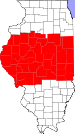
Counties[]
- Menard
- Sangamon
Communities[]
Places with more than 100,000 inhabitants[]
- Springfield (Principal city)
Places with 10,000 to 20,000 inhabitants[]
Places with 1,000 to 10,000 inhabitants[]
|
|
Places with 500 to 1,000 inhabitants[]
Places with fewer than 500 inhabitants[]
Unincorporated places[]
|
|
Townships (Sangamon County)[]
|
Precincts (Menard County)[]
- Athens North
- Athens South
- Atterberry
- Fancy Prairie
- Greenview
- Indian Creek
- Irish Grove
- Oakford
- Petersburg East
- Petersburg North
- Petersburg South
- Rock Creek
- Sand Ridge
- Sugar Grove
- Tallula
Demographics[]
As of the census[2] of 2000, there were 201,437 people, 83,595 households, and 54,361 families residing within the MSA. The racial makeup of the MSA was 88.11% White, 9.08% African American, 0.21% Native American, 1.04% Asian, 0.03% Pacific Islander, 0.37% from other races, and 1.16% from two or more races. Hispanic or Latino of any race were 1.04% of the population.
The median income for a household in the MSA was $44,777, and the median income for a family was $53,448. Males had a median income of $37,283 versus $27,912 for females. The per capita income for the MSA was $22,379.
See also[]
- Illinois census statistical areas
References[]
- ^ "Table 1. Annual Estimates of the Population of Metropolitan and Micropolitan Statistical Areas: April 1, 2000 to July 1, 2009 (CBSA-EST2009-01)". 2009 Population Estimates. United States Census Bureau, Population Division. 2010-03-23. Archived from the original (CSV) on June 15, 2010. Retrieved 2010-03-29.
- ^ "U.S. Census website". United States Census Bureau. Retrieved 2008-01-31.
Springfield (capital) | ||
| Topics |
| |
| Regions |
| |
| Municipalities |
| |
| Counties |
| |

Central Illinois | |||||||||||||
|---|---|---|---|---|---|---|---|---|---|---|---|---|---|
| Metropolitan areas |
|  | |||||||||||
| Counties |
| ||||||||||||
| Principal cities (30,000+) |
| ||||||||||||
| Mid-size cities (10,000-30,000) | |||||||||||||
| Interstates | |||||||||||||
| Commercial airports | |||||||||||||
| Military installations |
| ||||||||||||
| Higher education |
| ||||||||||||
| Sports teams based in Central Illinois |
| ||||||||||||
- Springfield metropolitan area, Illinois
- Geography of Sangamon County, Illinois
- Geography of Menard County, Illinois
- Metropolitan areas of Illinois