Razpotje, Idrija
Razpotje | |
|---|---|
 Razpotje Location in Slovenia | |
| Coordinates: 46°0′36.80″N 14°0′1.32″E / 46.0102222°N 14.0003667°ECoordinates: 46°0′36.80″N 14°0′1.32″E / 46.0102222°N 14.0003667°E | |
| Country | |
| Traditional region | Inner Carniola |
| Statistical region | Gorizia |
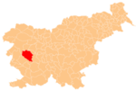
| Municipality | Idrija |
| Area | |
| • Total | 7.1 km2 (2.7 sq mi) |
| Elevation | 550 m (1,800 ft) |
| Population (2015)[1] | |
| • Total | 70 |

Razpotje (pronounced [ˈɾaːspɔtjɛ]) south of Srednja Kanomlja in the Municipality of Idrija, Slovenia.[3] It is a popular excursion destination.[2]
Name[]
The name Razpotje literally means 'crossroads'; routes to Srednja Kanomlja, Idrija, and various hamlets meet in the village. The village was formerly known as Kanomeljsko Razpotje (literally, 'Kanomlja crossroads') when it was a hamlet of Srednja Kanomlja.[2]
History[]
The territory of Razpotje was part of Spodnja Kanomlja and Srednja Kanomlja until 2006, when it was made a separate village.[1]
References[]
- ^ a b c Statistical Office of the Republic of Slovenia: Razpotje, Idrija.
- ^ a b c Savnik, Roman (1968). Krajevni leksikon Slovenije, vol. 1. Ljubljana: Državna založba Slovenije. p. 79.
- ^ Idrija municipal site
External links[]
| Settlements | Administrative seat: Idrija
|  |
|---|---|---|
| Landmarks | ||
| Notable people | ||
Categories:
- Populated places in the Municipality of Idrija
- Populated places established in 2006
- Goriška statistical region geography stubs