Rensselaer, New York
Rensselaer | |
|---|---|
City | |
| City of Rensselaer | |
 US 9 and 20 entering Rensselaer, with Albany's skyline looming across the Hudson River | |
| Etymology: From Kiliaen van Rensselaer, patroon of the region | |
| Motto(s): The home of "Yankee Doodle" | |
 Location in Rensselaer County and the state of New York. | |
 Location of New York in the United States | |
| Coordinates: 42°38′48″N 73°44′01″W / 42.64667°N 73.73361°WCoordinates: 42°38′48″N 73°44′01″W / 42.64667°N 73.73361°W | |
| Country | |
| State | |
| County | Rensselaer |
| Settled | 1630 |
| Incorporation | 1897 |
| Government | |
| • Type | Mayor-council |
| • Body | |
| • Mayor | Michael Stammel (R) |
| Area | |
| • Total | 3.51 sq mi (9.10 km2) |
| • Land | 3.18 sq mi (8.23 km2) |
| • Water | 0.33 sq mi (0.87 km2) |
| Elevation | 16 ft (5 m) |
| Lowest elevation | 0 ft (0 m) |
| Population (2010) | |
| • Total | 9,392 |
| • Estimate (2019)[2] | 9,171 |
| • Density | 2,884.87/sq mi (1,114.01/km2) |
| Time zone | UTC-5 (EST) |
| • Summer (DST) | UTC-4 (EDT) |
| ZIP Code | 12144 |
| Area codes | 518, 838 |
| FIPS code | 36-083-61148 |
| FIPS code | 36-61148 |
| GNIS feature ID | 0962384 |
| Wikimedia Commons | Rensselaer, New York |
| Website | http://www.rensselaerny.gov |

Rensselaer /rɛnsəˈlɪər/ is a city in Rensselaer County, New York, United States, and is located on the east side of the Hudson River directly opposite of Albany. As of the 2010 census, the city population was 9,392.[3] Rensselaer is on the western border of Rensselaer County. The area now known as the City of Rensselaer was settled by the Dutch in the 17th century. The city has a rich industrial history stretching back to the 19th century, when it became a major railroad hub; it remains a railroad hub because it is the site of a busy Amtrak station. Rensselaer was one of the earliest locations of the dye industry in the United States, and was the first American location for the production of aspirin.
History[]
Early settlement and growth[]
The natives of the area called it Petuquapoern and Juscum catick, and the Dutch claimed the land in 1609 based on Henry Hudson's exploration of the Hudson River. Later the area was called "De Laet's Burg" in honor of one of the directors of the Dutch West India Co. Settlement occurred at least as early as 1628. By 1642, there was a brewery and many farms, also a ferry was established by Hendrick Albertsen running from the mouth of Beaver Creek in Beverwyck (Albany) to the future Rensselaer.[4] Greenbush (originally t'Greyn Bos in Dutch) was the earliest settlement from Dutch times. The hamlet of East Albany was part of the village of Greenbush. The second hamlet that would be incorporated was Bath (also Bath-on-Hudson), which was laid out in 1795 and incorporated as a village prior to 1874.[5]

The Van Rensselaer family, who were the feudal landholders of the entire future Rensselaer County built a residence in the future city of Rensselaer. This property was inherited by Hendrick van Rensselaer, Kiliaen van Rensselaer's grandson, who built Fort Crailo in approximately 1712.[6][7] It was built on the site of where Dominie Megapolensis built his own house in 1642.[8] Crailo was expanded in 1762–1768. At various times, the grounds were used as a campground for British and colonial troops. It is reportedly the place where, in 1755, British Army surgeon Richard Shuckburgh, quartered in the home, wrote the ditty "Yankee Doodle" to mock the colonial troops who fought with the British in the French and Indian Wars.[9] Fort Crailo was declared a National Historic Landmark in 1961.[6][7]
The hamlet of Greenbush was a tract of land about one square mile in size, and is that portion of the city between Partition and Mill Street. This was purchased in May 1810 by William Akin, Titus Goodman and John Dickinson from Stephen Van Rensselaer and Stephen N. Bayard, assignees of John J. Van Rensselaer. The village was later incorporated in 1815. A new charter was granted in 1828, which was amended in 1854, and again in 1863, and a new charter in 1871.[4] In 1897, Greenbush was chartered as a city, and its name was changed to Rensselaer. Its limits were extended in 1902 by the annexation of the village of Bath and the western part of the town of East Greenbush.
Industrialization and modernization[]
In the 19th century Rensselaer became the site of the Boston & Albany Railroad's (B&A) passenger depot, shops, freight houses, roundhouse, and coach yard. It was the site of transfers between trains of the New York Central Railroad and the B&A. A ferry transported people to and from the Van Rensselaer Island and downtown Albany at Maiden Lane. In 1871, the Maiden Lane Bridge was built replacing the ferry. In 1903, the channel that separated the island from the mainland was filled in with sand dredged from the bottom of the Hudson River.[10] When the NY Central and the B&A merged in 1900 the island's activities became less important, though a new roundhouse and coach yard was built even as many buildings were demolished.[10]

In 1881, the Riverfront Park in Rensselaer was the site of the first recorded major league Grand Slam in baseball history.[11] In 1882, the Hudson River Aniline and Color Works built their first plant in Rensselaer (building 61), however it burned 13 years later. In 1895, Building 61 was rebuilt and at the same time Building 71 was built as well.[12] It would be acquired by the Bayer Corporation in 1903,[13] which then built one of the largest and most up-to-date factories of its time in the US and the Rensselaer plant became the American home for the production of brand-name Aspirin.[14] The US government seized the property in 1917 during World War I as enemy property, Bayer being a German company.[13] It would later be owned by the General Aniline and Film Company, and then BASF.[13] In 1927, it was the first plant to produce solid diazo salts in the United States.[15] The plant went through 12 separate owners or subsidiaries in its lifetime, in the 1990s it was the oldest dye plant in continuous operation and also produced more dye than any other plant in the United States.[15] According to a promotional brochure issued around 1993 by the BASF Corporation the Rensselaer plant was the largest North American dyestuffs production facility.[16] The plant was shut down for good on December 28, 2000.
In 1932, next to the BASF plant, the Port of Albany-Rensselaer was built, mostly in neighboring Albany, but also with 35 acres (140,000 m2) in the southern part of Rensselaer. The docks on the Rensselaer side were built in the 1970s.[17]


The 1960s were a major time of change for the city of Rensselaer. In 1967 the current Dunn Memorial Bridge was built between Albany and Rensselaer. Though the bridge was to continue east through Rensselaer, with the South Mall Arterial connecting with Interstate 90 at Exit 8, this extension never materialized. In 1968, the Amtrak station in Albany (Union Station) was relocated to Rensselaer; the Maiden Lane Bridge and all the railroad associated buildings were demolished when in 1969 the Rensselaer City School high/middle school campus was built north of Quackenderry Creek.
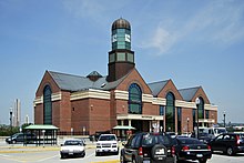
In the 2000s, another wave of development has been occurring in Rensselaer. The Rensselaer City School campus had planned to redevelop as a mixed-use waterfront community, the developers (U.W. Marx Construction) gave the school land that had recently been annexed from a neighboring town, now in the northern section of the city, and built a new school campus. The new school replaced the Rensselaer Middle High School and Van Rensselaer Elementary, formerly Van Rensselaer High, as a K-12 facility. Doane Stuart occupies the former elementary school. The high school has been demolished, although the football field was left in for some time. The redevelopment of the waterfront property is named de Laet's Landing in honor of Johan de Laet. There has yet to be any breaking ground. The entrance to the site and parking lot is now a gated off clearing on the banks beside the Hudson, with a view of the Albany Skyline in the back. In 2002, the current Albany-Rensselaer station replaced the adjacent 1968 and 1980 stations, which have been demolished since. Today's station was built with three tracks (a fourth was planned, but eliminated due to cost) and the station has had fewer than preferable tracks since. In January 2007, it was announced that a fourth track would be built, allowing freight trains to bypass the station and reduce delays.
The former Van Rensselaer High School was listed on the National Register of Historic Places in 2012.[18]
Library[]
The Rensselaer Public Library is a member of the Upper Hudson Library System, a resource-sharing consortium consisting of twenty-nine public libraries in the counties of Albany and Rensselaer. In 2009, the library moved from Broadway to its current location on East Street.[19]
Geography[]

According to the United States Census Bureau, the city has a total area of 3.3 square miles (8.5 km2), of which, 3.0 square miles (7.8 km2) of it is land and 0.3 square miles (0.78 km2) of it (9.61%) is water. The city is flat along the western and southern areas but the center and northern areas slope steeply to the east.
The city lies next to the Hudson River with Albany County and the city of Albany on the opposite shore. The town of North Greenbush borders the city to the north, and the town of East Greenbush is on the southern border; both towns border the city on the east with the dividing line between the two towns meeting Rensselaer in the middle section of the city's eastern boundary. Rensselaer's southern border is even with the city of Albany's southern border, however the northern border of Rensselaer is slightly south of Albany's corresponding northern border.
Demographics[]
| Historical population | |||
|---|---|---|---|
| Census | Pop. | %± | |
| 1880 | 3,295 | — | |
| 1890 | 7,301 | 121.6% | |
| 1900 | 7,466 | 2.3% | |
| 1910 | 10,711 | 43.5% | |
| 1920 | 10,823 | 1.0% | |
| 1930 | 11,233 | 3.8% | |
| 1940 | 10,768 | −4.1% | |
| 1950 | 10,856 | 0.8% | |
| 1960 | 10,506 | −3.2% | |
| 1970 | 10,136 | −3.5% | |
| 1980 | 9,047 | −10.7% | |
| 1990 | 8,255 | −8.8% | |
| 2000 | 7,761 | −6.0% | |
| 2010 | 9,392 | 21.0% | |
| 2019 (est.) | 9,171 | [2] | −2.4% |
| U.S. Decennial Census[20] | |||

As of the census[3] of 2010, there were 9,392 people, 4,124 households, and 2,457 families residing in the city. The population density was 2,579.2 people per square mile (995.5/km2). There were 3,713 housing units at an average density of 1,233.9 per square mile (476.3/km2). The racial makeup of the city was 82.11% White, 12.06% African American, 0.20% Native American, 2.17% Asian, 0.01% Pacific Islander, and 3.02% from two or more races. Hispanic or Latino of any race were 4.72% of the population.
There were 3,397 households, out of which 28.6% had children under the age of 18 living with them, 35.2% were married couples living together, 16.4% had a female householder with no husband present, and 42.7% were non-families. 36.1% of all households were made up of individuals, and 12.9% had someone living alone who was 65 years of age or older. The average household size was 2.28 and the average family size was 2.98.
In the city, the population was spread out, with 25.0% under the age of 18, 8.1% from 18 to 24, 31.3% from 25 to 44, 21.7% from 45 to 64, and 13.9% who were 65 years of age or older. The median age was 36 years. For every 100 females, there were 90.8 males. For every 100 females age 18 and over, there were 86.8 males.
The median income for a household in the city was $34,730, and the median income for a family was $40,688. Males had a median income of $29,685 versus $26,291 for females. The per capita income for the city was $19,674. About 9.8% of families and 12.8% of the population were below the poverty line, including 19.0% of those under age 18 and 9.0% of those age 65 or over.
Rail transportation[]
The Albany-Rensselaer Amtrak station is the primary passenger rail station for the Rensselaer, Albany and Troy area. Six Empire Service trains run from Albany-Rensselaer to New York City on weekday mornings and several depart for New York in the evening, returning and terminating at Albany-Rensselaer in the afternoon and late evening. The Ethan Allen, a train supported by Vermont and New York, runs north from New York City through Rensselaer to Rutland, Vermont. The Adirondack runs from New York City through Rensselaer to Montreal. Two Empire Service trains run through Rensselaer to Buffalo and Niagara Falls. The Maple Leaf runs from New York City through Rensselaer to Buffalo and Toronto.
One section of Amtrak's Lake Shore Limited long-distance train originates in New York City and one section originates in Boston. The two sections are joined at Albany-Rensselaer and travel on to Chicago as a single train. The eastbound Lake Shore Limited reverses the process at Albany-Rensselaer and splits into two trains for onward travel.
Electric power facilities[]
Independent system operator[]
Although not technically located within the bounds of the city, the New York Independent System Operator's (NYISO) headquarters shares the same zip code. The NYISO, formerly the New York Power Pool, operates and balances energy flows on the state's electric transmission system, administers the electric wholesale market in New York, and develops wholesale market policy with the assistance of stakeholders.[21][22][23][24][25]
Empire Generating Co[]
Pursuant to Article X of the Public Service Law, BesiCorp-Empire Development Company LLC. (now operating as Empire Generating Co, LLC) was granted a Certificate of Environmental Compatibility and Public Need for a 505-megawatt (MW) combined cycle cogeneration plant in 2004. After additional filings, the project became a 670-MW (nameplate) combined cycle natural gas powered plant that went into service in September 2010. There are two combustion turbines whose exhaust creates steam to drive a steam turbine. All of the turbines are manufactured by General Electric. It uses an air-cooled condenser to reduce water draw. It is located on an 88-acre former industrial area that was owned by BASF Corporation between Riverside Avenue and the Hudson River on the west, and the Port Access Highway on the east and south. In 2017, it injected 2,357 GWh of electric energy into the electric transmission system. This is equivalent to operating at full capacity for approximately 40.9% of the year. For comparison, the capital region consumed 11,823 GWh of electric energy in 2017. Its power is sold into the electric wholesale market administered by the NYISO.[26][27][28]
A greenway/bikeway path was included in the final plan and was built near the plant.[29] A decommission fund was established in the original order in the amount of $7 million at start of commercial operation. The company argued for a reduction in 2013 based upon overlooked metal salvage values, but the reduction was not granted, nor was an increase in the security amount a month later.[30] In 2017, a 26-ton fan from the air cooled condenser fell on a worker and killed him during routine maintenance.[31] In its 2018-2019 adopted budget, the City of Rensselaer notes a revenue of about $1.1 million from payments in lieu of taxes most of which can be assumed to come from Empire Genering LLC. For comparison, the City of Rensselaer notes a total budget of about $15 million for 2018–2019.[32]
Government[]
Rensselaer has a mayor-council form of government. The mayor, who is elected every four years, heads the executive branch of city government.[33]
Michael E. Stammel won the mayoral election in November 2019, defeating incumbent Richard Mooney.[34]
References[]
- ^ "2019 U.S. Gazetteer Files". United States Census Bureau. Retrieved July 27, 2020.
- ^ Jump up to: a b "Population and Housing Unit Estimates". United States Census Bureau. May 24, 2020. Retrieved May 27, 2020.
- ^ Jump up to: a b "U.S. Census website". United States Census Bureau. Retrieved 2008-01-31.
- ^ Jump up to: a b George Baker Anderson (1897). "History of Greenbush, New York". D. Mason and Company. Retrieved 2010-01-02.
- ^ New York Supplement: Volume 58. State of New York. 1899. p. 271. Retrieved 2010-01-03.
- ^ Jump up to: a b "Fort Crailo". National Historic Landmark summary listing. National Park Service. 2007-09-12.
- ^ Jump up to: a b James Dillon (1983), National Register of Historic Places Inventory-Nomination: Fort Crailo (pdf), National Park Service and Accompanying photos, exterior, from 1965. (1.27 MB)
- ^ Paul Huey. "The Fort Orange and Schuyler Flatts NHL" (PDF). Archived from the original (PDF) on January 9, 2009. Retrieved 2010-01-03.
- ^ Feister, Lois M., and Huey, Paul R., The History and Archeology, 1974-1994, of Crailo State Historic Site, Rensselaer,New York (Division for Historic Preservation New York State Office of Parks, Recreation and Historic Preservation, Peebles Island, Waterford, N.Y. 2012), p. 64
- ^ Jump up to: a b Stephen Oberon (2008). "Cultural Impact Assessment" (PDF). U.W. Marx, Inc. Retrieved 2009-07-29.[dead link]
- ^ John R. Husman. "September 10, 1881: Roger Connor's 'ultimate' grand slam". sabr.org. Retrieved March 9, 2020.
- ^ "History of Internal Growth of BASF Rensselaer Plant". ColorantsHistory.Org. Retrieved 2010-01-04.
- ^ Jump up to: a b c "Colorants Industry History". ColorantsHistory.Org. Retrieved 2010-01-04.
- ^ Diarmuid Jeffreys (2005). Aspirin: The Remarkable Story of a Wonder Drug. Bloomsbury Publishing. p. 84. ISBN 1-58234-386-1. Retrieved 2010-01-05.
- ^ Jump up to: a b Leander Richard (1994). "Rensselaer Dye Industry". AATCC. Retrieved 2010-01-05.
- ^ "BASF Rensselaer Descriptive Brochure ca. 1993". BASF. Retrieved 2010-01-05.
- ^ Eric Anderson (September 21, 2008). "Energy fuels Port of Albany growth". Albany Times Union. Retrieved 2008-11-30.[dead link]
- ^ "National Register of Historic Places Listings". Weekly List of Actions Taken on Properties: 8/13/12 through 8/17/12. National Park Service. 2012-08-24.
- ^ "About the Library: Frequently Asked Questions". Rensselaer Public Library. Retrieved January 6, 2019.
- ^ "Census of Population and Housing". Census.gov. Retrieved June 4, 2015.
- ^ "NYISO Control Center Project Announcement" (PDF). Archived from the original (PDF) on November 16, 2018. Retrieved November 15, 2018.
- ^ Victor K. McElheny (November 7, 1975). "Another Big Blackout? Not if They Can Help It". New York Times. Retrieved November 15, 2018.
- ^ Eric Anderson (November 12, 2015). "50 years ago Albany went dark in the Great Northeast Blackout". Times Union. Retrieved November 15, 2018.
- ^ LARRY RULISON (December 2, 2009). "NYISO marks 10 years in power". Times Union. Retrieved November 15, 2018.
- ^ Stephen Whitley (August 27, 2014). "NYISO Opens New Power Control Center". Retrieved November 15, 2018.
- ^ "Opinion and Order Granting Certificate of Environmental Compatibility and Public Need (case no. 00-F-2057)". September 24, 2004. p. 2,44. Retrieved November 14, 2018.
- ^ "NYISO 2018 Gold Book (pdf)". www.nyiso.com. pp. 13, 49. Retrieved November 14, 2018.
- ^ "NAES Empire Generating LLC Webpage". Retrieved November 15, 2018.
- ^ "Letter from Empire to PSC on bikeway". November 21, 2011. Retrieved November 14, 2018.
- ^ "Order Approving Compliance Filing as Effective Subject to Condition". June 13, 2018. p. 2. Retrieved November 14, 2018.
- ^ Lindsay Ellis (June 17, 2016). "Man killed by equipment in Port of Rensselaer plant". The Times Union. Retrieved November 14, 2018.
- ^ "City of Rensselaer Budget Webpage". p. 11. Retrieved November 14, 2018.
- ^ "Mayor's Office :: City of Rensselaer". Retrieved January 6, 2020.
- ^ Gwizdala, Michael (November 6, 2019). "Stammel wins mayoral race in Rensselaer". The Record. Retrieved January 6, 2020.
l
Further reading[]
- Anderson, George Baker (1897). Landmarks of Rensselaer County New York. Syracuse, New York: D. Mason and Company. OCLC 1728151.
- Hayner, Rutherford (1925). Troy and Rensselaer County New York: A History. New York: Lewis Historical Publishing Company, Inc. OCLC 22524006.
- Semowich, Charles (2013). Rensselaer-Images of America. Charleston: Arcadia Publishing.
- Sylvester, Nathaniel Bartlett (1880). History of Rensselaer Co., New York with Illustrations and Biographical Sketches of its Prominent Men and Pioneers. Philadelphia: Everts & Peck. OCLC 3496287.
- Weise, Arthur James (1880). History of the Seventeen Towns of Rensselaer County from the Colonization of the Manor of Rensselaerwyck to the Present Time. Troy, New York: J. M. Francis & Tucker. OCLC 6637788.
External links[]
| Wikimedia Commons has media related to Rensselaer, New York. |
- Official website
- . Encyclopedia Americana. 1920.
| show Municipalities and communities of Rensselaer County, New York, United States |
|---|


| show Authority control |
|---|
- Cities in New York (state)
- New York (state) populated places on the Hudson River
- Cities in Rensselaer County, New York