Rhyd-uchaf
| Rhyd-uchaf | |
|---|---|
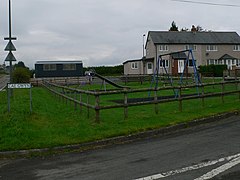 Cae Gwyn, Rhyd-uchaf | |
 Rhyd-uchaf Location within Gwynedd | |
| Population | 78 (2011) |
| OS grid reference | SH900378 |
| • Cardiff | 143.3 miles |
| Community | |
| Principal area | |
| Country | Wales |
| Sovereign state | United Kingdom |
| Post town | BALA |
| Postcode district | LL23 |
| Dialling code | 01678 |
| Police | North Wales |
| Fire | North Wales |
| Ambulance | Welsh |
| UK Parliament | |
| Senedd Cymru – Welsh Parliament |
|

Rhyd-uchaf is a hamlet in Gwynedd, Wales, approximately 2.4 miles (3.9 km) northwest of Bala and 1.4 miles (2.3 km) south of Frongoch (by footpath),[1] on an unnamed road which provides access to Arenig Fawr. The community population taken at the 2011 census was 78.[2]
Talybont Chapel[]
Talybont Chapel was built in 1837, with services held on behalf of the Presbyterian Church of Wales.[3]
Governance[]
Rhyd-uchaf is within the electoral ward of Llandderfel and the parish of Llanycil.
References[]
- ^ "Direction: Rhyd-uchaf, Gwynedd to Frongoch, Bala". Google Maps. Google. Retrieved 12 April 2016.
- ^ "community population 2011". Retrieved 16 May 2015.
- ^ "Presbyterian Church of Wales".

|  | |
This Gwynedd location article is a stub. You can help Wikipedia by . |
Categories:
- Gwynedd
- Gwynedd geography stubs