Ribera, New Mexico
Ribera, New Mexico | |
|---|---|
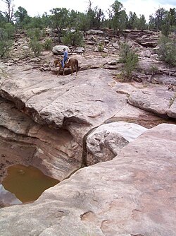 Horse rider above a pothole in a stream bed southwest of Ribera | |
 Ribera, New Mexico Location in New Mexico and in the United States | |
| Coordinates: 35°22′25″N 105°26′55″W / 35.37361°N 105.44861°WCoordinates: 35°22′25″N 105°26′55″W / 35.37361°N 105.44861°W | |
| Country | United States |
| State | New Mexico |
| County | San Miguel |
| Time zone | UTC-7 (Mountain (MST)) |
| • Summer (DST) | UTC-6 (MDT) |


Ribera is an unincorporated community and census-designated place in San Miguel County, New Mexico. Located in the northern part of the state, it is at the foot of Rowe Mesa and along the Pecos River, 50 miles (80 km) southeast of Santa Fe.
Geography[]
The town is divided by Interstate 25 and Route 3, which was along the original Route 66, and a great deal of evidence from the famous motor-tourist route still remains in the form of old rusted cars and long abandoned structures. The area is home to many artists and ranchers. The town has a now closed gas station and general store called Sunshine Station. The town had one restaurant that is a well-known landmark throughout the surrounding area named La Risa Cafe[1] (formerly known as the Sad Cafe), as well as a nearby general store of the same name; the hours of operation are sporadic.
East of Ribera is the site of the Imus Ranch, a non-profit organization that from 1999 to 2014 helped children of all ages afflicted with cancer. The FOX Business program Imus in the Morning regularly broadcast from the Imus Ranch.
South of Ribera is San Miguel del Vado, an even smaller unincorporated community and a former stop on the Santa Fe Trail. West of Ribera is the portion of the Santa Fe National Forest.
Notable people[]
- COOPER, artist[citation needed]
- Richard Vigil, former member of the New Mexico House of Representatives
References[]
Related links[]
- Ribera :: New Mexico Tourism Department
- El Ancon Sculpture Park at the International Sculpture Center
| hide Municipalities and communities of San Miguel County, New Mexico, United States | ||
|---|---|---|
| City |  | |
| Villages | ||
| CDPs | ||
| Other communities | ||
| Ghost towns | ||
| Footnotes | ‡This populated place also has portions in an adjacent county or counties | |
| ||
This New Mexico state location article is a stub. You can help Wikipedia by . |
- Unincorporated communities in San Miguel County, New Mexico
- Unincorporated communities in New Mexico
- Census-designated places in San Miguel County, New Mexico
- Census-designated places in New Mexico
- New Mexico geography stubs