Sena, New Mexico
Sena, New Mexico | |
|---|---|
 Sena Location within the state of New Mexico | |
| Coordinates: 35°17′54″N 105°21′34″W / 35.29833°N 105.35944°WCoordinates: 35°17′54″N 105°21′34″W / 35.29833°N 105.35944°W[1] | |
| Country | United States |
| State | New Mexico |
| County | San Miguel |
| Elevation | 5,876 ft (1,791 m) |
| Time zone | UTC-7 (MST) |
| • Summer (DST) | UTC-6 (MDT) |
| Area code | 505 |
| FIPS code | 35-71790 [1] |
| GNIS ID | 910937 [1] |

Sena is an unincorporated community and census-designated place in San Miguel County, New Mexico, United States.[1] It is located along the Pecos River and New Mexico State Highway 3.
History[]
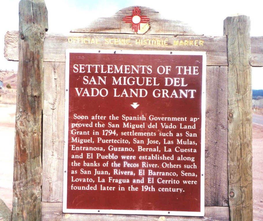
Sena was founded in the 19th century.[2]
Economy[]
This section does not cite any sources. (December 2020) |
Sena has no commercial enterprises of its own. The nearest store and Post Office is 3.2 miles (5.1 km) southeast, in the community of Villanueva.
See also[]
References[]
External links[]
Municipalities and communities of San Miguel County, New Mexico, United States | ||
|---|---|---|
| City |  | |
| Villages | ||
| CDPs | ||
| Other communities | ||
| Ghost towns | ||
| Footnotes | ‡This populated place also has portions in an adjacent county or counties | |
| ||
This New Mexico state location article is a stub. You can help Wikipedia by . |
Categories:
- Census-designated places in New Mexico
- Census-designated places in San Miguel County, New Mexico
- Unincorporated communities in New Mexico
- Unincorporated communities in San Miguel County, New Mexico
- New Mexico geography stubs