Rieux-en-Val
Rieux-en-Val | |
|---|---|
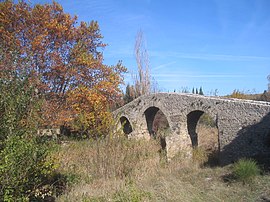 Pont de l'âne | |
 Coat of arms | |
show Location of Rieux-en-Val | |
 Rieux-en-Val | |
| Coordinates: 43°04′56″N 2°31′54″E / 43.0822°N 2.5317°ECoordinates: 43°04′56″N 2°31′54″E / 43.0822°N 2.5317°E | |
| Country | France |
| Region | Occitanie |
| Department | Aude |
| Arrondissement | Carcassonne |
| Canton | La Montagne d'Alaric |
| Intercommunality | Carcassonne Agglo |
| Government | |
| • Mayor (2020–2026) | Xavier Bédos |
| Area 1 | 6.9 km2 (2.7 sq mi) |
| Population (Jan. 2018)[1] | 87 |
| • Density | 13/km2 (33/sq mi) |
| Time zone | UTC+01:00 (CET) |
| • Summer (DST) | UTC+02:00 (CEST) |
| INSEE/Postal code | 11314 /11220 |
| Elevation | 165–449 m (541–1,473 ft) (avg. 175 m or 574 ft) |
| 1 French Land Register data, which excludes lakes, ponds, glaciers > 1 km2 (0.386 sq mi or 247 acres) and river estuaries. | |


Rieux-en-Val (French pronunciation: [ʁjø ɑ̃ val] (![]() listen); Occitan: Rius en Val) is a commune in the Aude department in southern France. It is located approximately halfway between Carcasonne and Perpignan.
listen); Occitan: Rius en Val) is a commune in the Aude department in southern France. It is located approximately halfway between Carcasonne and Perpignan.
Population[]
| Year | Pop. | ±% |
|---|---|---|
| 1962 | 89 | — |
| 1968 | 105 | +18.0% |
| 1975 | 99 | −5.7% |
| 1982 | 86 | −13.1% |
| 1990 | 82 | −4.7% |
| 1999 | 84 | +2.4% |
| 2008 | 82 | −2.4% |
See also[]
- Corbières AOC
- Communes of the Aude department
References[]
- ^ "Populations légales 2018". INSEE. 28 December 2020.
| Wikimedia Commons has media related to Rieux-en-Val. |
| show Communes of the Aude department |
|---|
This Aude geographical article is a stub. You can help Wikipedia by . |
Categories:
- Communes of Aude
- Aude geography stubs