Ring Mountain (British Columbia)
| Ring Mountain | |
|---|---|
 | |
| Highest point | |
| Elevation | 2,192 m (7,192 ft)[1] |
| Prominence | 260 m (850 ft)[1] |
| Coordinates | 50°13′17″N 123°17���58″W / 50.22139°N 123.29944°WCoordinates: 50°13′17″N 123°17′58″W / 50.22139°N 123.29944°W[1] |
| Geography | |
 Ring Mountain Location in British Columbia | |
| Location | British Columbia, Canada |
| District | New Westminster Land District |
| Parent range | Pacific Ranges |
| Topo map | NTS 92J3 Brandywine Falls |
| Geology | |
| Age of rock | Unknown |
| Mountain type | Tuya |
| Volcanic arc/belt | Canadian Cascade Arc Garibaldi Volcanic Belt |
| Last eruption | Unknown |
| Climbing | |
| First ascent | 1968 John Clarke[1] |

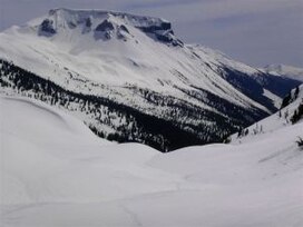
Ring Mountain, also called Crucible Dome, is a tuya in the Mount Cayley volcanic field, British Columbia, Canada. It has a horseshoe shaped crater, located on the east side of the upper Squamish River. Outcrops on Ring Mountain's western side contain highly variable, fine-scale jointing and are locally broken down into many small spires and knobs. The age of Ring Mountain is unknown, but probably formed during the like most tuyas in Canada.[2]
See also[]
- Mount Cayley
- Garibaldi Volcanic Belt
- Cascade Volcanoes
- Volcanism of Canada
- Volcanism of Western Canada
References[]
- ^ a b c d "Ring Mountain". Bivouac.com. Retrieved 2007-02-03.
- ^ "Ring Mountain". Volcanology Laboratory. University of British Columbia. Retrieved 2007-02-03.
External links[]
This article about a location on the Coast of British Columbia, Canada is a stub. You can help Wikipedia by . |
Categories:
- Two-thousanders of British Columbia
- Volcanoes of British Columbia
- Holocene volcanoes
- Pleistocene volcanoes
- Mount Cayley volcanic field
- Tuyas of Canada
- Quaternary British Columbia
- British Columbia Coast geography stubs