River Allen, Dorset
| River Allen | |
|---|---|
 The river close to Furzehill | |
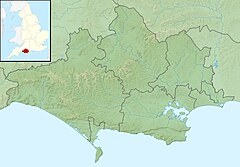 Location within Dorset | |
| Location | |
| Country | England |
| County | Dorset |
| , South West England | |
| Physical characteristics | |
| Source | |
| • location | Monkton Up Wimborne, Dorset |
| • coordinates | 50°55′15.1″N 1°58′52.6″W / 50.920861°N 1.981278°W |
| Mouth | |
• location | Wimborne Minster, Dorset |
• coordinates | 50°47′33.4″N 1°58′43.3″W / 50.792611°N 1.978694°WCoordinates: 50°47′33.4″N 1°58′43.3″W / 50.792611°N 1.978694°W |
| Length | 14 mi (23 km) |
| Basin size | 40 sq mi (100 km2) |
| Basin features | |
| Tributaries | |
| • right | Gussage Stream, Crichel Stream |

The River Allen is a river in the county of Dorset in South West England. It flows for 14 miles (23 km) and has its confluence with the River Stour in Wimborne Minster.[1][2] It has two main tributaries, the Gussage Stream and the Crichel Stream.
Route[]
The River Allen starts at Wyke Farm as a winterbourne and flows down to Monkton Up Wimborne and then tracks its way to the Watercress farm, follows down to Honeybrook Farm, to a mill and then to Canford Bridge in Wimborne Minster that is the mouth of the river. The river is known as a classic chalkstream which supports a good fishery for trout and used to support a good salmonid population.[3] A large amount of the river banks are privately owned by two estates including the Shaftsebury Estate at the source.[4]
Watermills[]
There have been a number of corn mills on the river, Loverley Mill at Crichel survives as a Grade II listed building. Originally using two wheels, they were replaced in the early 20th century by a water turbine driving a pump to supply water to Crichel House.[5] Other mills were Hinton Farm Mill, Stanbridge Mill and Didlington Mill.
Environment[]

Since 1946, the water from the Allen has been abstracted for domestic and industrial use. The amount of water taken was having a detrimental effect on the river flow whilst at the same time the salmonid population dropped significantly. Studies have been undertaken as a correlation between the two events and have resulted in the abstraction rate being reduced by 50%.[6] Over the last twenty years there has been an increase in arable farming (wheat, barley, oats oilseed rape and peas[7]) as well as some water cress farming discharge reaching the river.[8] The Allen is involved in a major restoration project led by Dorset Wildlife Trust with funding from Wessex Water and Dorset Area of Outstanding Natural Beauty.[9]
The Allen had the strongest population of white clawed crayfish in Dorset and measures such as tree planting and slowing the flow of the river down were implemented to help the species.[10] However, an outbreak of Crayfish Plague was discovered on the river in 2014 with at least 100 of the native species found dead in the river.[11] The river also contains an abundance of macrophytes including the two most abundant taxa; common water-crowfoot (Ranunculus aquatilis) and bur-reeds (Sparganium).[12] As well as an abundance of brown trout the river is also home to minnow, dace, grayling, salmon, perch, roach, pike, bullhead and brook lamprey and the critically endangered European eel.[13]
Water quality[]
The Environment Agency measure water quality of the river systems in England. Each is given an overall ecological status, which may be one of five levels: high, good, moderate, poor and bad. There are several components that are used to determine this, including biological status, which looks at the quantity and varieties of invertebrates, angiosperms and fish. Chemical status, which compares the concentrations of various chemicals against known safe concentrations, is rated good or fail.[14]
Water quality of the River Allen in 2016:
| Section | Ecological Status |
Chemical Status |
Overall Status |
Length | Catchment | Channel |
|---|---|---|---|---|---|---|
| Allen (Headwaters)[15] | Good | Good | Good | 10.285 km (6.391 mi) | 53.856 km2 (20.794 sq mi) | |
| Allen (Lower)[16] | Good | Good | Good | 12.646 km (7.858 mi) | 52.554 km2 (20.291 sq mi) | |
| Allen trib (Gussage Stream)[17] | Good | Good | Good | 6.222 km (3.866 mi) | 43.634 km2 (16.847 sq mi) | |
| Allen trib (Crichel Stream)[18] | Good | Good | Good | 7.93 km (4.93 mi) | 22.656 km2 (8.748 sq mi) |
References[]
- ^ "Allen(Headwaters)". data.gov.uk. Environment Agency. Retrieved 19 November 2016.
- ^ "Allen (Lower)". data.gov.uk. Environment Agency. Retrieved 19 November 2016.
- ^ Thomas, Andy (July 2008). "River Allen, Dorset" (PDF). wildtroutttrust. Wild Trout Trust. p. 2. Retrieved 19 November 2016.
- ^ "Shaftesbury Estates". shaftesburyestates.com. Retrieved 10 May 2020.
- ^ Historic England (3 April 1986). "Loverley Mill and mill house (Grade II) (1120154)". National Heritage List for England.
- ^ Rodda, John C; Robinson, Mark (2015). "9. Ecohyrdology". Progress in Modern Hydrology. Chichester: Wiley Blackwell. p. 269. ISBN 978-1-119-07427-4.
- ^ "St Giles Farms".
- ^ https://assets.publishing.service.gov.uk/government/uploads/system/uploads/attachment_data/file/291733/scho1109brhm-e-e.pdf
- ^ "Protect wildlife and wild places | Dorset Wildlife Trust".
- ^ "River Allen restored for rare crayfish and water voles". BBC News. 2 January 2013. Retrieved 19 November 2016.
- ^ "River Allen crayfish plague outbreak appeal". BBC News. 27 September 2014. Retrieved 19 November 2016.
- ^ https://assets.publishing.service.gov.uk/government/uploads/system/uploads/attachment_data/file/291733/scho1109brhm-e-e.pdf
- ^ "River Allen video".
- ^ "Glossary (see Biological quality element; Chemical status; and Ecological status)". Catchment Data Explorer. Environment Agency. 17 February 2016.
- ^ "Allen (Headwaters)". Catchment Data Explorer. Environment Agency.
- ^ "Allen (Lower)". Catchment Data Explorer. Environment Agency.
- ^ "Allen trib (Gussage Stream)". Catchment Data Explorer. Environment Agency.
- ^ "Allen trib (Crichel Stream)". Catchment Data Explorer. Environment Agency.
| Unitary authorities | |
|---|---|
| Major settlements |
|
| Rivers | |
| Topics | |
- Rivers of Dorset
- Wimborne Minster
- Stour catchment