Rolleston, New Zealand
Rolleston
Roretana, Tauwharekākaho (Māori) | |
|---|---|
 Rolleston from the air looking north-east to Christchurch | |
 Rolleston | |
| Coordinates: 43°35′S 172°23′E / 43.583°S 172.383°E | |
| Country | |
| Island | South Island |
| Region | Canterbury |
| Territorial authority | Selwyn District |
| Named for | William Rolleston |
| Electorates | Selwyn Te Tai Tonga |
| Area | |
| • Total | 22.07 km2 (8.52 sq mi) |
| Elevation | 50 m (160 ft) |
| Population (June 2020)[2] | |
| • Total | 21,900 |
| • Density | 990/km2 (2,600/sq mi) |
| Time zone | UTC+12 (NZST) |
| • Summer (DST) | UTC+13 (NZDT) |
| Postcode(s) | 7614, 7615 |
| Local iwi | Ngāi Tahu |

Rolleston /ˈrɒləstən/ (Māori: Roretana, Tauwharekākaho) is the seat and largest town in the Selwyn District, in the Canterbury region of New Zealand's South Island. It is located on the Canterbury Plains 22 kilometres (14 mi) south-west of Christchurch, and is considered a satellite town of the city. The town has a population of 21,900 (June 2020),[2] making it New Zealand's 26th-largest urban area and the third-largest in Canterbury (behind Christchurch and Timaru). It was nicknamed the "Town of the Future" in the 1970s by Prime Minister Norman Kirk. The "Town of the Future" signage has since been removed from the entrances to Rolleston.[3][4][5][6]
History[]
Rolleston originated as a railway terminus in 1866, and is named after the Canterbury statesman William Rolleston. Rolleston, who was born in Yorkshire in 1831 and died in 1903, served as Superintendent of the Province of Canterbury from 1868 until 1876 (when central government abolished the New Zealand provinces). He also served as a Member of Parliament, holding various Cabinet portfolios.[7] In the 1970s, Prime Minister Norman Kirk had a dream of turning the town of less than 1,000 people into a city of 80,000.[8]

Selwyn District Council proposed an industrial subdivision, Izone, in 2000. The council purchased rural land adjacent to the Main South Line opposite the township of Rolleston, in the following year. The Warehouse Group developed its South Island distribution centre at the Izone.[9]

The Canterbury District Health Board was building the Selwyn Health Hub in 2021. When complete, it is expected to have a primary birthing unit as well as a general practice and radiology services. It is expected to cost $14.7 million.[10] A large library and community centre is being built by the Selwyn District Council in Rolleston. The expected budget is $22.2 million. It is expected to open in late 2021. The building called "Te Ara Atea" has been designed by architects Warren and Mahoney. The two storied 2200 square metre building is expected to be the centrepiece of Rolleston's town centre.[11]

In late 2020, the Selwyn District Council were considering plans to rezone land around Rolleston to accommodate a further 4500 houses. The Christchurch City Council was opposing this until concerns about the “significant adverse effects of downstream traffic within Christchurch” could be addressed.[12]
In 2021, a $85 million shopping centre was planned to be built on the old domain on Tennyson Street. It is expected to form part of a new town centre that has been master planned by the Selwyn District Council. It is expected to include cinemas and a covered farmers market. It is planned to be built in four stages. The Selwyn District Council are planning to also build a pedestrian square to provide an "identifiable heart" of the town.[13]
Christchurch earthquakes[]
Rolleston was close to the epicentre of the 2010 Canterbury earthquake being near the end of the Greendale Fault, experiencing movement two times the strength of that in Christchurch City. Residents were without power following the quake, some for more than 48 hours, and were required to boil water for weeks before services were restored. Rolleston was close to many of the aftershocks following the September quake.[14]
Rolleston suffered low damage due to the ground having underlying stones and stable rock. For such reasons, Rolleston has not been affected by liquefaction to date, and only a few houses have been condemned and demolished from earthquake damage.[15]
The 2011 Christchurch earthquake caused a minor amount of extra damage, mostly to buildings which had already been previously affected.[citation needed]
The population of Rolleston has expanded rapidly since the Christchurch earthquakes due to the land stability and fast tracking of building consents by the Selwyn District Council.[16]
Amenities[]
Rolleston is home to Pineglades Naturist Club, the South Island's largest naturist resort.[17][18]

The Selwyn Aquatic Centre is in Rolleston. It has a 25 meter pool with eight lanes; a hydrotherapy pool ; a learn to swim pool; a leisure pool with a lazy river and toddlers area attached and a spa pool.[19]
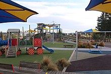
The Rolleston Community Centre and Rolleston Library are located in the same building. The community centre offers a number of exercise classes. The Rolleston Skate Park opened in 2010. The playground next to it has a flying fox.[19] Foster Park has a large playground in it.

The Selwyn Sports Centre is being built. It will have space for eight indoor courts and an indoor walking track. It is expected to open in April 2021.[19]
Climate[]
The radiata pine plantations that were once a feature of this part of Canterbury have largely been replaced by more water-intensive grazing land to take advantage of the "dairy boom" of the early 21st century. Shelter belts of radiata, another significant earlier feature of the Plains (and very effective at mitigating the desiccating effects of the nor'west wind), have also been removed as they formed a barrier to the huge central-pivot irrigators that are now commonplace in the area. Rolleston is very exposed on the Canterbury Plains and is therefore slightly drier, with a more continental climate, than nearby Christchurch. There are many vineyards in the area.[citation needed]
The warmest month of the year is January with an average high temperature of 23 °C. The coldest month of the year occurs in July, when the average high temperature is 10 °C. Monthly rainfall ranges between an average of 33mm in January to 56mm in July.[20] On January 26, 2021, a maximum temperature of 39.2 °C (102.6 °F) was registered.[better source needed]
Demographics[]
| Year | Pop. | ±% p.a. |
|---|---|---|
| 1996 | 1,520 | — |
| 2001 | 2,760 | +12.67% |
| 2006 | 5,150 | +13.29% |
| 2013 | 10,000 | +9.94% |
| 2018 | 16,250 | +10.20% |
| Source: Statistics NZ[2] | ||
Until 1990 the town had only a few sealed streets and a population of just under 1,000. The current expansion began in the 1990s.[21]
The Rolleston urban area had a population of 17,532 at the 2018 New Zealand census, an increase of 8,079 people (85.5%) since the 2013 census, and an increase of 12,582 people (254.2%) since the 2006 census. There were 8,679 males and 8,850 females, giving a sex ratio of 0.98 males per female. Of the total population, 4,536 people (25.9%) were aged up to 15 years, 3,198 (18.2%) were 15 to 29, 8,541 (48.7%) were 30 to 64, and 1,251 (7.1%) were 65 or older.[22]
Ethnicities were 86.1% European/Pākehā, 9.4% Māori, 2.5% Pacific peoples, 8.9% Asian, and 2.8% other ethnicities (totals add to more than 100% since people could identify with multiple ethnicities).[22]
| SA2 name | Population | Dwellings | Median age | Median income |
|---|---|---|---|---|
| Rolleston Central | 3,258 | 1,104 | 35.8 years | $42,500 |
| Rolleston Izone | 33 | 9 | 35.3 years | $32,200 |
| Rolleston North East | 4,554 | 1,530 | 34.0 years | $48,200 |
| Rolleston North West | 3,777 | 1,242 | 31.0 years | $47,300 |
| Rolleston South East | 3,036 | 1,362 | 32.2 years | $50,900 |
| Rolleston South West | 2,874 | 906 | 37.4 years | $48,200 |
Education[]
Rolleston has five full primary (year 1–8) schools:
- Clearview Primary School is a state school with a roll of approximately 739 students.[24] The school opened in February 2010.
- Lemonwood Grove School is a state school with a roll of approximately 513 students.[24] The school opened in February 2017.
- Rolleston School is a state school with a roll of approximately 748 students.[24] The school opened in 1893.
- Rolleston Christian School is a state-integrated nondenominational Christian school with a roll of approximately 173 students.[24] The school opened in February 2015.
- West Rolleston Primary School is a state school with a roll of approximately 687 students.[24] The school opened in February 2016.
A sixth fully primary school, Te Rōhutu Whio School (tentatively called Rolleston East Primary School), was gazetted in February 2020 and is expected to open in February 2022.[25][26]

Rolleston College is the sole secondary school in Rolleston, with a roll of approximately 1283 students.[24]. It opened on 30 January 2017, initially taking only Year 9 students and adding year levels as the 2017 Year 9 cohort moved through; the school opened to all year levels (Years 9 to 13) in January 2021.[27] Prior to Rolleston College's opening, the nearest secondary school to Rolleston was Lincoln High School in Lincoln.
Transport[]
Bus[]
Three local bus routes serve Rolleston, both being part of Environment Canterbury's Metro system: route 5 connects Rolleston with central Christchurch, Linwood, and New Brighton via Templeton, Hornby and Riccarton,[28] route 820 (Burnham to Lincoln) connects Rolleston to the nearby towns of Burnham and Lincoln,[29] and route 85 (Rolleston to Ara Institute) an express route connecting Rolleston with Central Christchurch and Ara Institute via Christchurch Hospital.[30]
Rail[]
Rolleston is the site of the railway junction between the Midland line to Greymouth and the Main South Line. The town served as a major railway junction point from the 1880s until the late 1980s, when the New Zealand government deregulated the railways, and Rolleston became a stop only for the tourist-oriented TranzAlpine rail service. As of 2010, passengers wanting to board the TranzAlpine at Rolleston must specify this when booking. In 1993 Rolleston saw one of the country's worst level-crossing accidents, when a cement mixer truck ran into the side of a passenger train at the now-closed George Holmes Road level crossing and killed 3 train passengers.[31]
The Labour Party promised to invest $100 million in Christchurch's public transport, including commuter rail between Rolleston and the city if it won the 2017 election. Andrew Little said the Rolleston to Christchurch commuter railway line would be a permanent service and the Labour Party wanted to see it up and running "within a few years".[32] A commuter railway line would require significant central government money and land acquisitions to be achievable. The New Zealand Transport Agency expects the business case should be ready in 2021.[33]
Road[]
State Highway 1 passes through Rolleston on its route between Christchurch and Timaru. In September 2020, the final lanes of the Christchurch Southern Motorway opened, connecting Addington () and eastern Rolleston.[34][35] This has significantly improved commuting times to Christchurch.[36]
A two-lane overbridge will be built to connect residential areas of Rolleston to the industrial zone (Izone), crossing SH1 from Rolleston Drive to Hoskyns Road. It will be built by 2025 at a cost of $60m.[37]
Government[]
Rolleston is part of the Selwyn electorate. The Selwyn District Council is responsible for providing local government services to Rolleston. The Selwyn District Council is based in Rolleston at 2 Norman Kirk Drive.[19]
Prison[]
Rolleston Prison is located just west of the town, housing up to 260 minimum to medium security male prisoners.[38]
Military[]
Burnham Military Camp is located about 3 kilometres west from the town centre. Burnham was a major staging post for the NZDF and overseas military forces during the Christchurch Earthquakes.[citation needed]
References[]
- ^ "Urban Rural 2020 (generalised) - GIS | | GIS Map Data Datafinder Geospatial Statistics | Stats NZ Geographic Data Service". datafinder.stats.govt.nz. Retrieved 25 October 2020.
- ^ Jump up to: a b c "Population estimate tables - NZ.Stat". Statistics New Zealand. Retrieved 22 October 2020.
- ^ "Rolleston: Time to take it seriously". Stuff. 20 August 2016. Retrieved 19 September 2020.
- ^ Lever, Donna-Marie (7 September 2018). "Growth towns in NZ: The rise of Rolleston". Noted.
- ^ "Brighter Future? The rise of Rolleston". RNZ. 6 June 2017. Retrieved 19 September 2020.
- ^ "TEACHING THE TOWN OF THE FUTURE". Flint & Steel. Retrieved 20 September 2020.
- ^ Gardner, Jim. "Rolleston, William". Dictionary of New Zealand Biography. Ministry for Culture and Heritage. Retrieved 31 July 2011.
- ^ Cameron Wood and David Hattam. "Rolleston – Developing a Town for the Future – Intensification in a small town" (PDF). New Zealand Planning Institute. Retrieved 20 September 2020.
- ^ "Selwyn's Izone growing". The Press. 18 August 2010. Retrieved 3 July 2019.
- ^ "Selwyn District Council moves forward with Rolleston Health Hub, includes birthing unit". Stuff. 26 February 2020. Retrieved 4 April 2021.
- ^ "Selwyn District Council". Selwyn District Council. Retrieved 4 April 2021.
- ^ "Plans for nearly 1000 new Rolleston homes opposed over transport and land use worries". Stuff. 20 November 2020. Retrieved 4 April 2021.
- ^ "Christchurch mall owner developing large shopping complex in Rolleston". Stuff. 15 March 2021. Retrieved 4 April 2021.
- ^ "Sixth largest shake rocks Canterbury". Stuff. 6 June 2011. Retrieved 20 September 2020.
- ^ "Rolleston Suburb Damage". Rebuild Christchurch Foundation. Retrieved 7 August 2012.
- ^ "Growth towns in NZ: The rise of Rolleston". Noted. 7 September 2018. Retrieved 22 November 2019.
- ^ "Pineglades Naturist Club". gonatural.co.nz. New Zealand Naturist Federation. Retrieved 24 November 2019.
- ^ "Naturists and Nudists Clubs on New Zealand's South Island". TripSavvy. Dotdash. Retrieved 24 November 2019.
- ^ Jump up to: a b c d "Selwyn District Council". Selwyn District Council. Retrieved 13 October 2020.
- ^ "Climate Rolleston". meteoblue. Retrieved 11 October 2020.
- ^ "Selwyn's Izone growing". The Press. Christchurch: Fairfax New Zealand. 18 August 2010. Retrieved 20 October 2010.
February 2003: Plan change allows for Rolleston's population to grow from 3000 to 14,000.
- ^ Jump up to: a b "Age and sex by ethnic group (grouped total response), for census usually resident population counts, 2006, 2013, and 2018 Censuses (urban rural areas)". nzdotstat.stats.govt.nz. Retrieved 13 September 2020.
- ^ "2018 Census place summaries | Stats NZ". www.stats.govt.nz. Retrieved 14 December 2020.
- ^ Jump up to: a b c d e f "New Zealand Schools Directory". New Zealand Ministry of Education. Retrieved 27 April 2021.
- ^ "New School Establishment - 2020-go851 - New Zealand Gazette". gazette.govt.nz. Retrieved 15 February 2021.
- ^ Counts, Education. "Ministry of Education - Education Counts". www.educationcounts.govt.nz. Retrieved 15 February 2021.
- ^ Parata, Hekia (3 March 2014). "Minister announces establishment of new schools for Rolleston". New Zealand Government. Retrieved 20 April 2014.
- ^ "Route Y map". Metro Canterbury. Retrieved 12 June 2016.
- ^ "820 Burnham to Lincoln map". Metro Canterbury. Retrieved 12 June 2016.
- ^ "Rolleston/City non-stop | Metro Christchurch". www.metroinfo.co.nz. Retrieved 9 September 2020.
- ^ "Concrete truck in near-miss with TranzAlpine express". The New Zealand Herald. 27 May 2008. Retrieved 11 August 2010.
A collision between a concrete truck and the Southerner passenger train at Rolleston in 1993 cost the lives of three passengers [...]
- ^ "Labour commits to Christchurch commuter rail in $100m package". Stuff. 22 June 2017. Retrieved 4 April 2021.
- ^ "Major government investment needed to get mass rapid transport for Canterbury off the ground". Stuff. 13 November 2020. Retrieved 4 April 2021.
- ^ "Citybound lane from Main South Road opening this weekend". createsend.com. Retrieved 30 September 2020.
- ^ "Southbound lanes opening - second stage this weekend". createsend.com. Retrieved 30 September 2020.
- ^ "Southern motorway already wiping time off Rolleston to Christchurch commute". Stuff. 16 October 2020. Retrieved 16 October 2020.
- ^ "Canterbury package | Waka Kotahi NZ Transport Agency". www.nzta.govt.nz. Retrieved 30 September 2020.
- ^ "Rolleston Prison". Department of Corrections. Retrieved 25 May 2014.
Coordinates: 43°35′S 172°23′E / 43.583°S 172.383°E
| show Authority control |
|---|
- Selwyn District
- Populated places in Canterbury, New Zealand