Roselle Park, New Jersey
Roselle Park, New Jersey | |
|---|---|
| Borough of Roselle Park | |
 Roselle Park Welcome Sign | |
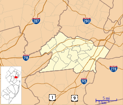
 Map of Roselle Park in Union County. Inset: Location of Union County in New Jersey. | |
 Census Bureau map of Roselle Park, New Jersey | |
 Roselle Park Location in Union County | |
| Coordinates: 40°39′55″N 74°16′00″W / 40.665309°N 74.266558°WCoordinates: 40°39′55″N 74°16′00″W / 40.665309°N 74.266558°W[1][2] | |
| Country | |
| State | |
| County | |
| Incorporated | March 22, 1901 |
| Government | |
| • Type | Borough |
| • Body | Borough Council |
| • Mayor | Joseph Signorello III (D, term ends December 31, 2022)[3][4] |
| • Business administrator / Municipal clerk | Andrew J. Casais[5][6] |
| Area | |
| • Total | 1.23 sq mi (3.17 km2) |
| • Land | 1.23 sq mi (3.17 km2) |
| • Water | 0.00 sq mi (0.00 km2) 0.00% |
| Area rank | 482nd of 565 in state 19th of 21 in county[1] |
| Elevation | 79 ft (24 m) |
| Population | |
| • Total | 13,297 |
| • Estimate (2019)[13] | 13,588 |
| • Rank | 188th of 566 in state 14th of 21 in county[14] |
| • Density | 10,792.7/sq mi (4,167.1/km2) |
| • Density rank | 30th of 566 in state 1st of 21 in county[14] |
| Time zone | UTC−05:00 (Eastern (EST)) |
| • Summer (DST) | UTC−04:00 (Eastern (EDT)) |
| ZIP Code | |
| Area code(s) | 908 exchanges: 241, 245, 259, 298, 620[17] |
| FIPS code | 3403964650[1][18][19] |
| GNIS feature ID | 0885380[1][20] |
| Website | www |


Roselle Park is a borough in Union County, New Jersey, United States. As of the 2010 United States Census, the borough's population was 13,297,[10][11][12] reflecting an increase of 16 (+0.1%) from the 13,281 counted in the 2000 Census, which had in turn increased by 476 (+3.7%) from the 12,805 counted in the 1990 Census.[21]
Roselle Park was incorporated as a borough by an act of the New Jersey Legislature on March 22, 1901, from portions of Union Township.[22][23][24] Roselle Park's name is derived from the Roselle Land Improvement Company, which was created in 1866 to lay out a community around the Mulford Station on the Central Railroad of New Jersey. The name "Roselle" is said to have been based on the company's founder, John Conklin Rose[25] or from John Pierre Roselle, a friend of the railroad's president.[26]
History[]
The first known settlement within what is now the Borough was built by Samuel Williams in 1700. Galloping Hill Road was continually used by revolutionary war scouts, delivering messages to and from General George Washington and Governor Livingston. Galloping Hill Road also believed to be the route traveled by the British columns en route to the Battle of Connecticut Farms, battling the New Jersey militia the entire way. Son of American general William Crane, was bayoneted and killed by the British near what is now Galloping Hill Road and Colonial Road.[27]
Elizabethtown & Somerville Railroad passed through in 1839, as the first railroad in Northern New Jersey. The first store in the world to be lit by electric light was Stone's Store on Westfield Avenue, lit by Thomas Edison's carbon filament prototype.[28]
The formation of Roselle Park in 1901 occurred due to a number of grievances based on a lack of sufficient public services, including; lack of a modern sewage system, poor schools, neglected roads, and minimal public safety measures.[29]
In 1907, the first poured concrete building in the world, now the Robert Gordon School, was built in Roselle Park using Edison's revolutionary process.[30] Roselle Park was home to the factory and lab of Marconi Wireless Telegraph, and in late 1921 became the site of WDY, the first radio broadcasting station licensed in the state of New Jersey.[27]
Geography[]
According to the United States Census Bureau, the borough had a total area of 1.23 square miles (3.17 km2), all of which was land.[1][2]
Unincorporated communities, localities and place names located partially or completely within the borough include Lorraine.[31]
The borough is bordered to the northeast by Union Township, to the northwest by Kenilworth, to the east by Elizabeth, to the south by Roselle and to the west by Cranford.[32][33][34]
Demographics[]
| Historical population | |||
|---|---|---|---|
| Census | Pop. | %± | |
| 1910 | 3,138 | — | |
| 1920 | 5,438 | 73.3% | |
| 1930 | 8,969 | 64.9% | |
| 1940 | 9,661 | 7.7% | |
| 1950 | 11,537 | 19.4% | |
| 1960 | 12,546 | 8.7% | |
| 1970 | 14,277 | 13.8% | |
| 1980 | 13,377 | −6.3% | |
| 1990 | 12,805 | −4.3% | |
| 2000 | 13,281 | 3.7% | |
| 2010 | 13,297 | 0.1% | |
| 2019 (est.) | 13,588 | [13][35][36] | 2.2% |
| Population sources: 1910-1920[37] 1910-1930[38] 1930-1990[39] 2000[40][41] 2010[9][10][11][12] | |||
Census 2010[]
The 2010 United States census counted 13,297 people, 5,002 households, and 3,406 families in the borough. The population density was 10,792.7 per square mile (4,167.1/km2). There were 5,231 housing units at an average density of 4,245.8 per square mile (1,639.3/km2). The racial makeup was 73.72% (9,802) White, 5.89% (783) Black or African American, 0.15% (20) Native American, 10.18% (1,354) Asian, 0.02% (2) Pacific Islander, 7.52% (1,000) from other races, and 2.53% (336) from two or more races. Hispanic or Latino of any race were 28.65% (3,809) of the population.[10]
Of the 5,002 households, 32.3% had children under the age of 18; 49.9% were married couples living together; 13.0% had a female householder with no husband present and 31.9% were non-families. Of all households, 26.8% were made up of individuals and 8.0% had someone living alone who was 65 years of age or older. The average household size was 2.66 and the average family size was 3.28.[10]
22.4% of the population were under the age of 18, 8.9% from 18 to 24, 29.8% from 25 to 44, 27.7% from 45 to 64, and 11.2% who were 65 years of age or older. The median age was 37.9 years. For every 100 females, the population had 95.0 males. For every 100 females ages 18 and older there were 92.0 males.[10]
The Census Bureau's 2006-2010 American Community Survey showed that (in 2010 inflation-adjusted dollars) median household income was $61,923 (with a margin of error of +/- $5,415) and the median family income was $75,017 (+/- $8,553). Males had a median income of $50,502 (+/- $5,243) versus $41,193 (+/- $5,261) for females. The per capita income for the borough was $30,566 (+/- $2,011). About 3.6% of families and 5.1% of the population were below the poverty line, including 9.0% of those under age 18 and 1.9% of those age 65 or over.[42]
Census 2000[]
As of the 2000 United States Census[18] there were 13,281 people, 5,137 households, and 3,416 families residing in the borough. The population density was 10,855.7 people per square mile (4,203.1/km2). There were 5,258 housing units at an average density of 4,297.8 per square mile (1,664.0/km2). The racial makeup of the borough was 80.87% White, 2.42% African American, 0.11% Native American, 9.14% Asian, 0.02% Pacific Islander, 4.89% from other races, and 2.55% from two or more races. Hispanic or Latino of any race were 16.34% of the population.[40][41]
There were 5,137 households, out of which 30.1% had children under the age of 18 living with them, 50.8% were married couples living together, 11.2% had a female householder with no husband present, and 33.5% were non-families. 28.2% of all households were made up of individuals, and 8.5% had someone living alone who was 65 years of age or older. The average household size was 2.58 and the average family size was 3.22.[40][41]
In the borough the population was spread out, with 22.2% under the age of 18, 8.8% from 18 to 24, 33.5% from 25 to 44, 22.8% from 45 to 64, and 12.6% who were 65 years of age or older. The median age was 37 years. For every 100 females, there were 95.0 males. For every 100 females age 18 and over, there were 91.4 males.[40][41]
The median income for a household in the borough was $53,717, and the median income for a family was $63,403. Males had a median income of $42,623 versus $33,105 for females. The per capita income for the borough was $24,101. About 3.4% of families and 4.3% of the population were below the poverty line, including 6.3% of those under age 18 and 1.6% of those age 65 or over.[40][41]
Government[]
Local government[]


The Borough of Roselle Park is governed under the Borough form of New Jersey municipal government, which is used in 218 municipalities (of the 565) statewide, making it the most common form of government in New Jersey.[43] The governing body is comprised of the Mayor and the Borough Council, with all positions elected on a partisan basis as part of the November general election. The Mayor is elected directly by the voters to a four-year term of office. The Borough Council is comprised of six members elected to serve three-year terms on a staggered basis, with two seats coming up for election each year in a three-year cycle.[7] Roselle Park is divided into five election districts, referred to as wards.[44] One councilperson is elected from each ward, and one councilperson is elected from the borough at-large, with two council seats up for election each year for three-year terms of office.[45][46] Roselle Park is one of only two boroughs statewide that use wards (the other is Roselle).[47] The borough form of government used by Roselle Park is a "weak mayor / strong council" government in which council members act as the legislative body with the mayor presiding at meetings and voting only in the event of a tie. The mayor can veto ordinances subject to an override by a two-thirds majority vote of the council. The mayor makes committee and liaison assignments for council members, and most appointments are made by the mayor with the advice and consent of the council.[48][49]
As of 2020, the mayor of Roselle Park is Democrat Joseph Signorello III, whose term of office ends December 31, 2022.[3] Members of the Borough Council are Michael Connelly (Ward 4; D, 2022), Joseph Signorello, Jr.(At-large; [D], 2023), Robert Rubilla (Ward 3; R, 2021), Jay Robaina (Ward 5; D, 2021), Gregory Johnson (Ward 1; D, 2023) and Joseph Petrosky (Ward 2; D, 2021).[45][50][51][52][53][54][55][56]
When former Mayor and newly elected Councilman-At-Large Joe DeIorio was sworn into office in January 2018, serving with his husband Fifth Ward Councilman Thos Shipley, they became the first openly gay married couple to serve elected public office together for the same municipality.[57]
On December 4, 2015, Councilwoman Charlene Storey announced that she would resign from here seat effective January 7, 2016, due to her opposition to the council's decision to rename the annual ceremony from "The Tree Lighting" to "The Christmas Tree Lighting", citing issues of establishment of a preferred religion.[58] However, the next day, Storey and Mayor Hokanson reached an agreement stating that Storey would rescind her resignation and that she would chair a committee on diversity in the borough.[59] In August 2016, Storey became an independent after being removed by the Democratic Committee; In January 2017, Eugene Meola switched his voter registration from Democratic to independent.[60]
In January 2015, Joseph Petrosky was chosen by the borough council from among three candidates offered by the municipal Democratic committee to fill the Second Ward seat vacated by Charlene Storey when she took office to fill the at-large seat.[61]
In the wake of charges that he had stolen campaign signs from a neighbor's lawn, Fifth Ward Michael Yakubov announced in January 2015 that he would be resigning from office in March.[62] Richard Templeton was selected by three candidate nominated by the Republican municipal committee and appointed to Yakubov's vacant seat in March 2015, before switching parties and becoming a Democrat five days after he took office.[63]
On November 3, 2015, Republican Thos Shipley bested incumbent Rich Templeton by 60% of the vote [64] On January 7, 2016, Thos Shipley made Borough history twice as the first African American and the first openly gay member of the governing body sworn into office. Councilman Shipley is also married to former 16-year Mayor Joseph DeIorio, the longest-serving mayor in Borough history.[65][66]
Federal, state and county representation[]
Roselle Park is located in the 10th Congressional District[67] and is part of New Jersey's 21st state legislative district.[11][68][69] Prior to the 2010 Census, Roselle Park had been part of the 7th Congressional District, a change made by the New Jersey Redistricting Commission that took effect in January 2013, based on the results of the November 2012 general elections.[70]
For the 117th United States Congress, New Jersey's Tenth Congressional District is represented by Donald Payne Jr. (D, Newark).[71][72] New Jersey is represented in the United States Senate by Democrats Cory Booker (Newark, term ends 2027)[73] and Bob Menendez (Harrison, term ends 2025).[74][75]
For the 2018–2019 session (Senate, General Assembly), the 21st Legislative District of the New Jersey Legislature is represented in the State Senate by Thomas Kean Jr. (R, Westfield) and in the General Assembly by Jon Bramnick (R, Westfield) and Nancy Munoz (R, Summit).[76][77]
Union County is governed by a Board of Chosen Freeholders, whose nine members are elected at-large to three-year terms of office on a staggered basis with three seats coming up for election each year, with an appointed County Manager overseeing the day-to-day operations of the county. At an annual reorganization meeting held in the beginning of January, the board selects a Chair and Vice Chair from among its members.[78] As of 2019, Union County's Freeholders are Chair Bette Jane Kowalski (D, Cranford, term ends December 31, 2019),[79] Vice Chair Alexander Mirabella (D, Fanwood, 2021)[80] Angel G. Estrada (D, Elizabeth, 2020),[81] Angela R. Garretson (D, Hillside Township, 2020),[82] Sergio Granados (D, Elizabeth, 2019),[83] Christopher Hudak (D, Linden, term ends December 31, 2020),[84] Kimberly Palmieri-Mouded (D, Westfield, 2021),[85] Andrea Staten (D, Roselle, 2021),[86] and Rebecca Williams (D, Plainfield, 2019).[87] Constitutional officers elected on a countywide basis are County Clerk Joanne Rajoppi (D, Union, 2020),[88] Sheriff Peter Corvelli (D, Kenilworth, 2020)[89] and Surrogate James S. LaCorte (D, Springfield Township, 2019).[90] The County Manager is Edward Oatman.
Politics[]
As of March 23, 2011, there were a total of 7,525 registered voters in Roselle Park, of which 2,325 (30.9% vs. 41.8% countywide) were registered as Democrats, 1,279 (17.0% vs. 15.3%) were registered as Republicans and 3,918 (52.1% vs. 42.9%) were registered as Unaffiliated. There were 3 voters registered to other parties.[91] Among the borough's 2010 Census population, 56.6% (vs. 53.3% in Union County) were registered to vote, including 72.9% of those ages 18 and over (vs. 70.6% countywide).[91][92]
In the 2012 presidential election, Democrat Barack Obama received 60.4% of the vote (3,064 cast), ahead of Republican Mitt Romney with 38.1% (1,931 votes), and other candidates with 1.5% (75 votes), among the 5,117 ballots cast by the borough's 7,841 registered voters (47 ballots were spoiled), for a turnout of 65.3%.[93][94] In the 2012 presidential election, Democrat Barack Obama received 3,064 votes (59.9% vs. 66.0% countywide), ahead of Republican Mitt Romney with 1,931 votes (37.7% vs. 32.3%) and other candidates with 75 votes (1.5% vs. 0.8%), among the 5,117 ballots cast by the borough's 7,841 registered voters, for a turnout of 65.3% (vs. 68.8% in Union County).[95][96] In the 2008 presidential election, Democrat Barack Obama received 3,083 votes (53.5% vs. 63.1% countywide), ahead of Republican John McCain with 2,530 votes (43.9% vs. 35.2%) and other candidates with 96 votes (1.7% vs. 0.9%), among the 5,759 ballots cast by the borough's 7,953 registered voters, for a turnout of 72.4% (vs. 74.7% in Union County).[97] In the 2004 presidential election, Democrat John Kerry received 2,753 votes (50.6% vs. 58.3% countywide), ahead of Republican George W. Bush with 2,619 votes (48.1% vs. 40.3%) and other candidates with 43 votes (0.8% vs. 0.7%), among the 5,443 ballots cast by the borough's 7,773 registered voters, for a turnout of 70.0% (vs. 72.3% in the whole county).[98]
In the 2013 gubernatorial election, Republican Chris Christie received 56.6% of the vote (1,610 cast), ahead of Democrat Barbara Buono with 41.6% (1,183 votes), and other candidates with 1.8% (50 votes), among the 2,923 ballots cast by the borough's 7,676 registered voters (80 ballots were spoiled), for a turnout of 38.1%.[99][100] In the 2009 gubernatorial election, Republican Chris Christie received 1,700 votes (49.2% vs. 41.7% countywide), ahead of Democrat Jon Corzine with 1,404 votes (40.6% vs. 50.6%), Independent Chris Daggett with 249 votes (7.2% vs. 5.9%) and other candidates with 41 votes (1.2% vs. 0.8%), among the 3,455 ballots cast by the borough's 7,711 registered voters, yielding a 44.8% turnout (vs. 46.5% in the county).[101]
Education[]
The Roselle Park School District serves public school students in pre-kindergarten through twelfth grade.[102] As of the 2018–19 school year, the district, comprised of five schools, had an enrollment of 2,034 students and 174.8 classroom teachers (on an FTE basis), for a student–teacher ratio of 11.6:1.[103] Schools in the district (with 2018–19 enrollment data from the National Center for Education Statistics[104]) are Aldene Elementary School[105] with 286 students in grades PreK-5, Robert Gordon Elementary School[106] with 266 students in grades PreK-5, Sherman Elementary School[107] with 355 students in grades K-5, Roselle Park Middle School[108] with 526 students in grades 6-8 and Roselle Park High School[109] with 587 students in grades 9-12.[110][111]
Library[]
The Roselle Park Veterans Memorial Library was renamed in the early 1980s in honor of the veterans of Roselle Park. The library currently has more than 10,000 square feet (930 m2) of space used to store traditional books in addition to computers, books on tape, videos, CD's, Meeting Room, information center, pictures, and music tapes. The library offers a photocopier and fax service and allows its patrons to reserve and renew materials over the phone and online. The library offers free Wi-Fi access.[112]
The Veterans Memorial Library offers an array of events such as charity projects, book discussions, and a Book of the Month Club.[113] The Veterans Memorial Library also caters to children and young teens with many different events. Events such as Homework Help, No Bullying Resources, and Crazy For Crafts, among other things, are offered free of charge and children are encouraged to participate.[114]
Transportation[]

Roads and highways[]
As of May 2010, the borough had a total of 27.48 miles (44.22 km) of roadways, of which 23.20 miles (37.34 km) were maintained by the municipality, 2.32 miles (3.73 km) by Union County and 1.96 miles (3.15 km) by the New Jersey Department of Transportation.[115]
Route 28 passes through Roselle Park. The Garden State Parkway passes just beyond the western boundary of the borough.
Public transportation[]
NJ Transit provides service on bus routes 58 route with service from Elizabeth to Kenilworth, 94 to Newark and 113 to the Port Authority Bus Terminal in New York City.[116]
Newark Liberty International Airport is approximately 10 minutes away. Linden Airport, a general aviation facility, is in nearby Linden.
The Roselle Park station offers NJ Transit commuter rail service as part of its Raritan Valley Line service. This was a result of the Aldene Connection that opened in Roselle Park on April 30, 1967, between tracks of the Central Railroad of New Jersey and the Lehigh Valley Railroad, allowing passengers to travel directly to Newark Penn Station and change there for trains to New York Penn Station, rather than riding to Jersey City and taking ferries into Manhattan.[117] In January 2015, New Jersey Transit began Raritan Valley service directly to New York Penn Station through the use of dual-powered diesel and overhead electric ALP-45DP locomotives.[118] Currently the Roselle Park station is located at milepost 16.0 on the Conrail Lehigh Line, on the corner of Chestnut Street and West Lincoln Avenue; the same location as the original Lehigh Valley station. In addition to local travel, one can take the train to Newark or New York and connect to various modes of travel to nearly anywhere in the U.S. and Canada.
Railroad history[]

Roselle Park has a rich railroading heritage. A steam locomotive adorns the Borough seal, and the town is very welcoming to railroad enthusiasts.
The Elizabethtown & Somerville railway began laying rails through what would become Roselle Park in 1839. It eventually became the Central Railroad of New Jersey between Jersey City, New Jersey and Scranton, Pennsylvania. Throughout the years as traffic grew, the line would grow to four main tracks, and also offered trains of Reading Company and the Baltimore and Ohio Railroad.[27]
Competition would come as the Lehigh Coal and Navigation Company realized that railroading was a more efficient mode of transportation for their coal than a canal system. They formed the Lehigh Valley Railroad, and began building eastward in 1853. By 1872, they had reached Roselle, and formed the subsidiary Newark and Roselle Railway in order to continue building east to the Hudson River.
Roselle Park and Roselle formerly shared a rail station on the CNJ mainline. Passenger service east of Bayonne ended on April 30, 1967. Shuttle service between Bayonne and Cranford continued on until August 1978 but eventually ended, resulting in the closure of the old station on Chestnut Street.[119] The line continued to see operation as an access route to the NJTransit/NJDOT railroad shops at Elizabethport until the mid-1980s. It is currently in service and used, as the Conrail Shared Assets Elizabeth Industrial Track and serves several local industries.
On April 1, 1976, the Lehigh Valley Railroad became part of the Consolidated Rail Corporation (Conrail) and became known as the "Lehigh Line". On June 1, 1999, Conrail was purchased and split between Norfolk Southern (58%) and CSX (42%), and became "shared assets". Conrail continues to operate the Lehigh Line between Newark and Manville for Norfolk Southern and CSX. In addition to NJ Transit, the line sees anywhere from 35-45 freight trains per day from three railroads; Conrail, Norfolk Southern, and CSX. Canadian Pacific (formerly Delaware and Hudson Railway) utilized trackage rights into Oak Island Yard in Newark until 2012. The track is Norfolk Southern's primary access on their northern transcontinental route into and out of the New York City metropolitan area, and is also part of CSX's primary north–south corridor between New England and Jacksonville, Florida.
The borough was once served by the Rahway Valley Railroad. The line was exempted in 1991 by then Rahway Valley Railroad controller Delaware Otsego Corporation, and was given to the County of Union.[120] It has remained dormant since. However, beginning in 2004, the Union County Board of Chosen Freeholders began taking steps to reactivate the routes. They named the Morristown and Erie Railway as designated operator and funded the beginning of right-of-way renewal, though the project has faced opposition from residents who incorrectly believed that the line would be used to transport trash.[121] All funding for the project was spent on litigation with opponents. Currently the Morristown and Erie Railway is awaiting further funding to complete the work. As of 2011, the project has halted and no further steps are being taken to reactivate the railway.
Notable people[]
People who were born in, residents of, or otherwise closely associated with Roselle Park include:
- Michael Ausiello (born 1972), TV Guide writer.[122]
- Rick Barry (born 1944), NBA All-Pro forward who was ranked #2 on the Sports Illustrated list of The 50 Greatest New Jersey Sports Figures.[123]
- Frank R. Burns (1928-2012, class of 1945), American football player and coach, who was head coach of the Rutgers Scarlet Knights from 1973 -1982.[124]
- Mike Daly, producer / songwriter / multi-instrumentalist.[125]
- Gregory Gillespie (1936–2000), artist.[126]
- Edmund Kara (1925–2001), fashion illustrator and designer, interior designer, and sculptor on the Big Sur coast of California.[127]
- Keith Loneker (born 1971), former professional football player and actor.[128]
- Marisa Acocella Marchetto (born 1962), cartoonist and author of the New York Times best-selling graphic novel Ann Tenna, the graphic memoir Cancer Vixen and Just Who the Hell is She, Anyway?.[129]
- James J. Norris (1907-1976), advocate for refugees and migrants who was the first president of the International Catholic Migration Commission.[130]
- Alan Pasqua (born 1952), pianist, composer and jazz musician.[131]
- Dick Sweeney, businessman and co-founder of Keurig, developer of the K-Cup single coffee brewing system.[132]
References[]
- ^ Jump up to: a b c d e f 2019 Census Gazetteer Files: New Jersey Places, United States Census Bureau. Accessed July 1, 2020.
- ^ Jump up to: a b US Gazetteer files: 2010, 2000, and 1990, United States Census Bureau. Accessed September 4, 2014.
- ^ Jump up to: a b Mayor, Borough of Roselle Park. Accessed May 14, 2020.
- ^ 2020 New Jersey Mayors Directory, New Jersey Department of Community Affairs. Accessed February 1, 2020.
- ^ Administration, Borough of Roselle Park. Accessed March 18, 2021.
- ^ Clerk, Borough of Roselle Park. Accessed March 18, 2021.
- ^ Jump up to: a b 2012 New Jersey Legislative District Data Book, Rutgers University Edward J. Bloustein School of Planning and Public Policy, March 2013, p. 90.
- ^ U.S. Geological Survey Geographic Names Information System: Borough of Roselle Park, Geographic Names Information System. Accessed March 11, 2013.
- ^ Jump up to: a b 2010 Census Populations: Union County, Asbury Park Press. Accessed December 10, 2011.
- ^ Jump up to: a b c d e f DP-1 - Profile of General Population and Housing Characteristics: 2010 for Roselle Park borough, Union County, New Jersey Archived February 12, 2020, at archive.today, United States Census Bureau. Accessed May 22, 2013.
- ^ Jump up to: a b c d Municipalities Sorted by 2011-2020 Legislative District, New Jersey Department of State. Accessed February 1, 2020.
- ^ Jump up to: a b c Profile of General Demographic Characteristics: 2010 for Roselle Park borough Archived February 10, 2015, at the Wayback Machine, New Jersey Department of Labor and Workforce Development. Accessed May 22, 2013.
- ^ Jump up to: a b QuickFacts for Roselle Park borough, New Jersey; Union County, New Jersey; New Jersey from Population estimates, July 1, 2019, (V2019), United States Census Bureau. Accessed May 21, 2020.
- ^ Jump up to: a b GCT-PH1 Population, Housing Units, Area, and Density: 2010 - State -- County Subdivision from the 2010 Census Summary File 1 for New Jersey Archived February 12, 2020, at archive.today, United States Census Bureau. Accessed May 22, 2013.
- ^ Look Up a ZIP Code for Roselle Park, NJ, United States Postal Service. Accessed December 10, 2011.
- ^ ZIP Codes, State of New Jersey. Accessed August 29, 2013.
- ^ Area Code Lookup - NPA NXX for Roselle Park, NJ, Area-Codes.com. Accessed August 29, 2013.
- ^ Jump up to: a b U.S. Census website, United States Census Bureau. Accessed September 4, 2014.
- ^ Geographic codes for New Jersey, Missouri Census Data Center. Accessed September 1, 2019.
- ^ US Board on Geographic Names, United States Geological Survey. Accessed September 4, 2014.
- ^ Table 7. Population for the Counties and Municipalities in New Jersey: 1990, 2000 and 2010, New Jersey Department of Labor and Workforce Development, February 2011. Accessed May 20, 2013.
- ^ Snyder, John P. The Story of New Jersey's Civil Boundaries: 1606-1968, Bureau of Geology and Topography; Trenton, New Jersey; 1969. p. 240. Accessed October 23, 2012.
- ^ Borough of Roselle Park[permanent dead link], Union County, New Jersey. Accessed January 2, 2008.
- ^ Honeyman, Abraham Van Doren. Index-analysis of the Statutes of New Jersey, 1896-1909: Together with References to All Acts, and Parts of Acts, in the 'General Statutes' and Pamphlet Laws Expressly Repealed: and the Statutory Crimes of New Jersey During the Same Period, p. 245. New Jersey Law Journal Publishing Company, 1910. Accessed September 25, 2015.
- ^ A Brief History of Roselle, Borough of Roselle. Accessed September 25, 2015. "By 1866, a Mr. John Conklin Rose took advantage of his connections with the railroad, (which was by then known as the Central Railroad of New Jersey) and with the cooperation of several landowners in this area established the Roselle Land Improvement Company. They laid out 'The Village of Roselle' on an area that the railroad had called Mulford Station, a stop on the road named for the many Mulford families who lived here."
- ^ The History of Roselle Park, New Jersey, Borough of Roselle Park. Accessed September 25, 2015. "In 1839, the first railroad began regular routes from Elizabethtown to Plainfield, and soon a stop at Mulford Station, named in honor of a prominent family, was scheduled, where Union Road crossed the tracks to Roselle. The stop was moved to Chestnut street about 30 years later and named Roselle in honor of the railroad president's good friend, John Pierre Roselle."
- ^ Jump up to: a b c Roselle Park - History. Accessed December 10, 2011.
- ^ Morgan, Audrey; Pagnetti, Patricia; and Sokol, Barbara. Roselle Park, p. 87. Arcadia Publishing, 2000. ISBN 9780738504308. Accessed April 7, 2016. "In 1883, the first store in the world to be lighted by electricity was Charles E. Stone's general store at 14 East Westfield Avenue."
- ^ The History of Roselle Park, New Jersey Archived December 4, 2007, at the Wayback Machine, Borough of Roselle Park. Accessed January 2, 2008.
- ^ About the School, Robert Gordon Elementary School. Accessed April 7, 2016. "The Robert Gordon School is quite distinctive in that it is the first poured concrete building, created by an experimental process invented by Thomas Edison."
- ^ Locality Search, State of New Jersey. Accessed May 21, 2015.
- ^ Areas touching Roselle Park, MapIt. Accessed March 4, 2020.
- ^ Union County Municipal Profiles, Union County, New Jersey. Accessed March 4, 2020.
- ^ New Jersey Municipal Boundaries, New Jersey Department of Transportation. Accessed November 15, 2019.
- ^ Annual Estimates of the Resident Population for Minor Civil Divisions in New Jersey: April 1, 2010 to July 1, 2019, United States Census Bureau. Accessed May 21, 2020.
- ^ Census Estimates for New Jersey April 1, 2010 to July 1, 2019, United States Census Bureau. Accessed May 21, 2020.
- ^ Compendium of censuses 1726-1905: together with the tabulated returns of 1905, New Jersey Department of State, 1906. Accessed May 21, 2013.
- ^ Fifteenth Census of the United States : 1930 - Population Volume I, United States Census Bureau, p. 719. Accessed December 10, 2011.
- ^ Table 6. New Jersey Resident Population by Municipality: 1930 - 1990, New Jersey Department of Labor and Workforce Development. Accessed June 28, 2015.
- ^ Jump up to: a b c d e Census 2000 Profiles of Demographic / Social / Economic / Housing Characteristics for Roselle Park borough, New Jersey Archived August 14, 2014, at the Wayback Machine, United States Census Bureau. Accessed May 22, 2013.
- ^ Jump up to: a b c d e DP-1: Profile of General Demographic Characteristics: 2000 - Census 2000 Summary File 1 (SF 1) 100-Percent Data for Roselle Park borough, Union County, New Jersey Archived February 12, 2020, at archive.today, United States Census Bureau. Accessed May 22, 2013.
- ^ DP03: Selected Economic Characteristics from the 2006-2010 American Community Survey 5-Year Estimates for Roselle Park borough, Union County, New Jersey Archived February 10, 2020, at archive.today, United States Census Bureau. Accessed May 22, 2013.
- ^ Inventory of Municipal Forms of Government in New Jersey, Rutgers University Center for Government Studies, July 1, 2011. Accessed November 18, 2019.
- ^ Ward District Map, Borough of Roselle Park. Accessed May 14, 2020.
- ^ Jump up to: a b Governing Body, Borough of Roselle Park. Accessed May 14, 2020. Links are provided to each of the six councilmembers.
- ^ Borough Code: Chapter II Administration, Borough of Roselle Park. Accessed October 24, 2014. "The Governing Body shall consist of the Mayor and six (6) Council members, one (1) member elected at large, five (5) members elected by ward in the Borough, all of whom shall be elected and take office in the manner provided by law. The term of office shall commence January 1 next following their election. ... Roselle Park is governed under the Borough form of government outlined in Chapter 60 of Title 40A of the New Jersey Statutes with the exception of the election of Council members."
- ^ "What Ward Am I In?: A Primer On Roselle Park’s Wards", Roselle Park News. Accessed May 14, 2020. "Out of the 566 municipalities in the state, Roselle Park is only one of two that have a Borough form of government that have ward councilmembers dedicated to individual wards. The other is its neighbor to the south, Roselle.... In Roselle Park and Roselle, residents in each of the five wards can vote for their ward council representative and only they can vote for their councilmember."
- ^ Cerra, Michael F. "Forms of Government: Everything You've Always Wanted to Know, But Were Afraid to Ask" Archived September 24, 2014, at the Wayback Machine, New Jersey State League of Municipalities. Accessed November 30, 2014.
- ^ "Forms of Municipal Government in New Jersey", p. 6. Rutgers University Center for Government Studies. Accessed June 3, 2015.
- ^ 2020 Municipal Data Sheet, Borough of Roselle Park. Accessed May 14, 2020.
- ^ Union County 2017 Directory, Union County, New Jersey. Accessed May 14, 2020.
- ^ Elected Officials, Union County, New Jersey. Accessed May 14, 2020.
- ^ General Election November 5, 2019 Official Results, Union County, New Jersey, updated December 5, 2019. Accessed January 1, 2020.
- ^ General Election November 6, 2018 Official Results, Union County, New Jersey, updated November 16, 2018. Accessed January 1, 2019.
- ^ General Election November 7, 2017 Official Results, Union County, New Jersey, updated November 13, 2017. Accessed January 1, 2018.
- ^ General Election November 8, 2016 Official Results, Union County, New Jersey, updated November 14, 2016. Accessed January 1, 2017.
- ^ Lloyd, Kathy. "Roselle Park Swears in Two Council Members and Makes History as First Community to Have a Gay Married Couple Serve on Council", TAP into Roselle / Roselle Park, January 8, 2018. Accessed January 26, 2018. "Two council members took the oath of office on Sunday at Roselle Park’s reorganization meeting. History was made as the council will now have a gay married couple sitting on the dais to serve as councilmen at the same time. Joseph DeIorio (R) took the oath of office as councilman-at-large. DeIorio’s husband Thomas (Thos) Shipley (R) is currently serving as the community's Fifth Ward councilman."
- ^ Haydon, Tom. "Roselle Park councilwoman quits over 'Christmas' tree lighting", NJ Advance Media for NJ.com, December 4, 2015. Accessed December 5, 2015. "It came down to the addition of a single word for the a tree lighting ceremony, but that word carried enough significance for borough Councilwoman Charlene Storey to resign. Minutes after the council voted 4-2 Thursday night to change the name of the ceremony from A Tree Lighting to A Christmas Tree Lighting, the councilwoman-at-large, left the meeting. She later submitted her letter of resignation with the municipal clerk's office."
- ^ "NJ Councilwoman Rescinds Resignation Over 'Christmas' Tree Lighting Ceremony", WCBS-TV, December 5, 2015. Accessed August 4, 2016. "Earlier this week, the Roselle Park City Council voted 4 to 2 to change the name of their 'Tree Lighting Ceremony' to 'Christmas Tree Lighting Ceremony.' Councilwoman Charlene Storey, a Democrat, left the meeting and later sent in a letter of resignation, WCBS 880's Stephanie Colombini reported.... But on Saturday, Storey rescinded her resignation and agreed to chair a new diversity committee, Conybeare reported."
- ^ Lloyd, Kathy. "Roselle Park Re-organization - Councilman Changes Party Affiliation", TAP into Roselle / Roselle Park, January 6, 2017. Accessed August 17, 2017. "Councilwoman Storey who is a registered Democrat, was publicly removed from the Democratic Committee in Aug. of last year, by the Roselle Park Democratic Committee (RPDC) Dan Petrosky, the brother of Councilman Joe Petrosky.... Ward Councilman Eugene Meola also known to be registered as a Democrat, had voted through the whole meeting with the Republican team. It was found out later that Meola had actually switched parties from Democrat to the Independent Party. "
- ^ Qersdyn, Saul. "Joseph Petrosky Appointed Second Ward Councilman", Roselle Park News, January 3, 2015. Accessed January 4, 2015. "During last night's Mayor & Council Re-Organization Meeting, Joseph Petrosky was unanimously voted by council to become Roselle Park's Second Ward Councilman.Mr. Petrosky will complete the term left vacant by Charlene Storey who was elected to Councilwoman-At-Large in November."
- ^ Remo, Jessica. "Sign-stealing mayoral candidate resigns, claims he's victim of sting operation", NJ Advance Media for NJ.com, January 31, 2015. Accessed January 31, 2015. "Roselle Park Councilman and 2014 Republican mayoral candidate Michael Yakubov says the borough and its police department conducted a sting operation that led to his October arrest for stealing his opponent's campaign sign from a neighbor's lawn. Yakubov filed a notice of tort claim against the borough last week and on Friday announced that he will step down from his seat on council as of March 5."
- ^ Haydon, Tom. "N.J. councilman switches parties 5 days after taking office", NJ Advance media for NJ.com, May 5, 2015. Accessed December 5, 2015. "Roselle Park Councilman Richard Templeton was appointed to the governing body March 19 to fill a seat held by a Republican. On March 24, Templeton switched parties to become a Democrat."
- ^ Union County Clerk. "Union County Clerk". Union County Clerk. Retrieved July 11, 2016.
- ^ Lloyd, Kathy. "Democrats Sweep All of Roselle and Roselle Park… Well Almost", TAP into Roselle/Roselle Park, November 4, 2015. Accessed August 4, 2016. "Shipley made history as the first African-American man to ever be elected to a council seat in Roselle Park, as well the first openly gay man to be elected in the town. Shipley is married to his campaign manager and former Mayor of the town for 16 years, Joe DeIorio."
- ^ Lloyd, Kathy. "Councilman Shipley and Petrosky Sworn In During Reorganization Meeting", TAPinto.net, January 8, 2016. Accessed August 4, 2016.
- ^ Plan Components Report, New Jersey Redistricting Commission, December 23, 2011. Accessed February 1, 2020.
- ^ 2019 New Jersey Citizen's Guide to Government, New Jersey League of Women Voters. Accessed October 30, 2019.
- ^ Districts by Number for 2011-2020, New Jersey Legislature. Accessed January 6, 2013.
- ^ 2011 New Jersey Citizen's Guide to Government Archived June 4, 2013, at the Wayback Machine, p. 64, New Jersey League of Women Voters. Accessed May 22, 2015.
- ^ Directory of Representatives: New Jersey, United States House of Representatives. Accessed January 3, 2019.
- ^ Biography, Congressman Donald M. Payne Jr. Accessed January 3, 2019. "U.S. Representative Donald M. Payne, Jr. is a lifelong resident of Newark, New Jersey."
- ^ [1], United States Senate. Accessed April 30, 2021. "He now owns a home and lives in Newark's Central Ward community."
- ^ Biography of Bob Menendez, United States Senate, January 26, 2015. "Menendez, who started his political career in Union City, moved in September from Paramus to one of Harrison's new apartment buildings near the town's PATH station.."
- ^ [2]. United States Senate. Accessed April 30, 2021. "Booker, Cory A. - (D - NJ) Class II; Menendez, Robert - (D - NJ) Class I"
- ^ Legislative Roster 2018-2019 Session, New Jersey Legislature. Accessed January 22, 2018.
- ^ District 21 Legislators, New Jersey Legislature. Accessed January 22, 2018.
- ^ [3], Union County, New Jersey. Accessed May 6, 2019.
- ^ [4], Union County, New Jersey. Accessed May 6, 2019.
- ^ [5], Union County, New Jersey. Accessed May 6, 2019.
- ^ [6], Union County, New Jersey. Accessed May 6, 2019.
- ^ [7], Union County, New Jersey. Accessed May 6, 2019.
- ^ [8], Union County, New Jersey. Accessed May 6, 2019.
- ^ [9], Union County, New Jersey. Accessed May 6, 2019.
- ^ [10], Union County, New Jersey. Accessed May 6, 2019.
- ^ [11], Union County, New Jersey. Accessed May 6, 2019.
- ^ [12], Union County, New Jersey. Accessed May 5, 2019.
- ^ [13], Union County, New Jersey. Accessed May 6, 2019.
- ^ [14], Union County, New Jersey. Accessed May 6, 2019.
- ^ [15], Union County, New Jersey. Accessed May 6, 2019.
- ^ Jump up to: a b Voter Registration Summary - Union, New Jersey Department of State Division of Elections, March 23, 2011. Accessed May 22, 2013.
- ^ GCT-P7: Selected Age Groups: 2010 - State -- County Subdivision; 2010 Census Summary File 1 for New Jersey Archived February 12, 2020, at archive.today, United States Census Bureau. Accessed May 22, 2013.
- ^ "Presidential General Election Results - November 6, 2012 - Union County" (PDF). New Jersey Department of Elections. March 15, 2013. Retrieved December 24, 2014.
- ^ "Number of Registered Voters and Ballots Cast - November 6, 2012 - General Election Results - Union County" (PDF). New Jersey Department of Elections. March 15, 2013. Retrieved December 24, 2014.
- ^ Presidential November 6, 2012 General Election Results - Union County Archived February 1, 2014, at the Wayback Machine, New Jersey Department of State Division of Elections, March 15, 2013. Accessed May 22, 2013.
- ^ Number of Registered Voters and Ballots Cast November 6, 2012 General Election Results - Union County Archived February 1, 2014, at the Wayback Machine, New Jersey Department of State Division of Elections, March 15, 2013. Accessed May 22, 2013.
- ^ 2008 Presidential General Election Results: Union County, New Jersey Department of State Division of Elections, December 23, 2008. Accessed May 22, 2013.
- ^ 2004 Presidential Election: Union County, New Jersey Department of State Division of Elections, December 13, 2004. Accessed May 22, 2013.
- ^ "Governor - Union County" (PDF). New Jersey Department of Elections. January 29, 2014. Retrieved December 24, 2014.
- ^ "Number of Registered Voters and Ballots Cast - November 5, 2013 - General Election Results - Union County" (PDF). New Jersey Department of Elections. January 29, 2014. Retrieved December 24, 2014.
- ^ 2009 Governor: Union County Archived October 17, 2012, at the Wayback Machine, New Jersey Department of State Division of Elections, December 31, 2009. Accessed May 22, 2013.
- ^ Roselle Park Board of Education District Policy 9009 _ Name and Classification, Roselle Park School District. Accessed May 14, 2020. "The Roselle Park Borough School District has been comprised of all the area within the municipal boundaries of Roselle Park for the purpose of providing a program of education in grades Kindergarten through Twelve."
- ^ District information for Roselle Park Public School District, National Center for Education Statistics. Accessed April 1, 2020.
- ^ School Data for the Roselle Park School District, National Center for Education Statistics. Accessed April 1, 2020.
- ^ Aldene Elementary School, Roselle Park School District. Accessed May 14, 2020.
- ^ Robert Gordon Elementary School, Roselle Park School District. Accessed May 14, 2020.
- ^ Sherman Elementary School, Roselle Park School District. Accessed May 14, 2020.
- ^ Roselle Park Middle School, Roselle Park School District. Accessed May 14, 2020.
- ^ Roselle Park High School, Roselle Park School District. Accessed May 14, 2020.
- ^ Schools, Roselle Park School District. Accessed May 14, 2020.
- ^ New Jersey School Directory for the Roselle Park School District, New Jersey Department of Education. Accessed December 29, 2016.
- ^ Veterans Memorial Library, Union County, New Jersey. Accessed March 18, 2012.
- ^ Current Events & Programs, Roselle Park Veterans Memorial Library. Accessed September 3, 2013.
- ^ Children & Teens, Roselle Park Veterans Memorial Library. Accessed September 3, 2013.
- ^ Union County Mileage by Municipality and Jurisdiction, New Jersey Department of Transportation, May 2010. Accessed July 18, 2014.
- ^ Union County Bus / Rail Connections, NJ Transit, backed up by the Internet Archive as of May 22, 2009. Accessed December 10, 2011.
- ^ Burks, Edward C. "HIGHER FARES SET FOR ALDENE LINK; Rail Connection in Jersey Will Benefit 12,000", The New York Times, April 30, 1967. Accessed September 3, 2013. "The long-delayed $25-million Aldene plan for the 12,000 daily commuters on the Central Railroad of New Jersey goes into effect today with increases in most monthly commutation fares."
- ^ NJ.com Raritan Valley Line passengers, local officials celebrate first 'one-seat' evening ride
- ^ Frassinelli, Mike. "NJ Transit opens Bayonne 8th Street Station, extending Hudson-Bergen Light Rail service", The Star-Ledger, January 31, 2011. Accessed September 3, 2013. "Bayonne Mayor Mark Smith was in high school when that part of downtown Bayonne waved goodbye to train service nearly 33 years ago. 'The last time a train rolled out of here was in August of 1978, headed for Cranford and points west,' he said. For 113 years previously, Smith said, Bayonne had been part of the reliable Jersey Central railroad system that linked the state."
- ^ Maxton, Donald A. The Rahway Valley Railroad, p. 7. Arcadia Publishing, 2002. ISBN 9780738510088. Accessed September 3, 2013.
- ^ Staff. "Garbage Trains", Daily Record (Morristown), May 16, 2005. Accessed September 3, 2013. "But the chief executive officer of the Morristown & Erie Railway Co., the Morristown company contracted by Union County to rebuild the Rahway Valley Railroad and the Staten Island Railroad lines, and a representative of a group that supports the Lackawanna Cutoff, said the opponent group's assertion was wrong."
- ^ Gillette, Felix. "The Doctor Is In: TV addicts cut off by the W.G.A. turn to 'TV Guide' guy" Archived November 18, 2007, at the Wayback Machine, The New York Observer, November 15, 2007. Accessed November 28, 2007. "Indeed, it was TV that helped make life bearable for the young Mr. Ausiello. He grew up in the small town of Roselle Park, New Jersey, a half hour outside of Elizabeth."
- ^ The 50 Greatest New Jersey Sports Figures, Sports Illustrated, December 27, 1999.
- ^ "Frank Burns Memorial Service Set For September 9", Rutgers Scarlet Knights, July 25, 2012. Accessed August 12, 2019. "Frank was born March 16, 1928 and was raised in Roselle Park, NJ."
- ^ Louie, Tim. "North Jersey Notes Updates", The Aquarian Weekly, November 5, 2008. Accessed October 28, 2014. "And finally, my bud and legendary photographer, Mark Weiss, handled all of the photography in a new book that was recently released called Time Flies When You're In A Coma: The Wisdom Of The Metal Gods by author and Roselle Park, NJ, native Mike Daly."
- ^ "Gregory Gillespie, 64, Unflinching Painter", The Plain Dealer, April 30, 2000. Accessed August 18, 2007. "Gillespie was born in 1936 in Roselle Park, N.J., and raised in a strict Roman Catholic household."
- ^ Brin, David M. "Outrageous Energy and Very Good Discipline", Edmund Kara. Accessed September 25, 2015. "Kara was born in 1925 in Roselle Park, New Jersey, the grandson of Jewish immigrants from Eastern Europe."
- ^ Keith Loneker, NFL.com. Accessed June 23, 2017.
- ^ Schlesinger, Toni. "Cancer Vixen Tells All", New York Observer, October 2, 2006. Accessed August 12, 2019. "Ms. Marchetto grew up in a split-level home in Roselle Park, N.J."
- ^ "James J. Norris - Vatican Council II Collection", Catholic University of America. "Norris was born on August 10, 1907 in Roselle Park, New Jersey, the eldest child of James Henry Norris and Rose Elizabeth Schenk."
- ^ Stewart, Zan. "Valley Weekend; He's Taking His Grand Piano and Going Out on a Limb; In a break from soundtracks, synthesizers and written music, Alan Pasqua will play a spontaneous, acoustic solo show Sunday in Glendale.", Los Angeles Times, April 18, 1996. Accessed February 25, 2008. "Pasqua's been fond of acoustic pianos since he started playing at age 7 in Roselle Park, N.J."
- ^ Canal, Christopher. "Coffee Connoisseur Dick Sweeney", Bost Inno, October 28, 2014. Accessed July 18, 2018. "Life wasn’t easy for the young Richard Sweeney who was raised by a widowed mother in Roselle Park, New Jersey."
External links[]
| Wikimedia Commons has media related to Roselle Park, New Jersey. |
| show Municipalities and communities of Union County, New Jersey, United States |
|---|

| show Authority control |
|---|
- Roselle Park, New Jersey
- 1901 establishments in New Jersey
- Borough form of New Jersey government
- Boroughs in Union County, New Jersey
- Populated places established in 1901