Royal Hobart Regatta
| Royal Hobart Regatta | |
|---|---|
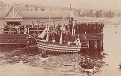
 Royal Hobart Regatta in 1914 | |
| Also called | 'The Regatta' |
| Observed by | Southern Tasmania |
| Type | Southern public holiday |
| Significance | Australia's Largest Aquatic Event |
| Celebrations | maritime regatta, racing, competitions, military displays |
| Date | Three days, ending on the second Monday in February |
| 2022 date | 12-14 February |
| Frequency | Annual |
The Royal Hobart Regatta is a series of aquatic competitions and displays held annually in Hobart, Tasmania, Australia and is Tasmania's oldest sporting event.
The regatta began in 1838.[1][2]
The event runs for three days, ending on the second Monday in February, and dominates the whole river for the duration of the event.[3]
History[]
On 1 December 1838, the first Hobart Town Anniversary Regatta was held in Hobart, Tasmania to celebrate the Tasmanian Anniversary of the 17th-century European discovery of the island by Dutch explorer Abel Tasman, who made the first reported European sighting of the island on 24 November 1642.[4] It was decided that the annual anniversary regatta should be celebrated by the wearing of a sprig of silver wattle blossom tied with British Navy blue ribbon.[5] It was begun by the then Governor of Tasmania, Sir John Franklin. Franklin provided free food and beer for all of the spectators, and the tradition of free entry continues to this day. The Monday was declared as a public holiday by the governor, and is now the oldest public holiday still continuing in Australia. Since 1879 the regatta has been held in January or February, rather than December. The Regatta was not staged in 1853 and 1854. The regatta of 6 February 1934 was the first to be called the Royal Hobart Regatta, the title being conferred by King George V. The 1942 regatta, which commemorated the 300th anniversary of Abel Tasman's exploration, was held on 5 December 1942. The 1967 regatta was cancelled because of the 'Black Tuesday' bushfire on 7 February 1967.
Originally staged at Pavilion Point, the regatta has, since 1856, been held in grounds near Macquarie Point known as the "Regatta Ground" at the Queens Domain along the western side of the River Derwent. The grounds are now dominated by the Hobart Cenotaph, a war memorial to Tasmania's war dead.
It is normally well attended by public and competitors and is usually well supported by the Royal Australian Navy, which sends a warship to be a flagship for the regatta, and sometimes the Royal Australian Air Force, who provide fly-pasts with military aircraft. Often the RAAF Roulettes will do aerobatic performances. The Australian Army's elite Red Beret parachute regiment provides sky diving displays.
The events includes sailing, rowing, open water swimming, wood chopping, jet ski racing, dragon boat racing, a tug of war and a trans-Derwent swim across the 1.6 km width of the river. There is also a Miss Regatta girl competition, and the regatta always has an official attendance ceremony by the Governor.
In 2013, the regatta celebrated 175 years of the event.[6]
References[]
- ^ Australian Geographical Society (1 November 1937), "The Hobart Regatta which celebrates its 100th birthday, February, 1938 (1 November 1937)", Walkabout, Australian National Travel Association, 4 (1), ISSN 0043-0064
- ^ "Royal Hobart Regatta:175 years". LINC Tasmania. Archived from the original on 27 June 2013. Retrieved 28 May 2013.
- ^ Hobart Regatta, Royal (2016). "Royal Hobart Regatta, Hobart, Tasmania". royalhobartregatta.com. Royal Hobart Regatta.
- ^ "THE REGATTA". The True Colonist Van Diemen's Land Political Despatch, And Agricultural And Commercial... No. 800. Tasmania, Australia. 7 December 1838. p. 4. Retrieved 7 December 2016 – via National Library of Australia.
- ^ "Classified Advertising". The Hobart Town Courier (Tas. : 1827 - 1839). Tas.: National Library of Australia. 23 November 1838. p. 4. Retrieved 19 August 2015.
- ^ "175th Royal Hobart Regatta underway on the River Derwent". Sail World. Retrieved 14 August 2021.
External links[]
Coordinates: 42°52′34″S 147°20′17″E / 42.876158°S 147.338089°E
- 1838 establishments in Australia
- Annual fairs
- Annual sporting events in Australia
- Fairs in Australia
- Festivals in Hobart
- Organisations based in Australia with royal patronage
- Recurring sporting events established in 1838
- Rowing competitions in Australia
- Sailing competitions in Australia
- Sailing regattas
- Sport in Hobart
- Public holidays in Australia
- Sailing in Tasmania
- February observances
