Ruperts, Saint Helena
Ruperts | |
|---|---|
 View of Ruperts with the harbour in Rupert's Bay | |
 Location on Saint Helena | |
| Coordinates: 15°55′10.9″S 5°42′44.0″W / 15.919694°S 5.712222°WCoordinates: 15°55′10.9″S 5°42′44.0″W / 15.919694°S 5.712222°W | |
| Sovereign state | |
| British overseas territory | |
| Island | |
| District | Jamestown |
| Time zone | UTC+0 (GMT) |
| Area code(s) | +44 |

Ruperts, sometimes also written Rupert's,[1] is a village of the island of Saint Helena, in Saint Helena, Ascension and Tristan da Cunha, an overseas territory of the United Kingdom, in the South Atlantic Ocean.[2]
History[]
It is believed that the village was named after Prince Rupert of the Rhine (1619–1682), but it is uncertain.[1]
Geography[]
Ruperts belongs to the district of Jamestown, It is 3.5 km by road from Jamestown but is, as the crow flies, only 660 meters away from it, separated by a hill.
The village is composed by the zones of Rupert's Valley, inner and between two hills,[3] and Rupert's Wharf, by the sea and in front of Rupert's Bay.[4] Ruperts' main road runs into the valley to the harbour area, and the settlements spans on it for about 800 m.
Transport[]
Ruperts main street forks into two roads: Field Road to Jamestown (3.5 km), Briars (2 km) and Alarm Forest (4.5 km); and Airport Access Road to Longwood (7 km) and Saint Helena Airport (13.7 km).
It is a port village with a small harbour by Rupert's Bay, with a wharf, a fuel ganrty and expanded with the opening of a new jetty, for largest ships, in February 2020.[5] In early 20th century Ruperts had a small narrow gauge railway, by the seashore, serving the local desalination plant. The Ruperts Railway had a small fork to the valley.[6][7]
Gallery[]
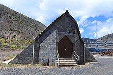
Rupert's Bay Church

Coastline of Rupert's Wharf

St Helena Sea Rescue Service office building

Old fortification and fuel offloading boom at the harbour


See also[]

References[]
- ^ a b "Why Ruperts": Ruperts on St. Helena official website
- ^ Ruperts' page on Saint Helena official website
- ^ 8397106714 Rupert's Valley on OpenStreetMap
- ^ 7467276062 Rupert's Wharf on OpenStreetMap
- ^ "The harbour and the new jetty of Ruperts": Ruperts on St. Helena official website
- ^ "Our (Other) Railway": Ruperts on St. Helena official website
- ^ Ruperts' Railway article on St. Helena official website
External links[]
| Wikimedia Commons has media related to Ruperts. |
- Jamestown, Saint Helena
- Populated places in Saint Helena, Ascension and Tristan da Cunha