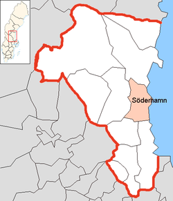
Söderhamn Municipality
Söderhamn Municipality
Söderhamns kommun | |
|---|---|
 Railway station in Söderhamn | |
 Coat of arms | |
 | |
| Coordinates: 61°18′N 17°05′E / 61.300°N 17.083°ECoordinates: 61°18′N 17°05′E / 61.300°N 17.083°E | |
| Country | Sweden |
| County | Gävleborg County |
| Seat | Söderhamn |
| Area | |
| • Total | 2,281.32 km2 (880.82 sq mi) |
| • Land | 1,060.77 km2 (409.57 sq mi) |
| • Water | 1,220.55 km2 (471.26 sq mi) |
| Area as of 1 January 2014. | |
| Population (31 December 2019)[2] | |
| • Total | 25,643 |
| • Density | 11/km2 (29/sq mi) |
| Time zone | UTC+1 (CET) |
| • Summer (DST) | UTC+2 (CEST) |
| ISO 3166 code | SE |
| Province | Hälsingland |
| Municipal code | 2182 |
| Website | www.soderhamn.se |

Söderhamn Municipality (Söderhamns kommun) is a municipality in Gävleborg County, in east central Sweden. The seat is located in Söderhamn.
The present municipality was created in 1971 when the former City of Söderhamn was amalgamated with two rural municipalities and parts of a third.
Localities[]
- Bergvik
- Ljusne
- Marmaskogen
- Marmaverken
- Mohed
- Sandarne
- Skog
- Söderala
- Söderhamn (seat)
- Vallvik
- Vannsätter
International relations[]
Twin towns — Sister cities[]
The municipality is twinned with:[3]
 Kunda, Estonia
 Jakobstad, Finland
 Os, Hordaland, Norway
 Szczecinek, Poland
References[]
- ^ "Statistiska centralbyrån, Kommunarealer den 1 januari 2014" (in Swedish). Statistics Sweden. 2014-01-01. Archived from the original (Microsoft Excel) on 2016-09-27. Retrieved 2014-04-18.
- ^ "Folkmängd i riket, län och kommuner 31 december 2019" (in Swedish). Statistics Sweden. February 20, 2020. Retrieved February 20, 2020.
- ^ "Vänorter". soderhamn.se. Retrieved 26 April 2014.
External links[]
 Media related to Söderhamn Municipality at Wikimedia Commons
- Söderhamn - Official site
Places adjacent to Söderhamn Municipality | ||||||||||||||||
|---|---|---|---|---|---|---|---|---|---|---|---|---|---|---|---|---|
| ||||||||||||||||
Municipalities and seats of Gävleborg County | ||
|---|---|---|
| Municipalities | ||
| Municipal seats | ||
Authority control | |
|---|---|
| General | |
| National libraries | |
This article about a location in Gävleborg County, Sweden is a stub. You can help Wikipedia by . |
Categories:
- Söderhamn Municipality
- Municipalities of Gävleborg County
- Gävleborg County geography stubs