Saint-François-de-la-Rivière-du-Sud, Quebec
show This article may be expanded with text translated from the corresponding article in French. (May 2019) Click [show] for important translation instructions. |
Saint-François-de-la-Rivière-du-Sud | |
|---|---|
Municipality | |
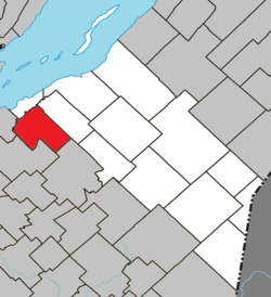 Location within La Matapédia RCM. | |
 Saint-François-de-la-Rivière-du-Sud Location in province of Quebec. | |
| Coordinates: 46°53′N 70°43′W / 46.883°N 70.717°WCoordinates: 46°53′N 70°43′W / 46.883°N 70.717°W[1] | |
| Country | |
| Province | |
| Region | Chaudière-Appalaches |
| RCM | Montmagny |
| Constituted | July 1, 1855 |
| Government | |
| • Mayor | Yves Laflamme |
| • Federal riding | Montmagny—L'Islet— Kamouraska—Rivière- du-Loup |
| • Prov. riding | Côte-du-Sud |
| Area | |
| • Total | 96.50 km2 (37.26 sq mi) |
| • Land | 94.05 km2 (36.31 sq mi) |
| Population | |
| • Total | 1,596 |
| • Density | 17.0/km2 (44/sq mi) |
| • Pop 2006-2011 | |
| • Dwellings | 684 |
| Time zone | UTC−5 (EST) |
| • Summer (DST) | UTC−4 (EDT) |
| Postal code(s) | G0R 3A0 |
| Area code(s) | 418 and 581 |
| Highways | |
| Website | www.stfrancois delarivieredusud.net |

Saint-François-de-la-Rivière-du-Sud is a municipality in Quebec.
See also[]
References[]
- ^ Reference number 148072 of the Commission de toponymie du Québec (in French)
- ^ Jump up to: a b Geographic code 18060 in the official Répertoire des municipalités (in French)
- ^ Jump up to: a b "(Code 2418060) Census Profile". 2011 census. Statistics Canada. 2012.
| show Adjacent Municipal Subdivisions |
|---|
| hide | |
|---|---|
| Cities & Towns | |
| Municipalities | |
| Parishes |
|
| |
| show Authority control |
|---|
This Quebec location article is a stub. You can help Wikipedia by . |
Categories:
- Municipalities in Quebec
- Incorporated places in Chaudière-Appalaches
- Quebec geography stubs