Saint-Gérard-Majella, Quebec
Saint-Gérard-Majella | |
|---|---|
Parish municipality | |
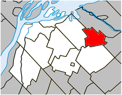 Location within Pierre-De Saurel RCM. | |
 Saint-Gérard-Majella Location in southern Quebec. | |
| Coordinates: 46°00′N 72°50′W / 46.000°N 72.833°WCoordinates: 46°00′N 72°50′W / 46.000°N 72.833°W[1] | |
| Country | |
| Province | |
| Region | Montérégie |
| RCM | Pierre-De Saurel |
| Constituted | February 18, 1907 |
| Named for | Gerard Majella[1] |
| Government | |
| • Mayor | Charles Lachapelle |
| • Federal riding | Bas-Richelieu—Nicolet—Bécancour |
| • Prov. riding | Richelieu |
| Area | |
| • Total | 38.20 km2 (14.75 sq mi) |
| • Land | 38.21 km2 (14.75 sq mi) |
| There is an apparent contradiction between two authoritative sources | |
| Population | |
| • Total | 246 |
| • Density | 6.4/km2 (17/sq mi) |
| • Pop 2006-2011 | |
| • Dwellings | 109 |
| Time zone | UTC−5 (EST) |
| • Summer (DST) | UTC−4 (EDT) |
| Postal code(s) | J0G 1X1 |
| Area code(s) | 450 and 579 |
| Highways | |

Saint-Gérard-Majella is a parish municipality located in the Pierre-De Saurel Regional County Municipality of Québec (Canada), in the administrative region of Montérégie. The population as of the Canada 2011 Census was 246.
Demographics[]
Population[]Population trend:[5]
|
Language[]Mother tongue language (2006)[6]
|
See also[]
References[]
- ^ Jump up to: a b Reference number 56646 of the Commission de toponymie du Québec (in French)
- ^ Jump up to: a b Ministère des Affaires municipales, des Régions et de l'Occupation du territoire: Saint-Gérard-Majella
- ^ Parliament of Canada Federal Riding History: BAS-RICHELIEU--NICOLET--BÉCANCOUR (Quebec)
- ^ Jump up to: a b 2011 Statistics Canada Census Profile: Saint-Gérard-Majella, Quebec
- ^ Statistics Canada: 1996, 2001, 2006, 2011 census
- ^ 2006 Statistics Canada Community Profile: Saint-Gérard-Majella, Quebec
| show Adjacent Municipal Subdivisions |
|---|
| hide | |
|---|---|
| Cities |
|
| Municipalities |
|
| Parishes | |
| Villages | |
| |
| show Authority control |
|---|
Categories:
- Parish municipalities in Quebec
- Incorporated places in Pierre-De Saurel Regional County Municipality