Saint-Géry Island
Saint-Géry Island (French: île Saint-Géry) or Sint-Goriks Island (Dutch: ![]() Sint-Gorikseiland (help·info)) was the largest island in the Senne (Zenne) river in Brussels, Belgium. It was named after Saint Gaugericus of Cambrai, who built a chapel there around 580[citation needed]; hence the name "Brussels", which comes from Bruocsella or Broekzele, meaning "settlement in the marsh".[1] It ceased to exist as an island when the Senne was covered over in the late 19th century.
Sint-Gorikseiland (help·info)) was the largest island in the Senne (Zenne) river in Brussels, Belgium. It was named after Saint Gaugericus of Cambrai, who built a chapel there around 580[citation needed]; hence the name "Brussels", which comes from Bruocsella or Broekzele, meaning "settlement in the marsh".[1] It ceased to exist as an island when the Senne was covered over in the late 19th century.
Location[]

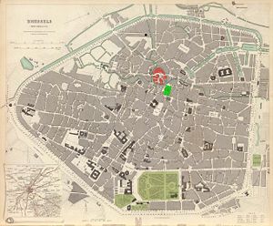
Saint-Géry Island's easternmost edge was located more or less due west across today's Boulevard Anspach from the Place de la Bourse/Beursplein and the former Brussels Stock Exchange building. The island was roughly round, and centred on the current Halles Saint-Géry/Sint-Gorikshallen, a former covered market, and one of the trendiest districts of the capital. Many streets and buildings in the area still bear the name "Saint-Géry/Sint-Goriks".
History[]

Saint Gaugericus of Cambrai built a chapel on the island around the year 580[citation needed]. Starting in the 10th century, the church began to house relics of Saint Gudula, who had died two centuries earlier, transferred there by Charles, Duke of Lower Lorraine. Later the relics were transferred to the nearby Church of St Michael and St Gudula (now Brussels cathedral).
When King Lothair II of Lotharingia appointed his brother Charles to be Duke of Lower Lotharingia in the 10th century, Charles constructed a fort on the island. Past the island navigation on the Senne was much more difficult, so it was a good strategic position.[2] It had to defend not only the area, but also the western frontier of the Holy Roman Empire (to which the Duchy of Brabant and thus also Brussels belonged) against attacks by the French kings and their powerful vassals, the Counts of Flanders.[1] This fort marked the birth of the city of Brussels, though the ruins have not been found.
The island was said to be once completely carpeted in yellow irises. Due to the importance of the island, the iris has been a symbol of Brussels since the 19th century, and a stylised version is featured on the flag of the Brussels-Capital Region.[2]

By the 12th century, the island was home to a high density of watermills, playing an important role in Brussels' growth as a commercial centre.[3] During the Middle Ages, the island was home to a large amount of fishmongers, who would use the river surrounding the island to exchange the water in their fish reservoirs.[4] Fish were extremely important in the Roman Catholic city, as fasts prescribed by the church were rigorously obeyed. This ceased to be common practice even before the Industrial Revolution, as a growing number of tanners, dyers and other trades dumped their waste into the river, causing it to be unsuitable for storing fish.[5]
At the end of the 18th century, under the French revolutionary regime, the Gothic church which had replaced the chapel was razed, replaced by a fountain centred on an obelisk dating from 1767 which had been taken from Grimbergen abbey. The square was an open-air market for the following century.
Around 1870, when the Senne was covered, the island ceased to exist as an island and some of the eastern sections were demolished to make way for the modern bourgeois housing on Anspach boulevard (then called Central Boulevard). Plans were made to create a covered market to replace the open-air one, and in 1882, work was finished. The building, known as the , (Dutch: Sint-Gorikshallen) is in the Flemish neo-Renaissance style. The fountain still stands inside it.
Today, the Saint-Géry area is well known for the many bars, cafés and restaurants in the area, making it a popular Brussels nightspot.
References[]
- ^ Jump up to: a b (in Dutch) Zo ontstond Brussel Archived 2011-07-06 at the Wayback Machine Vlaamse Gemeenschapscommissie - Commission of the Flemish Community in Brussels
- ^ Jump up to: a b "Brussels Town Hall". The Belgian Monarchy. Archived from the original on September 27, 2007. Retrieved November 3, 2007.
- ^ Deligne 15
- ^ Deligne 29
- ^ Deligne 9
Bibliography[]
- (in French) Deligne, Chloé. Bruxelles sortie des eaux. Éditions Historia Bruxellae, 2005. ISBN 2-9600373-1-6.
External links[]
| Wikimedia Commons has media related to Place Saint-Géry/Sint-Goriksplein, Brussels. |
- Halles Saint Géry official homepage - Events calendar, Photo gallery, and more.
- ASBL Saint Géry - Neighbours and Businesses Association.

- Geography of Brussels
- History of Brussels
- Former islands
- City of Brussels