Saint-Pierre-de-Lamy, Quebec
Saint-Pierre-de-Lamy | |
|---|---|
Municipality | |
 | |
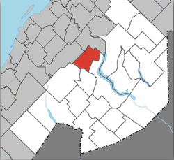 Location within Témiscouata RCM | |
 Saint-Pierre-de-Lamy Location in eastern Quebec | |
| Coordinates: 47°47′N 69°00′W / 47.783°N 69.000°WCoordinates: 47°47′N 69°00′W / 47.783°N 69.000°W[1] | |
| Country | |
| Province | |
| Region | Bas-Saint-Laurent |
| RCM | Témiscouata |
| Constituted | June 4, 1977 |
| Government | |
| • Mayor | Gaston Caron |
| • Federal riding | Rimouski-Neigette— Témiscouata—Les Basques |
| • Prov. riding | Rivière-du-Loup-Témiscouata |
| Area | |
| • Total | 114.10 km2 (44.05 sq mi) |
| • Land | 111.12 km2 (42.90 sq mi) |
| Population | |
| • Total | 112 |
| • Density | 1.0/km2 (3/sq mi) |
| • Pop 2006-2011 | |
| • Dwellings | 88 |
| Time zone | UTC−5 (EST) |
| • Summer (DST) | UTC−4 (EDT) |
| Postal code(s) | G0L 4B0 |
| Area code(s) | 418 and 581 |
| Highways | |

Saint-Pierre-de-Lamy is a municipality in the Canadian province of Quebec, located in Témiscouata Regional County Municipality. The municipality had a population of 112 in the Canada 2011 Census.
See also[]
References[]
- ^ Reference number 81518 of the Commission de toponymie du Québec (in French)
- ^ Jump up to: a b Geographic code 13075 in the official Répertoire des municipalités (in French)
- ^ Jump up to: a b "(Code 2413075) Census Profile". 2011 census. Statistics Canada. 2012.
External links[]
![]() Media related to Saint-Pierre-de-Lamy at Wikimedia Commons
Media related to Saint-Pierre-de-Lamy at Wikimedia Commons
| show Places adjacent to Saint-Pierre-de-Lamy, Quebec |
|---|
| hide | |
|---|---|
| Cities & Towns | |
| Municipalities | |
| Parishes |
|
| |
| show Authority control |
|---|
This Bas-Saint-Laurent location article is a stub. You can help Wikipedia by . |
Categories:
- Municipalities in Quebec
- Incorporated places in Bas-Saint-Laurent
- Bas-Saint-Laurent geography stubs