Sainte-Clotilde, Quebec
Sainte-Clotilde | |
|---|---|
Municipality | |
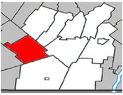 Location within Les Jardins-de-Napierville RCM. | |
 Sainte-Clotilde Location in southern Quebec. | |
| Coordinates: 45°09′N 73°41′W / 45.150°N 73.683°WCoordinates: 45°09′N 73°41′W / 45.150°N 73.683°W[1] | |
| Country | |
| Province | |
| Region | Montérégie |
| RCM | Les Jardins-de-Napierville |
| Constituted | April 2, 1885 |
| Government | |
| • Mayor | Clément Lemieux |
| • Federal riding | Beauharnois—Salaberry |
| • Prov. riding | Huntingdon |
| Area | |
| • Total | 78.80 km2 (30.42 sq mi) |
| • Land | 78.73 km2 (30.40 sq mi) |
| Population (2011)[4] | |
| • Total | 1,704 |
| • Density | 21.6/km2 (56/sq mi) |
| • Pop 2006-2011 | |
| • Dwellings | 669 |
| Time zone | UTC−5 (EST) |
| • Summer (DST) | UTC−4 (EDT) |
| Postal code(s) | J0L 1W0 |
| Area code(s) | 450 and 579 |
| Highways | |
| Geocode | 68020 |
| Website | www |

Sainte-Clotilde is a municipality in the Jardins de Napierville Regional County Municipality in Quebec, Canada, situated in the Montérégie administrative region. The population as of the Canada 2011 Census was 1,704.
Before February 6, 2010 it was known as Sainte-Clotilde-de-Châteauguay.[5]
Demographics[]
Population[]
| hideCanada census – Sainte-Clotilde, Quebec community profile | |||
|---|---|---|---|
| 2011 | 2006 | ||
| Population: | 1,704 (+6.0% from 2006) | 1,608 (+3.2% from 2001) | |
| Land area: | 78.73 km2 (30.40 sq mi) | 78.73 km2 (30.40 sq mi) | |
| Population density: | 21.6/km2 (56/sq mi) | 20.4/km2 (53/sq mi) | |
| Median age: | 41.5 (M: 41.2, F: 42.0) | 38.1 (M: 37.5, F: 39.0) | |
| Total private dwellings: | 669 | 618 | |
| Median household income: | $.N/A | $37,297 | |
| Notes: 2011 income data for this area has been suppressed for data quality or confidentiality reasons. – References: 2011[4] 2006[6] earlier[7] | |||
|
|
|
Language[]
| Canada Census Mother Tongue - Sainte-Clotilde, Quebec[8] | ||||||||||||||||||
|---|---|---|---|---|---|---|---|---|---|---|---|---|---|---|---|---|---|---|
| Census | Total | French
|
English
|
French & English
|
Other
| |||||||||||||
| Year | Responses | Count | Trend | Pop % | Count | Trend | Pop % | Count | Trend | Pop % | Count | Trend | Pop % | |||||
2011
|
1,700
|
1,445 | 85.00% | 65 | 3.82% | 10 | 0.59% | 180 | 10.59% | |||||||||
2006
|
1,610
|
1,455 | 90.37% | 35 | 2.17% | 10 | 0.62% | 110 | 6.83% | |||||||||
2001
|
1,540
|
1,375 | 89.29% | 95 | 6.17% | 0 | 0.00% | 70 | 4.54% | |||||||||
1996
|
1,595
|
1,515 | n/a | 94.98% | 50 | n/a | 3.13% | 15 | n/a | 0.94% | 15 | n/a | 0.94% | |||||
See also[]
References[]
- ^ Reference number 251292 of the Commission de toponymie du Québec (in French)
- ^ Jump up to: a b "Ministère des Affaires municipales, des Régions et de l'Occupation du territoire: Sainte-Clotilde". Archived from the original on 2011-08-06. Retrieved 2012-05-21.
- ^ Riding history for Beauharnois—Salaberry, Quebec from the Library of Parliament
- ^ Jump up to: a b c "2011 Community Profiles". 2011 Canadian Census. Statistics Canada. July 5, 2013. Retrieved 2014-04-10.
- ^ http://www.stat.gouv.qc.ca/publications/referenc/pdf2010/modif_fev10.pdf[permanent dead link]
- ^ "2006 Community Profiles". 2006 Canadian Census. Statistics Canada. March 30, 2011. Retrieved 2014-04-10.
- ^ "2001 Community Profiles". 2001 Canadian Census. Statistics Canada. February 17, 2012.
- ^ Jump up to: a b Statistics Canada: 1996, 2001, 2006, 2011 census
| show Adjacent Municipal Subdivisions |
|---|
| hide | |
|---|---|
| Cities | |
| Municipalities | |
| Parishes | |
| Townships | |
| Villages | |
| |
| show Authority control |
|---|
Categories:
- Incorporated places in Les Jardins-de-Napierville Regional County Municipality
- Municipalities in Quebec